Novato, California
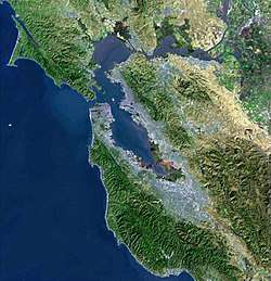
Novato (/nəˈvɑːtoʊ/ nə-VAH-toh) is a city in northern Marin County, in the North Bay region of the San Francisco Bay Area, in the U.S. state of California. At the 2010 census, its population was 51,904. Novato is located about 10 miles (16 km) northwest of San Rafael[10] and about 30 miles (48 km) north of San Francisco on U.S. 101. Novato has been called one of the best places to live in the U.S.[11]
City of Novato | |
|---|---|
City | |
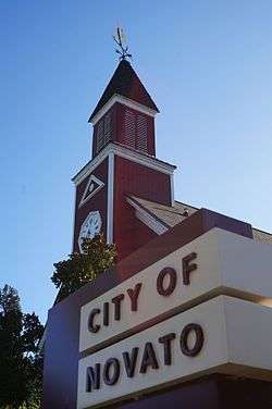 Novato city hall | |
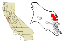 Location in Marin County and the state of California | |
 City of Novato Location in the United States | |
| Coordinates: 38°06′27″N 122°34′11″W[1] | |
| Country | |
| State | |
| County | Marin |
| Incorporated | January 20, 1960[2] |
| Government | |
| • Mayor | Eric Lucan[3] |
| • County Board | Districts 5 & 4 Judy Arnold Dennis Rodoni[4] |
| • State Senator | Mike McGuire (D)[5] |
| • Assemblymember | Marc Levine (D)[5] |
| • U. S. Rep. | Jared Huffman (D)[6] |
| Area | |
| • Total | 27.99 sq mi (72.48 km2) |
| • Land | 27.48 sq mi (71.16 km2) |
| • Water | 0.51 sq mi (1.32 km2) 1.85% |
| Elevation | 30 ft (9 m) |
| Population | |
| • Total | 51,904 |
| • Estimate (2019)[9] | 55,516 |
| • Density | 2,020.60/sq mi (780.16/km2) |
| • Demonym | Novatonian |
| Time zone | UTC−8 (Pacific) |
| • Summer (DST) | UTC−7 (PDT) |
| ZIP codes | 94945, 94947–94949, 94998 |
| Area codes | 415/628 |
| FIPS code | 06-52582 |
| GNIS feature IDs | 277612, 2411283 |
| Website | novato |
History
What is now Novato was originally the site of several Coast Miwok villages: Chokecherry, near downtown Novato; Puyuku, near Ignacio; and Olompali, at the present-day Olompali State Historic Park.[12]
In 1839, the Mexican government granted the 8,876-acre (35.92 km2) Rancho Novato to Fernando Feliz. The rancho was named after a local Miwok leader who had probably been given the name of Saint Novatus at his baptism.[13] Subsequently, four additional land grants were made in the area: Rancho Corte Madera de Novato, to John Martin in 1839; Rancho San Jose, to Ignacio Pacheco in 1840; Rancho Olompali, awarded in 1843 to Camilo Ynitia, son of a Coast Miwok chief; and Rancho Nicasio, by far the largest at 56,621 acres (229.1 km2), awarded to Pablo de la Guerra and John B.R. Cooper in 1844.[14] Novato, along with the rest of California, became part of the United States on February 2, 1848. Early pioneers included Joseph Sweetser and Francis De Long who bought 15,000 acres (61 km2) in the mid-1850s and planted orchards and vineyards.[15]
The first post office at Novato opened in 1856; it closed in 1860, and a new post office opened in 1891.[10]
The first school was built in 1859, at the corner of Grant Avenue and what is today Redwood Boulevard.
The original town was located around Novato Creek at what is now South Novato Boulevard. A railroad was built in 1879, connecting Novato to Sonoma County and San Rafael. The area around the train depot became known as New Town, and forms the edge of what today is Old Town Novato. The current depot was built in 1917, but closed in 1959, and is largely derelict. The depot consisted of two buildings: a warehouse and a station. The warehouse burned twice in the intervening years. Behind the rail station/warehouse complex was a grain and feed mill complex. The mill complex, along with the warehouse portion of the rail station, was torn down in late 2007 to make way for public parking and a Whole Foods/high-density housing development, while the derelict station is still standing.
A Presbyterian church, still a landmark in Novato today, was built in 1896. Until 2006, it housed a number of city offices, but was vacated that year due to safety concerns and condemned; the church has since been renovated. A new city center complex has been erected adjacent to the old City Hall.
The Great Depression of the 1930s had a marked effect on the area as many farmers lost their land. After World War II, Novato grew quickly with the construction of tract homes and a freeway. As the area was unincorporated much of the growth was unplanned and uncontrolled. Novato was finally incorporated as a city in 1960.[16] One of the most important venues of the time (1960 to 1965) was "Western Weekend". Beard-growing contests, sponsored by Bob's Barber Shop, and many other odd activities helped to bring this community together.
Geography
According to the United States Census Bureau, Novato has a total area of 28.0 square miles (73 km2) and is the largest city in area in Marin County. 27.4 square miles (71 km2) of it is land and 0.5 square miles (1.3 km2) of it (1.85%) is water.
Major geographical features nearby include Mount Burdell and Mount Burdell Open Space Preserve to the north and Big Rock Ridge to the southwest. Stafford Lake to the west is a secondary water supply for Novato, with the Russian River in Sonoma County to the north supplying most of the city's water. Novato includes ten Marin County Open Space District preserves: Mount Burdell, Rush Creek, Little Mountain, Verissimo Hills, Indian Tree, Deer Island, Indian Valley, Ignacio Valley, Loma Verde, and Pacheco Valle.
Climate
.JPG)
Official weather observations were taken at Hamilton Air Force Base through 1964. Average January temperatures were a maximum of 53.6 °F (12.0 °C) and a minimum of 38.7 °F (3.7 °C). Average July temperatures were a maximum of 79.9 °F (26.6 °C) and a minimum of 52.0 °F (11.1 °C). There were an average of 12.4 days with highs of 90 °F (32 °C) or higher and an average of 12.5 days with lows of 32 °F (0 °C) or lower. The record high temperature was 109 °F (43 °C) on September 2, 2017. The record low temperature was 16 °F (−9 °C) in December 2013. Average annual precipitation was 25.49 inches (64.7 cm). The wettest year was 1940 with 46.63 inches (118.4 cm) and the driest year was 2015 with 6.35 inches (16.1 cm). The most rainfall in one month was 18.87 inches (47.9 cm) in December 1955. The most rainfall in 24 hours was 10.55 inches (26.8 cm) between December 10, 2014 – December 11, 2014.[20]
Today, the nearest National Weather Service cooperative weather station is in San Rafael, where records date back to 1894. Compared to records from Hamilton Air Force Base, San Rafael is generally several degrees warmer than Novato and has an average of about 10 inches (25 cm) more rainfall. The record high temperature in San Rafael was 110 °F (43 °C) on September 7, 1904, and June 14, 1961. The record low temperature was 20 °F (−7 °C) on December 26, 1967.[21]
Government
Federal and state
In the United States House of Representatives, Novato is in California's 2nd congressional district, represented by Democrat Jared Huffman.[6] From 2008 to 2012, Huffman represented Marin County in the California State Assembly.
In the California State Legislature, Novato is in:
- the 10th Assembly District, represented by Democrat Marc Levine[22]
- the 2nd Senate District, represented by Democrat Mike McGuire.
According to the California Secretary of State, as of February 10, 2019, Novato has 31,544 registered voters. Of those, 15,794 (50.1%) are registered Democrats, 6,048 (19.2%) are registered Republicans, and 8,188 (26%) have declined to state a political party.[23]
Demographics
| Historical population | |||
|---|---|---|---|
| Census | Pop. | %± | |
| 1960 | 17,881 | — | |
| 1970 | 31,006 | 73.4% | |
| 1980 | 43,916 | 41.6% | |
| 1990 | 47,585 | 8.4% | |
| 2000 | 47,630 | 0.1% | |
| 2010 | 51,904 | 9.0% | |
| Est. 2019 | 55,516 | [9] | 7.0% |
| U.S. Decennial Census[24] | |||
2010
At the 2010 census Novato had a population of 51,904. The population density was 1,856.6 people per square mile (716.8/km2). The racial makeup of Novato was 39,443 (76.0%) White, 1,419 (2.7%) African American, 286 (0.6%) Native American, 3,428 (6.6%) Asian, 117 (0.2%) Pacific Islander, 4,693 (9.0%) from other races, and 2,518 (4.9%) from two or more races. Hispanic or Latino of any race were 11,046 persons (21.3%).[25]
The census reported that 51,278 people (98.8% of the population) lived in households, 449 (0.9%) lived in non-institutionalized group quarters, and 177 (0.3%) were institutionalized.
There were 21,279 households, 6,679 (32.9%) had children under the age of 18 living in them, 10,393 (51.3%) were opposite-sex married couples living together, 2,237 (11.0%) had a female householder with no husband present, 854 (4.2%) had a male householder with no wife present. There were 1,010 (5.0%) unmarried opposite-sex partnerships, and 195 (1.0%) same-sex married couples or partnerships. 5,358 households (26.4%) were one person and 2,415 (11.9%) had someone living alone who was 65 or older. The average household size was 2.53. There were 13,484 families (66.5% of households); the average family size was 3.04.
The age distribution was 11,769 people (22.7%) under the age of 18, 3,355 people (6.5%) aged 18 to 24, 12,743 people (24.6%) aged 25 to 44, 15,914 people (30.7%) aged 45 to 64, and 8,123 people (15.7%) who were 65 or older. The median age was 42.6 years. For every 100 females, there were 93.6 males. For every 100 females age 18 and over, there were 90.1 males.
There were 21,158 housing units at an average density of 756.8 per square mile, of the occupied units 13,591 (67.0%) were owner-occupied and 6,688 (33.0%) were rented. The homeowner vacancy rate was 1.0%; the rental vacancy rate was 4.7%. 33,252 people (64.1% of the population) lived in owner-occupied housing units and 18,026 people (34.7%) lived in rental housing units.
2000
At the 2000 census there were 47,630 people in 18,524 households, including 12,411 families, in the city. The population density was 1,719.2 inhabitants per square mile (663.9/km2). There were 18,994 housing units at an average density of 685.6 per square mile (264.8/km2). The racial makeup of the city in 2010 was 65.8% non-Hispanic White American, 2.5% non-Hispanic Black American, 0.2% Native American, 6.5% Asian, 0.2% Pacific Islander, 0.3% from other races, and 3.2% from two or more races. Hispanic or Latino of any race were 21.3%.[26]
Of the 18,524 households 32.1% had children under the age of 18 living with them, 52.7% were married couples living together, 10.3% had a female householder with no husband present, and 33.0% were non-families. 25.2% of households were one person and 9.3% were one person aged 65 or older. The average household size was 2.52 and the average family size was 3.01.
The age distribution was 23.1% under the age of 18, 6.4% from 18 to 24, 29.9% from 25 to 44, 27.5% from 45 to 64, and 13.0% 65 or older. The median age was 40 years. For every 100 females, there were 93.6 males. For every 100 females age 18 and over, there were 90.3 males.
The median household income was $63,453 and the median family income was $74,434 (these figures had risen to $78,895 and $91,890 respectively as of a 2007 estimate).[27] Males had a median income of $55,822 versus $40,287 for females. The per capita income for the city was $32,402. About 3.1% of families and 5.6% of the population were below the poverty line, including 6.1% of those under age 18 and 4.0% of those age 65 or over.
Economy
The city is home to the Buck Institute for Research on Aging, and several biotech firms, such as Biosearch Technologies, BioMarin Pharmaceutical and Ultragenyx Pharmaceutical.[28] Several small technology companies are also based in Novato, such as 2K, Radiant Logic, Toys For Bob, One Legal, International Genetics Incorporated, Channel Management Solutions, Enwisen, Sonic Solutions and DriveSavers.
The former Hamilton Air Force Base is also located in Novato, but was decommissioned in 1974 and designated a Historic District in 1998. After lying stagnant for many years, major renovations were pushed through by then-mayor Michael DiGiorgio. As of 2008 the base has largely been redeveloped into single-family homes. The former hangar buildings were gutted and redeveloped into two-story office buildings; tenants include 2K Sports, Sony Imageworks, Visual Concepts, The Republic of Tea, Toys For Bob, and Birkenstock Distribution USA.
From 1983 to 1998, the iconic[29] developer of video games, Brøderbund Software, was headquartered in Novato, known through games Choplifter, Lode Runner, Karateka, and Prince of Persia, and others.[30] From the 1982 until 2015, Novato was headquarters for Fireman's Fund Insurance Company, which was Marin County's largest employer at one time, with 2,400 employees as of 2000. By 2015, the company had laid off or transferred most its employees and relocated its remaining employees to its a smaller headquarters in nearby Petaluma.[31]
As of 2015–16 the city's principal employers were:[32]
| # | Employer | # of Employees |
|---|---|---|
| 1 | Novato Unified School District | 838 |
| 2 | BioMarin Pharmaceutical | 765 |
| 3 | 2K/Visual Concepts | 600 |
| 4 | Novato Community Hospital | 333 |
| 5 | Safeway Stores | 298 |
| 6 | Costco Wholesale | 297 |
| 7 | Bradley Electric | 255 |
| 8 | Brayton & Associates | 225 |
| 9 | Novato Healthcare Center | 209 |
| 10 | Buck Institute | 198 |
Neighborhoods
Novato has several different neighborhoods determined by the upcoming redistricting.[33] They can be roughly classified as:
- San Marin
- Old Town
- Northern Downtown
- Eastern Novato (includes lower population areas such as Atherton, Hamilton and Bel Marin Keys)
- Ignacio
- Hamilton
Transportation
Major roads in Novato include U.S. Route 101 and California State Route 37.
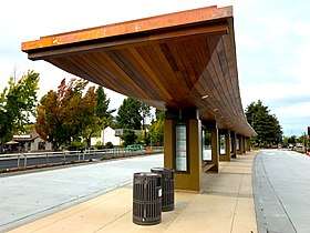
Sonoma–Marin Area Rail Transit (SMART) operates three commuter rail stations in Novato: San Marin / Atherton station, Hamilton station, and Novato Downtown station. Novato is served by several bus routes of Golden Gate Transit and Marin Transit.
Notable people
- Joe Rosenthal - Photographer of Raising the Flag on Iwo Jima, Pulitzer Prize winner
- Rebecca Solnit - Author, memoirist, essayist
- Emil Kakkis - President, CEO of Ultragenyx Pharmaceutical Inc.
- Jared Goff - NFL player for the Los Angeles Rams
- Juan Alderete - Grammy Award-winning bassist for The Mars Volta and former bassist of Racer X
- Manny Wilkins - quarterback for the Green Bay Packers
- Yvonne Cagle, M.D. - NASA astronaut
- Ralph Barbieri, sports journalist and host of The Razor and Mr. T on KNBR
- Brent Moore - former NFL linebacker for the Green Bay Packers
- Brad Muster - NFL and Stanford University running back
- Nick Rolovich - head football coach for the University of Hawaiʻi at Mānoa
- Mike Moroski - former NFL quarterback and current head football coach for The College of Idaho
- Wil Dasovich - television personality
- Ellen Estes - Olympic Water Polo player
- Lefty Gomez - Hall of Fame baseball pitcher for the New York Yankees and the Washington Senators during the 1930s and 1940s[34]
Education
- Good Shepherd Lutheran School (private school)
- The Novato Unified School District is a school district in Novato, California.
- Novato High School
- San Marin High School
- Marin Oaks High School
- Sinaloa Middle School
- San Jose Middle School
- Pleasant Valley Elementary School
- Loma Verde Elementary School
- Lu Sutton Elementary School
- Lynwood Elementary School
- Marin Christian Academy (private school)
- Olive Elementary School
- Hamilton Meadow Park School
- Rancho Elementary School
- San Ramon Elementary School
- Our Lady of Loretto School
- North Bay Christian Academy (Private school)
- Nova Independent Study]
- Samuel Hazelton School of the Arts
- Novato Charter School (charter school)
Research facilities
Museums
- Marin Museum of the American Indian
- Marin Museum of Contemporary Art
- Novato History Museum
- Hamilton Field Aviation Museum
- The Space Station Museum
Points of interest
- Marin Museum of Contemporary Art
- Olompali State Historic Park—Historic park with open space and trails
- Harkleroad wind turbine—Experimental wind-powered private residence that is visible from Highway 101, but no longer used to generate electricity
- Point Reyes National Seashore—Vast park with a visitor center and hiking
- Miwok Park
- Indian Valley Preserve
- Pioneer Park
- Ohair Park
- Hamilton Wetlands
- Mount Burdell Open Space Preserve—Mountain biking, cycling, hiking, and outdoor recreation
- Ignacio Valley Preserve
- The Space Station Museum
- Loma Verde Preserve
- Marin Treks Natural History Museum
- Novato History Museum
- Deer Island Open Space
- Arroyo Avichi Park
- Nicasio Reservoir—Fishing, hiking, and reservoir
- Hamilton Field History Museum
- Hill Recreation Area
- Deer Island Preserve
- The Novato Roundhouse
- Stafford Lake Disc Golf Course
Popular culture
- Parts of the 1992 movie Radio Flyer were filmed in Novato. The film starred Elijah Wood (The Lord of the Rings) and was directed by Richard Donner (Lethal Weapon, Superman).[35]
- The Fireman's Fund office complex in Novato was used as a shooting location in Howard the Duck (1986) and Star Trek VI: The Undiscovered Country (1991). The site features in exterior shots for the Khitomer Conference between humans and Klingons.[35]
Sister cities
.svg.png)
See also
References
- "Novato". Geographic Names Information System. United States Geological Survey.
- "California Cities by Incorporation Date". California Association of Local Agency Formation Commissions. Archived from the original (Word) on February 21, 2013. Retrieved August 25, 2014.
- "Council Members". City of Novato. Retrieved January 24, 2019.
- "County of Marin District 4 webpage". County of Marin. Retrieved February 7, 2020.
- "Statewide Database". UC Regents. Archived from the original on February 1, 2015. Retrieved December 5, 2014.
- "California's 2nd Congressional District - Representatives & District Map". Civic Impulse, LLC. Retrieved March 1, 2013.
- "2019 U.S. Gazetteer Files". United States Census Bureau. Retrieved July 1, 2020.
- "Novato (city) QuickFacts". United States Census Bureau. Archived from the original on July 7, 2012. Retrieved February 26, 2015.
- "Population and Housing Unit Estimates". United States Census Bureau. May 24, 2020. Retrieved May 27, 2020.
- Durham, David L. (1998). California's Geographic Names: A Gazetteer of Historic and Modern Names of the State. Clovis, Calif.: Word Dancer Press. p. 673. ISBN 1-884995-14-4.
- "Novato Ranked Among Best Places To Live". April 9, 2018. Retrieved April 10, 2018.
- Peterson, Bonnie J. (1976). Dawn of the World: Coast Miwok Myths. ISBN 0-912908-04-1
- Bright, William (1998) (November 30, 1998). 1500 California Place Names. University of California Press. ISBN 978-0-520-21271-8.
- Marin County Ranchos Archived November 14, 2008, at the Wayback Machine
- "Novato 1838-1899: Land Grants and Farming | NOVATO HISTORICAL GUILD". Retrieved November 12, 2019.
- "Early Novato Area History". Archived from the original on November 23, 2007. Retrieved December 6, 2007.
- "National Register Digital Assets – Fashion Shop and Stephen Porcella House". Archived from the original on October 20, 2016. Retrieved October 20, 2016.
- National Register Digital Assets – Rancho Olompali
- National Register Digital Assets – Hamilton Army Airfield
- http://rainfall.weatherdb.com/l/18987/Novato-California%5B%5D
- "SAN RAFAEL CIVIC CTR, CALIFORNIA - Climate Summary".
- "Members Assembly".
- "CA Secretary of State – Report of Registration – February 10, 2019" (PDF). ca.gov. Retrieved March 12, 2019.
- "Census of Population and Housing". Census.gov. Retrieved June 4, 2015.
- "2010 Census Interactive Population Search: CA - Novato city". U.S. Census Bureau. Archived from the original on July 15, 2014. Retrieved July 12, 2014.
- "U.S. Census website". United States Census Bureau. Retrieved January 31, 2008.
- FactFinder
- Bloomberg: Biotechnology Company Overview of Ultragenyx Pharmaceutical Inc.
- Time : The 10 Greatest Games for the Apple II
- Brøderbund Software, Inc. Company History
- Halstead, Richard (June 15, 2015). "Fireman's Fund to move from Novato to Petaluma in November". Marin Independent Journal.
- "City of Novato, California: Comprehensive Annual Financial Report for the Year Ended June 30, 2016". City of Novato. p. 164. Retrieved May 1, 2015.
- https://novato.org/government/city-clerk/district-based-city-elections
- https://www.nytimes.com/1989/02/18/obituaries/vernon-lefty-gomez-80-dies-starred-as-a-pitcher-for-yankees.html
- "Novato Proud". Novato.org. Retrieved April 12, 2017.
External links
| Wikimedia Commons has media related to Novato, California. |
Municipalities and communities of Marin County, California, United States | ||
|---|---|---|
| Cities and towns |  Marin County map | |
| CDPs | ||
| Unincorporated communities |
| |
| Former settlements | ||
| Bodies of water |
|  |
|---|---|---|
| Counties | ||
| Major cities | ||
| Cities and towns 100k–250k | ||
| Cities and towns 50k–99k | ||
| Cities and towns 25k–50k | ||
| Cities and towns 10k–25k |
| |
| Sub-regions | ||
| Authority control |
|
|---|