Crab Island (Queensland)
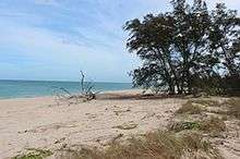
Crab Island, called Moent Island in the native language, is a now uninhabited island west of Muttee Heads and the coastal community of Seisia which is adjacent to Bamaga at the tip of Cape York Peninsula within the Endeavour Strait in the Gulf of Carpentaria in Queensland, Australia. It is around 280 hectares (690 acres).[1] The distance to the closest mainland (close to Slade Point) is 1.4 kilometres (0.87 mi). The original inhabitants were the Apukwi branch of the Ankamuti.
.png) Satellite image of Crab Island | |
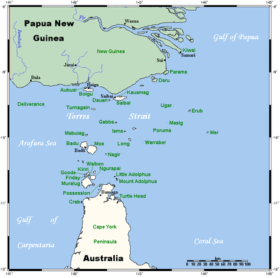 A map of the Torres Strait Islands showing Crab Island in the Gulf of Carpentaria | |
| Geography | |
|---|---|
| Location | Northern Australia |
| Coordinates | 10.973°S 142.106°E |
| Adjacent bodies of water | Gulf of Carpentaria |
| Area | 2.8 km2 (1.1 sq mi) |
| Administration | |
Australia | |
| State | Queensland |
| Demographics | |
| Population | Uninhabited |
Crab Island lies between Australia and the Melanesian island of New Guinea in the southwestern part of the Torres Strait, facing the Arafura Sea to the west. It is the most significant breeding ground of the flatback turtle (Natator depressus) and there is occasional nesting by the hawksbill sea turtle (Eretmochelys imbricata) and olive ridley sea turtle (Lepidochelys olivacea).
This island is south of the Torres Strait Islands.
References
- "Map of Crab Island, QLD". Bonzle Digital Atlas of Australia.
List of Torres Strait topics | |||||||||||||||||||
|---|---|---|---|---|---|---|---|---|---|---|---|---|---|---|---|---|---|---|---|
| Torres Strait Islands, islets, and cays |
| ||||||||||||||||||
| People, culture, communities and languages |
| ||||||||||||||||||
| Governance and legal matters |
| ||||||||||||||||||
| Buildings and structures | |||||||||||||||||||
| Other | |||||||||||||||||||