Bourke Isles
The Bourke Isles are a group of islands in the Torres Strait Islands archipelago, located west of the Cumberland Passage in the Torres Strait in Queensland, Australia.[1] The isles are situated approximately 130 kilometres (81 mi) northeast of Thursday Island and 54 kilometres (34 mi) southwest of Darnley Island.[2] The Bourke Isles are located within the Torres Strait Island Region local government area.
.png) A Landsat image of Yam Island, one of the Bourke Isles | |
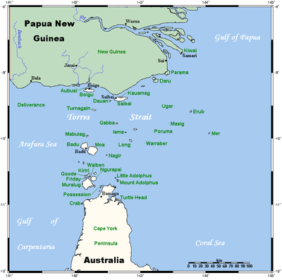 A map of the Torres Strait Islands showing Yam Island as Iama in central waters of the Torres Strait | |
| Etymology | Richard Bourke[1] |
|---|---|
| Geography | |
| Location | Cumberland Passage, Northern Australia |
| Coordinates | 9°54′00″S 143°23′41″E |
| Archipelago | Torres Strait Islands |
| Adjacent bodies of water | Torres Strait |
| Total islands | 7 |
| Major islands | Yam Island |
| Administration | |
| State | Queensland |
| Local government area | Torres Strait Island Region |
| Demographics | |
| Ethnic groups | Torres Strait Islanders |
The islands were named in 1836 by Charles Lewis, the Commander of colonial schooner Isabella, in honour of Richard Bourke, at the time, the Governor of New South Wales.[1]
The Bourke Isles includes:
- Aukane Islet
- Aureed Island
- Kabbikane Islet
- Layoak Islet
- Mimi Islet
- Roberts Islet
- Yam Island[3]
References
- "Bourke Isles (entry 4080)". Queensland Place Names. Queensland Government. Retrieved 30 August 2015.
- "Map of Bourke Isles, QLD". Bonzle Digital Atlas of Australia. Retrieved 26 April 2015.
- "Iama (Yam Island)". Torres Strait Island Region. 2015. Retrieved 26 April 2015.
List of Torres Strait topics | |||||||||||||||||||
|---|---|---|---|---|---|---|---|---|---|---|---|---|---|---|---|---|---|---|---|
| Torres Strait Islands, islets, and cays |
| ||||||||||||||||||
| People, culture, communities and languages |
| ||||||||||||||||||
| Governance and legal matters |
| ||||||||||||||||||
| Buildings and structures | |||||||||||||||||||
| Other | |||||||||||||||||||
This article is issued from Wikipedia. The text is licensed under Creative Commons - Attribution - Sharealike. Additional terms may apply for the media files.