Charente
Charente (French: [ʃaʁɑ̃t] (![]()
Charente | |
|---|---|
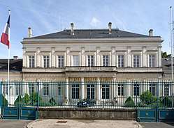 Prefecture building of the Charente department, in Angoulême | |
 Flag  Coat of arms | |
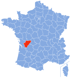 Location of Charente in France | |
| Coordinates: 45°50′N 0°20′E | |
| Country | France |
| Region | Nouvelle-Aquitaine |
| Prefecture | Angoulême |
| Subprefectures | Cognac Confolens |
| Government | |
| • President of the General Council | Michel Boutant (PS) |
| Area | |
| • Total | 5,956 km2 (2,300 sq mi) |
| Population (2016) | |
| • Total | 353,288 |
| • Rank | 67th |
| • Density | 59/km2 (150/sq mi) |
| Time zone | UTC+1 (CET) |
| • Summer (DST) | UTC+2 (CEST) |
| Department number | 16 |
| Arrondissements | 3 |
| Cantons | 19 |
| Communes | 366 |
| ^1 French Land Register data, which exclude estuaries, and lakes, ponds, and glaciers larger than 1 km2 | |
History
Charente is one of the original 83 departments created during the French Revolution on 4 March 1790. It was created from the former province of Angoumois, west and south of Saintonge.
Prior to the creation of the department, the area was not a natural unit, but much of it was commercially prosperous thanks to traditional industries such as salt and cognac production. Although the river Charente became silted up and was unnavigable for much of the twentieth century, in the eighteenth century it provided important links with coastal shipping routes both for traditional businesses and for newly evolving ones such as paper goods and iron smelting.
The accelerating pace of industrial and commercial development during the first half of the nineteenth century led to a period of prosperity, and the department's population peaked in 1851.[1] During the second half of the nineteenth century Charente, like many of France's rural departments, experienced a declining population as the economic prospects available in the cities and in France's overseas empire attracted the working age generations away. Economic ruin came to many in the Charentais wine industry with the arrival in 1872 of phylloxera.
During the twentieth century, the department with its traditional industries was adversely impacted by two major world wars and even in the second half of the century experienced relatively low growth, the overall population remaining remarkably stable at around 340,000 through the second half of the twentieth century, although industrial and commercial developments in the conurbation surrounding Angoulême have added some 10,000 to the overall population during the first decade of the twenty-first century.
The relatively relaxed pace of economic development in the twentieth century encouraged the immigration of retirees from overseas. Census data in 2006 revealed that the number of British citizens residing in the department had risen to 5,083,[2] placing the department fourth in this respect behind Paris, Dordogne and Alpes-Maritimes.[3]
Geography
It is part of the Aquitaine Basin for its major part, and of the Massif Central for its north-eastern part. The Charente flows through it and gave its name to the department, along with Charente-Maritime. It is composed with the historical region of Angoumois and contains part of the regions of Saintonge, Limousin, Périgord and Poitou.
The department is part of the current region of Nouvelle-Aquitaine. It is surrounded by the departments of Charente-Maritime, Dordogne, Haute-Vienne, Vienne and Deux-Sèvres. Its capital is Angoulême.
Demographics
The inhabitants of the department are called Charentais.
Population development since 1801:
| Year | Pop. | ±% p.a. |
|---|---|---|
| 1801 | 299,029 | — |
| 1806 | 327,052 | +1.81% |
| 1821 | 347,541 | +0.41% |
| 1831 | 362,531 | +0.42% |
| 1841 | 367,893 | +0.15% |
| 1851 | 382,912 | +0.40% |
| 1861 | 379,081 | −0.10% |
| 1872 | 367,520 | −0.28% |
| 1881 | 370,822 | +0.10% |
| 1891 | 360,259 | −0.29% |
| 1901 | 350,305 | −0.28% |
| 1911 | 347,061 | −0.09% |
| 1921 | 316,279 | −0.92% |
| 1931 | 310,489 | −0.18% |
| 1936 | 309,279 | −0.08% |
| 1946 | 311,137 | +0.06% |
| 1954 | 313,635 | +0.10% |
| 1962 | 327,658 | +0.55% |
| 1968 | 331,016 | +0.17% |
| 1975 | 337,064 | +0.26% |
| 1982 | 340,770 | +0.16% |
| 1990 | 341,993 | +0.04% |
| 1999 | 339,628 | −0.08% |
| 2007 | 349,535 | +0.36% |
| 2011 | 352,705 | +0.23% |
| 2016 | 353,288 | +0.03% |
| source:[4] | ||
Politics
The President of the General Council is Michel Boutant of the Socialist Party.
| Party | seats | |
|---|---|---|
| • | Socialist Party | 15 |
| Union for a Popular Movement | 6 | |
| Miscellaneous Right | 6 | |
| • | Miscellaneous Left | 6 |
| • | French Communist Party | 2 |
National Assembly representatives
Economy
Cognac and pineau are two of the major agricultural products of the region, along with butter. The Charentaise slipper (a type of slipper made from felt and wool) is another well-known traditional product.
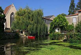
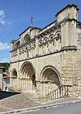
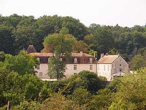
Tourism
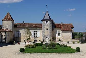
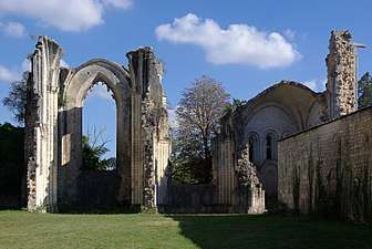 Abbey of La Couronne
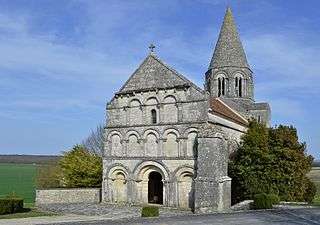
See also
Sources
- Jean Combes (dir.) et Michel Luc (dir.), La Charente de la préhistoire à nos jours, Imprimerie Bordessoules, coll. "L'histoire par les documents", 1986, 429 p. (ISBN 2-903504-21-0)
- Insee
- La Charente libre du 4 janvier 2010
- Site sur la Population et les Limites Administratives de la France
- http://www.assemblee-nationale.fr/
External links
- . Encyclopædia Britannica. 5 (11th ed.). 1911.
- (in French) Prefecture website
- (in French) General Council website
| Authority control |
|
|---|