Champfromier
Champfromier is a commune in the Ain department in eastern France.[2]
Champfromier | |
|---|---|
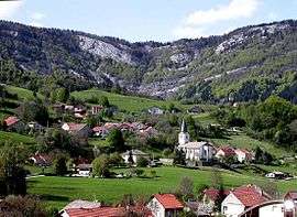 A general view of Champfromier | |
Location of Champfromier 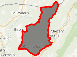
| |
 Champfromier  Champfromier | |
| Coordinates: 46°12′00″N 5°49′00″E | |
| Country | France |
| Region | Auvergne-Rhône-Alpes |
| Department | Ain |
| Arrondissement | Nantua |
| Canton | Bellegarde-sur-Valserine |
| Intercommunality | Pays Bellegardien |
| Government | |
| • Mayor (2014-2020) | Michel de Souza |
| Area 1 | 32.40 km2 (12.51 sq mi) |
| Population (2017-01-01)[1] | 729 |
| • Density | 23/km2 (58/sq mi) |
| Time zone | UTC+01:00 (CET) |
| • Summer (DST) | UTC+02:00 (CEST) |
| INSEE/Postal code | 01081 /01410 |
| Elevation | 480–1,540 m (1,570–5,050 ft) (avg. 646 m or 2,119 ft) |
| 1 French Land Register data, which excludes lakes, ponds, glaciers > 1 km2 (0.386 sq mi or 247 acres) and river estuaries. | |
Population
| Year | Pop. | ±% |
|---|---|---|
| 2004 | 613 | — |
| 2006 | 606 | −1.1% |
| 2007 | 630 | +4.0% |
| 2008 | 653 | +3.7% |
| 2009 | 676 | +3.5% |
| 2010 | 677 | +0.1% |
| 2011 | 676 | −0.1% |
| 2012 | 696 | +3.0% |
| 2013 | 713 | +2.4% |
| 2014 | 730 | +2.4% |
| 2015 | 735 | +0.7% |
| 2016 | 729 | −0.8% |
See also
References
- "Populations légales 2017". INSEE. Retrieved 6 January 2020.
- (Ain), Champfromier 2000 (2001). Champfromier: les moissons de la mémoire (in French). Musnier Gilbert (Editions). ISBN 9782910267414.
| Wikimedia Commons has media related to Champfromier. |
| Authority control |
|
|---|
This article is issued from Wikipedia. The text is licensed under Creative Commons - Attribution - Sharealike. Additional terms may apply for the media files.