Bâgé-le-Châtel
Bâgé-le-Châtel is a commune in the Ain department in eastern France.
Bâgé-le-Châtel | |
|---|---|
 The town hall and church in Bâgé-le-Châtel | |
.svg.png) Coat of arms | |
Location of Bâgé-le-Châtel 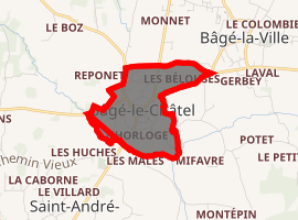
| |
 Bâgé-le-Châtel  Bâgé-le-Châtel | |
| Coordinates: 46°18′00″N 4°56′00″E | |
| Country | France |
| Region | Auvergne-Rhône-Alpes |
| Department | Ain |
| Arrondissement | Bourg-en-Bresse |
| Canton | Replonges |
| Intercommunality | Bresse et Saône |
| Government | |
| • Mayor (2020-2026) | Jean-Louis Malaterre |
| Area 1 | 0.88 km2 (0.34 sq mi) |
| Population (2017-01-01)[1] | 923 |
| • Density | 1,000/km2 (2,700/sq mi) |
| Time zone | UTC+01:00 (CET) |
| • Summer (DST) | UTC+02:00 (CEST) |
| INSEE/Postal code | 01026 /01380 |
| Elevation | 184–211 m (604–692 ft) (avg. 209 m or 686 ft) |
| 1 French Land Register data, which excludes lakes, ponds, glaciers > 1 km2 (0.386 sq mi or 247 acres) and river estuaries. | |
History
The name of Bâgé-le-Châtel comes from a Gallo-Roman villa belonging to a certain Balgiasius.
In the Middle Ages, three parishes were formed on the territory of the Seigneurs de Bâgé: Bâgé-le-Châtel around the chateau, Saint-André where the church was built, and Bâgé-la-Ville, the largest town.
Bâgé-le-Châtel is the ancient capital of Bresse. In 1272, Bresse became part of Savoy when Sibylle de Bâgé, sole heir, married Amadeus V, Count of Savoy. Bourg (today Bourg-en-Bresse), a fortified bastion with 3400 inhabitants, became the capital of Bresse. Bâgé remained a village, whereas Bourg expanded beyond its walls to become the city of today.
Population
| Year | Pop. | ±% |
|---|---|---|
| 2004 | 805 | — |
| 2006 | 802 | −0.4% |
| 2007 | 798 | −0.5% |
| 2008 | 795 | −0.4% |
| 2009 | 792 | −0.4% |
| 2010 | 796 | +0.5% |
| 2011 | 786 | −1.3% |
| 2012 | 829 | +5.5% |
| 2013 | 855 | +3.1% |
| 2014 | 881 | +3.0% |
| 2015 | 902 | +2.4% |
| 2016 | 915 | +1.4% |
See also
References
- "Populations légales 2017". INSEE. Retrieved 6 January 2020.
| Wikimedia Commons has media related to Bâgé-le-Châtel. |
| Authority control |
|---|
This article is issued from Wikipedia. The text is licensed under Creative Commons - Attribution - Sharealike. Additional terms may apply for the media files.