Canebrake (former town), California
Canebrake is a former settlement in Kern County, California.[1] It was located 5.5 miles (8.9 km) north-northwest of Walker Pass,[2] along Canebrake Creek at an elevation of 3930 feet (1198 m).[1]
Canebrake | |
|---|---|
Former settlement | |
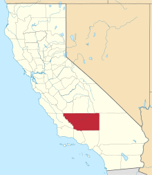
 Canebrake Location in California | |
| Coordinates: 35°43′54″N 118°04′43″W | |
| Country | United States |
| State | California |
| County | Kern County |
| Elevation | 3,930 ft (1,198 m) |
Thomas Hooper Smith built a stage coach station there in the 1870s. Canebrake still appeared on maps as of 1908.[1] The present town of Canebrake developed about three miles west.
References
- U.S. Geological Survey Geographic Names Information System: Canebrake (former town), California
- Durham, David L. (1998). California's Geographic Names: A Gazetteer of Historic and Modern Names of the State. Clovis, Calif.: Word Dancer Press. p. 1012. ISBN 1-884995-14-4.
This article is issued from Wikipedia. The text is licensed under Creative Commons - Attribution - Sharealike. Additional terms may apply for the media files.