Boogan, Queensland
Boogan is a locality in the Cassowary Coast Region, Queensland, Australia.[1]
| Boogan Queensland | |||||||||||||||
|---|---|---|---|---|---|---|---|---|---|---|---|---|---|---|---|
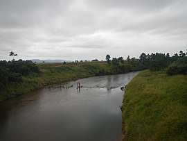 South Johnstone River at Boogan, 2013 | |||||||||||||||
 Boogan | |||||||||||||||
| Coordinates | 17.6086°S 146.0119°E | ||||||||||||||
| Postcode(s) | 4871 | ||||||||||||||
| Area | 13.7 km2 (5.3 sq mi) | ||||||||||||||
| LGA(s) | Cassowary Coast Region | ||||||||||||||
| State electorate(s) | Hill | ||||||||||||||
| Federal Division(s) | Kennedy | ||||||||||||||
| |||||||||||||||
Geography
The Bruce Highway forms part of the eastern boundary of the locality, while the South Johnstone River forms the north-western boundary. The land is relatively flat and low-lying (10–20 metres above sea level) and is predominantly used for cropping, particularly sugarcane. The North Coast railway line passes from south to north through the middle of the locality and there is a cane tramway to transport harvested sugarcane to the local sugar mills.[2]
History
The locality takes its name from the Boogan railway station named by the Queensland Railways Department on 12 September 1920. Boogan is an Aboriginal word meaning either forest country or dog.[1]
References
- "Boogan - locality in Cassowary Coast Region (entry 45680)". Queensland Place Names. Queensland Government. Retrieved 5 November 2017.
- "Queensland Globe". State of Queensland. Retrieved 13 December 2017.
This article is issued from Wikipedia. The text is licensed under Creative Commons - Attribution - Sharealike. Additional terms may apply for the media files.