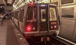
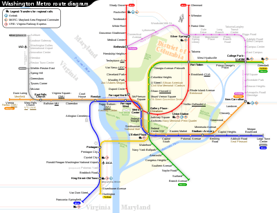
Blue Line (Washington Metro)
The Blue Line is a rapid transit line of the Washington Metro system, consisting of 27 stations in Fairfax County, Alexandria and Arlington, Virginia; the District of Columbia; and Prince George's County, Maryland, United States. The Blue Line runs from Franconia–Springfield to Largo Town Center. The line shares tracks with the Orange Line for 13 stations, the Silver Line for 18, and the Yellow Line for six. Only three stations are exclusive to the Blue Line. From May 22, 2019 to September 8, 2019 all Blue and Yellow Line services terminated at Ronald Reagan Washington National Airport due to platform reconstruction.[1][2]
Since March 19, 2020, trains are bypassing Arlington Cemetery station due to the 2020 coronavirus pandemic.[3][4]
History
Planning for Metro began with the Mass Transportation Survey in 1955 which attempted to forecast both freeway and mass transit systems sufficient to meet the needs of 1980.[5] In 1959, the study's final report included two rapid transit lines which anticipated subways in downtown Washington.[6] Because the plan called for extensive freeway construction within the District of Columbia, alarmed residents lobbied for federal legislation creating a moratorium on freeway construction through July 1, 1962.[7] The National Capital Transportation Agency's 1962 Transportation in the National Capital Region report anticipated much of the present Blue Line route in Virginia with the route following the railroad right-of-way inside Arlington and Alexandria to Springfield.[8] It did not include a route in Prince George's County.[8] The route continued in rapid transit plans until the formation of WMATA.
With the formation of WMATA in October 1966, planning of the system shifted from federal hands to a regional body with representatives of the District, Maryland and Virginia. Congressional route approval was no longer a key consideration.[9] Instead, routes had to serve each local suburban jurisdiction to assure that they would approve bond referenda to finance the system.[10]
The Virginia portion of the Blue Line took much of its present form along the Richmond, Fredericksburg and Potomac Railroad right-of-way to Colchester, as construction along existing right-of-way is the least expensive way to build into the suburbs.[11] A surface-level section of the Blue Line that parallels Virginia State Route 110 where passing Arlington National Cemetery and traveling between The Pentagon and Rosslyn replaced a section of the closed Rosslyn Connecting Railroad, a subsidiary of the Pennsylvania Railroad.[12][13] The railroad's predecessor, the Washington Southern Railway, constructed the section in 1896 within the grade of the old disused Alexandria Canal.[13][14]
In March 1968, the WMATA board approved its 98-mile (158 km) Adopted Regional System (ARS) which included the Blue Line from Huntington to Addison Road, with a possible extension to Largo.[15] The ARS contained a Blue Line/Orange Line station at Oklahoma Avenue between Stadium/Armory and the Anacostia River Bridge. Local residents objected to a proposed 1,000-car commuter parking lot at that station and the traffic that it would generate in the neighborhood. In reaction to their lobbying, the DC government insisted that the station be removed and that the tunnel for the line be extended through the neighborhood.[16] This then made the line the only one to have a station canceled due to neighborhood opposition.[17] To be constructed as an above ground station in the parking lot north of RFK Stadium near Oklahoma Avenue, the station was canceled saving Metro $12 million and the alignment of the line was shifted slightly to the east to address neighbor concerns.[17] To better accommodate tourists, a Smithsonian station exit was added on the Mall and the federal government requested in 1972 that the Arlington Cemetery Station be added to the Blue Line. The federal government paid the cost of both design changes.[18]
Service on the Blue Line began on July 1, 1977, on 18 stations between National Airport in Arlington and Stadium-Armory in Washington – the first link of the Metro to Virginia.[19][20] The line was extended by three stations to Addison Road on November 22, 1980.[21] Service south of National Airport began on June 15, 1991 when Van Dorn Street opened.[22] The original plan for the line was completed when this link was extended to Franconia–Springfield on June 29, 1997.[23] Two new stations in Maryland – Morgan Boulevard and Largo Town Center – opened on December 18, 2004.[24]
From its opening on November 20, 1978, until December 11, 1979, the Orange Line was co-aligned with the Blue Line from National Airport to Stadium-Armory, with the Orange Line continuing east from Stadium-Armory to New Carrollton.[25] Beginning December 1, 1979, the Orange Line diverged westward from Rosslyn to Ballston.[26] The Blue and Orange Lines remain co-aligned from Rosslyn to Stadium-Armory and the Silver Line is co-signed along the same route as well.[27]
The Blue Line was originally planned to follow a slightly different route. The plan would have sent Blue Line trains to Huntington, with Yellow Line trains serving Franconia–Springfield. This was changed due to a shortage of rail cars at the time of the completion of the line to Huntington. Because fewer rail cars were required to operate Yellow Line service than would be required to run Blue Line service out to Huntington – due to the Yellow Line's shorter route – the line designations were switched.[28] From 1999 to 2008, the Blue Line operated to Huntington on July 4, as part of Metro's special Independence Day service pattern.[29]
The ARS had the Blue Line end at Addison Road. However, sports fans continually argued for a three-mile (5 km) extension to the Capital Centre sports arena in Largo, Maryland. On February 27, 1997, the WMATA board approved construction of the extension.[20] By the time the extension opened in 2004, professional basketball and hockey had relocated to a new arena atop the Gallery Place Station and the Capital Centre was replaced with a shopping mall. However, the extension still drew considerable sport spectator traffic because it is within walking distance of the FedExField football stadium.[30] The extension cost $456 million.[31]
In 1998, Congress changed the name of the Washington National Airport to the Ronald Reagan Washington National Airport with the law specifying that no money be spent to implement the name change. As a result, WMATA did not change the name of the National Airport Station (which never included the full name of the airport). In response to repeated inquiries from Republican congressmen that the station be renamed, WMATA stated that stations are renamed only at the request of the local jurisdiction. Because both Arlington County and the District of Columbia were controlled by Democrats, the name change was blocked. Not until 2001 did Congress make changing the station's name a condition of further federal funding.[32][33][34][35]
In May 2018, Metro announced an extensive renovation of platforms at twenty stations across the system. To accommodate these platform reconstructions, Blue and Yellow Lines south of Ronald Reagan Washington National Airport would be closed from May to September 2019, in what would be the longest line closure in Metro's history.[36][37]
From March 26, 2020 until June 28, 2020, trains were bypassing Van Dorn Street, Arlington Cemetery, Federal Triangle, Smithsonian, Federal Center SW, and Morgan Boulevard stations due to the 2020 coronavirus pandemic.[3][4] All stations (except Arlington Cemetery) reopened beginning on June 28, 2020.[38]
Route
The southwestern terminal of the Blue Line is the Franconia–Springfield Station located at the intersection of Frontier Drive and the Franconia-Springfield Parkway (Virginia Route 289). The line travels above ground along the CSX Railroad right of way where it joins the Yellow Line just south of King Street in Old Town Alexandria. The joint line continues north along the CSX Railroad until it curves to the east on an elevated bridge adjacent to the National Airport terminal. The Blue Line then enters a subway tunnel under 15th Street South in Crystal City and bends north under Hayes Street and then The Pentagon parking lots. The Blue Line separates from the Yellow Line in this tunnel and emerges on surface tracks that parallel Virginia State Route 110 before entering a tunnel south of Rosslyn, where it merges with the Orange Line and Silver Line. The tunnel travels under North Lynn Street and then the Potomac River where it bends to the east and travels under I Street NW. The tunnel bends south under 12th Street NW and crosses under the Red Line in the Metro Center station. The tunnel then turns east under D Street SW, where it passes under the Yellow and Green Lines in the L'Enfant Plaza station. The tunnel continues east under Pennsylvania Avenue SE, G Street SE and Potomac Avenue SE. The Blue Line then bends north under 19th Street SE and transitions to an elevated line in the RFK Stadium parking lot near Oklahoma Avenue NE. The Blue Line crosses the Anacostia River on a bridge adjacent to Benning Road NE. At this point the line splits from the Orange Line and enters a tunnel under Benning Road and East Capitol Street. The Blue Line and Silver Line become a surface or elevated route with short tunnels parallel to Central Avenue from Addison Road – Seat Pleasant to its Eastern terminal at Largo Town Center, where it ends adjacent to the parking lots of "The Blvd" shopping center.[39]
In terms of WMATA's internal route designations, the Blue Line service travels along the entirety of the J Route (from the terminus at Franconia-Springfield to the C & J junction just south of King Street), part of the C Route (from the C & J junction just south of King Street to Metro Center), part of the D Route (from Metro Center to the D & G Junction just east of Stadium-Armory) and the entire G Route (from the D & G junction past Stadium-Armory to the terminus at Largo Town Center).[40] The Blue Line needs 23 six-car trains (138 rail cars) to run at peak capacity.[41]
Rush Plus
On June 18, 2012, Metro initiated its "Rush+" service plan, which had been under consideration for some time. This plan was intended to clear congestion at Rosslyn Station, where the Blue and Orange lines meet and ultimately prepare the tracks to accommodate the Silver Line.[42] Under the plan, Blue Line trains continued on the usual route but some Yellow Line trains originated at Franconia–Springfield and were routed over the Fenwick Bridge to Greenbelt.[43] During rush hour there were fewer Blue Line trains on the tracks which could mean potentially increased wait times for regular Blue Line customers. Furthermore, some Orange Line trains were routed to Largo Town Center until the Silver Line opened in 2014.[44]
Future
On November 16, 1995, WMATA and the developer of the Potomac Yard area of Alexandria, Virginia, signed an agreement to construct a new station between Braddock Road and National Airport that will be financed by the developer.[20] The Federal Transit Administration, in cooperation with WMATA, the National Park Service and The City of Alexandria government, completed an environmental impact statement for the project in June 2016.[45] The station will be completed by Spring 2022.[46]
A second improvement project involves building a pedestrian tunnel to interconnect the Gallery Place station with Metro Center. A July 2005 study proposed connecting the eastern mezzanine of Metro Center with the western mezzanine of Gallery Place that are only one block apart. The proposed connection would reduce the number of passengers that use the Red Line to transfer between the Yellow Line and the Blue and Orange lines at Metro Center. As of 2011, the project remained unfunded.[47]
In addition, a transportation planning group has proposed an extension of the Blue Line that would reach Potomac Mills in Prince William County.[48]
Stations
The following stations are along the line, from southwest to east:
| Station | Code | Opened | Image | Other Metro Line(s) |
Connections/other notes | |
|---|---|---|---|---|---|---|
| Franconia–Springfield | J02 | 1997 | | Southwestern terminus | ||
| Van Dorn Street | J01 | 1991 |  | |||
| King Street – Old Town | C13 | 1983 | ||||
| Braddock Road | C12 | 1983 | .jpg) | |||
| Potomac Yard | C11 | 2022 (projected)[46] | ||||
| Ronald Reagan Washington National Airport | C10 | 1977 | .jpg) | |||
| Crystal City | C09 | 1977 |  | |||
| Pentagon City | C08 | 1977 |  | |||
| Pentagon | C07 | 1977 | 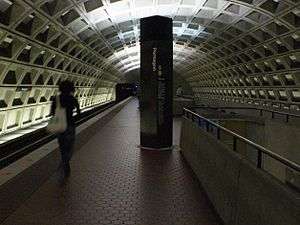 | Built as a multi-level station due to geographic constraints, with trains heading south towards Huntington (Yellow Line) and Franconia-Springfield (Blue Line) on the lower level, and trains heading north towards Greenbelt (Yellow Line) and Largo Town Center (Blue Line) on the upper level. | ||
| Arlington Cemetery | C06 | 1977 | 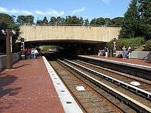 | Closed due to the 2020 coronavirus pandemic.[49][50] | ||
| Rosslyn | C05 | 1977 |  | Transfer station for the Orange and Silver Lines to join on same track | ||
| Foggy Bottom – GWU | C04 | 1977 | 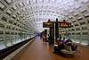 | |||
| Farragut West | C03 | 1977 | | Out of station interchange (OSI) to the Red Line's Farragut North station, which is located just one block away. There have been proposals to connect up the two stations through an underground passageway, though it has not been financed. | ||
| McPherson Square | C02 | 1977 |  | |||
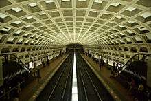
| Metro Center | C01 | 1977 | .jpg) | Transfer station for the Red Line | ||
| Federal Triangle | D01 | 1977 | ||||
| Smithsonian | D02 | 1977 | ||||
| L'Enfant Plaza | D03 | 1977 | Transfer station for the Yellow and Green Lines | |||
| Federal Center SW | D04 | 1977 | ||||
| Capitol South | D05 | 1977 | ||||
| Eastern Market | D06 | 1977 | ||||
| Potomac Avenue | D07 | 1977 | ||||
| Stadium–Armory | D08 | 1977 | Transfer station for the Orange Line | |||
| Benning Road | G01 | 1980 | ||||
| Capitol Heights | G02 | 1980 | ||||
| Addison Road | G03 | 1980 | ||||
| Morgan Boulevard | G04 | 2004 | ||||
| Largo Town Center | G05 | 2004 | Northeastern terminus | |||
| Future station | ||||||
References
- "Metro and regional officials urge customers to finalize alternative travel plans as summer 2019 station closures approach". www.wmata.com. Washington Metropolitan Area Transit Authority. May 22, 2019. Retrieved March 6, 2020.
- "Metro stations on Blue/Yellow lines to reopen Monday as planned". www.wmata.com. Washington Metropolitan Area Transit Authority. September 7, 2019. Retrieved March 6, 2020.
- "Special Covid-19 System Map" (PDF). Washington Metropolitan Area Transit Authority. Retrieved April 14, 2020.
- "Metrorail stations closed due to COVID-19 pandemic". Washington Metropolitan Area Transit Authority. March 23, 2020. Retrieved April 14, 2020.
- Schrag at p. 33-38.
- Schrag at p. 39.
- Schrag at p. 42.
- Schrag at p. 55.
- Schrag at p. 104
- Schrag at p. 108
- Schrag at p. 110-11.
- (1) Frank IBC (July 26, 2014). "Comments". The Metro plan has changed a lot since 1968. Greater Greater Washington. Archived from the original on June 28, 2017. Retrieved June 28, 2017.
There used to be a rail line from Rosslyn to the Long Bridge, but that was replaced by the Blue Line.
(2) 1942 map showing the Rosslyn Connecting Railroad, the planned route of Virginia State Route 110 (below the railroad), The Pentagon building and Arlington National Cemetery: "Plate 22". Plat Book of Arlington County, Virginia. Philadelphia, Pennsylvania: Franklin Survey Company. 1943. Retrieved October 25, 2019 – via Historic Map Works, LLC. Residential Genealogy.
(3) Maps and images of the area near the former route of the Rosslyn Connecting Railroad at the Arlington Cemetery Station of Metrorail's Blue Line (Coordinates: 38°53′03″N 77°03′46″W) - (1) "Certificate: Rosslyn Connecting Railroad Company - Virginia 1944". Scripophily.com. Archived from the original on June 28, 2017. Retrieved June 27, 2017.
Continuing south in Virginia was the Alexandria and Washington Railroad, opened in 1857. The Baltimore and Potomac acquired this line after reaching it, operating it until 1901, when the Washington Southern Railway (the successor of the Alexandria and Washington) was taken over by the Richmond, Fredericksburg and Potomac Railroad, an independent bridge line owned equally by the PRR and five other railroads. Soon after, in 1904, the line from the Long Bridge to Rosslyn, built by the Washington Southern, was split off into the Rosslyn Connecting Railroad, owned by the PRR.
(2) CSXvet (July 26, 2003). "Re: W&OD Railroad - Adjacent to Pentagon?". Nostalgia & History > W&OD Railroad. Trainorders.com. Archived from the original on July 1, 2017. Retrieved July 1, 2017 – via Digicert.com.The railroad that ran past the Pentagon was the onetime Pennsylvania RR Rosslyn branch. This branch left the mainline at RO (for Rosslyn) tower at the south end of the bridge over the Potomac and basically followed the Potomac northwest to Rosslyn. Part of it was built on the bed of the old canal that connected Alexandria with the C&O Canal in Georgetown.
(3) The Commission (1926). "Valuation Docket No. 160: Rosslyn Connecting Railroad Company: Appendix 1". Interstate Commerce Commission Reports: Decisions of the Interstate Commerce Commission of the United States (Valuation Reports): October 1925 — February 1926. Washington, D.C.: Government Printing Office. 106: 678. ISSN 0083-1530. OCLC 6392128. Retrieved October 26, 2019 – via HathiTrust Digital Library.The grading is rather light. The most of the line follows along the route of an old disused canal and in constructing the roadbed the carrier used the canal grading as far as possible.
- (1) Wilson, William Bender (1899). History of the Pennsylvania Railroad Company: with Plan of Organization, Portraits of Officials and Biographical Sketches. 1. Philadelphia: Henry T. Coates & Co. p. 332. OCLC 671596804. Retrieved June 27, 2017 – via Google Books.
The Washington Southern Railway extends from the junction of the Baltimore and Potomac Railroad at the south end of the Long Bridge, opposite Washington, D. C., to Quantico, Virginia, a distance of 32.12 miles. It has three branches — .... ; and the Rosslyn branch from the south end of the Long Bridge to the south end of the Aqueduct at the village of Rosslyn, Va., opposite Georgetown, D. C., a distance of 1.13 miles. This latter branch was opened for business April 2, 1896.
(2) 1900 map showing the Washington Southern Division of the Pennsylvania Railroad (formerly the Washington Southern Railway) inside the route of the "Old Alexandria Canal" within the "Arlington Reservation", between the Potomac River and the "National Cemetery": "Map of Alexandria County, Virginia for the Virginia Title Co". Alexandria, Virginia: The Company. 1900. Retrieved October 7, 2019 – via Library of Congress website. - Schrag at p. 117.
- Schrag at p. 161.
- Gorney, Cynthia (June 12, 1977), "Neighbors' unity wins fight against Metro station", The Washington Post, p. C1
- Schrag at p. 254.
- Feaver, Douglas B. (July 1, 1977). "Today, Metro could be U.S. model". The Washington Post. p. A1. Archived from the original on July 1, 2017. Retrieved July 1, 2017.
With the opening today of its 12-mile-long Blue Line from National Airport to RFK Stadium, Washington's Metro subway grows from a downtown demonstration line into the spine of a regional transportation system that could rival the Capital Beltway in its effect on Washington.
- "Metro History" (PDF). Washington Metropolitan Area Transit Authority. Archived from the original (PDF) on July 1, 2017. Retrieved July 1, 2017.
- Cooke, Janet (November 23, 1980). "Three new Metro stations have a festive first day". The Washington Post. p. D1.
- Staff Reporters (June 15, 1991). "Van Dorn Station to open". The Washington Post. p. B5.
- Tousignant, Marylou (June 27, 1997). "At last, Metro reaches end of the Blue Line; Franconia-Springfield station to begin service on Sunday". The Washington Post. p. B1.
- Dana, Rebecca (December 19, 2004). "Metro, Prince George's extend their reach; Two new Blue Line stations open, bringing passengers and economic potential". The Washington Post. p. C2.
- Eisen, Jack; John Feinstein (November 18, 1978). "City-County fanfare opens Orange Line; Ceremonies open new Orange Line". The Washington Post. p. D1.
- Feaver, Douglas B.; Sandra G. Boodman (December 2, 1979). "Area celebrates extension of Metrorail in Arlington". The Washington Post. p. C1.
- Metropolitan Washington Airports Authority (2010). "Dulles Metrorail Project Overview". Archived from the original on July 27, 2010. Retrieved July 25, 2010.
- Henderson, Nell (March 16, 1990), "Metro seeks comments on budget that includes new rail stations", The Washington Post, p. D3
- The Schumin Web Transit Center. "July 4 Service". Archived from the original on May 24, 2011. Retrieved July 26, 2010.
- "Evens and Venues: FedEx Field". WMATA. Retrieved November 8, 2018.
- Partlow, Joshua (January 1, 2005). "Newest stations to ease game-day crush; Redskins fans await rail, trail to FedEx". The Washington Post. p. B3.
- Schrag at p. 258.
- Layton, Lyndsey (April 20, 2001). "GOP Ups Pressure on Metro". Washington Post.
- Layton, Lyndsey (December 1, 2001). "House Votes to Require 'Reagan' at Metro Stop". Washington Post.
- 2002 Transportation Appropriations Act, Public Law 107-87, section 343, Statutes at Large 115 (2001) 833.
- "Metro wants to rebuild 20 station platforms over three years, creating SafeTrack-like disruptions". Washington Post. May 7, 2018. Retrieved February 19, 2019.
- "Metro plans 'summer shutdown' on Blue, Yellow lines next year". WTOP. May 7, 2018. Retrieved February 19, 2019.
- "Metro to reopen 15 stations, reallocate bus service to address crowding, starting Sunday | WMATA". www.wmata.com. Retrieved June 22, 2020.
- Metro Washington D.C. Beltway (Map) (2000–2001 ed.). 1:38016. AAA. 2000.
- Schrag at p. 188.
- "Approved Fiscal 2009 Annual Budget" (PDF). Washington Metropolitan Area Transit Authority. 2009. p. 80. Archived from the original (PDF) on December 3, 2010.
- Aratani, Lori (June 6, 2012). "Blue Line split". The Washington Post. Retrieved September 9, 2012.
- (1) Sun, Lena H. (February 11, 2008). "Metro Explores Rerouting Blue Line". The Washington Post. p. B-01. Retrieved June 2, 2011.
(2) Graphic (February 12, 2008). "A New Direction for the Blue Line". The Washington Post. Retrieved June 2, 2011.
(3) "Metro unveils new system map in preparation for Rush Plus: New rush service pattern begins June 18, 2012". Metro News Release. Washington Metropolitan Area Transit Authority. March 19, 2012.Rush Plus is designed to ease crowding, improve the commuting experience for Metrorail riders on the Orange, Blue, Green and Yellow lines, and prepare for the future Silver Line. .... Every third existing Blue Line train (three trains per hour in each direction) will now operate between Franconia-Springfield and Greenbelt via the Yellow Line bridge. These trains will be identified as Yellow Line trains. As a result, customers at Franconia-Springfield, Van Dorn Street and stations from L'Enfant Plaza to Greenbelt will have new transfer-free trip options between certain stations.
- (1) "Metro unveils new system map in preparation for Rush Plus: New rush service pattern begins June 18, 2012". Metro News Release. Washington Metropolitan Area Transit Authority. March 19, 2012. Archived from the original on July 5, 2017. Retrieved July 5, 2017.
Rush Plus is designed to ease crowding, improve the commuting experience for Metrorail riders on the Orange, Blue, Green and Yellow lines, and prepare for the future Silver Line. .... During each rush hour period, 18 new Orange Line trains — three per hour in each direction — will operate between Vienna and Largo Town Center.
(2) Washington Metropolitan Area Transit Authority (May 22, 2014). "Gaining Momentum: FY2015 Approved Budget: Effective July 1, 2014" (PDF). p. IV-33. Archived from the original (PDF) on July 5, 2017. Retrieved June 5, 2017. - "Potomac Yard Metrorail Station EIS". The Washington Metropolitan Area Transit Authority and the City of Alexandria. 2016. Archived from the original on July 5, 2017. Retrieved July 5, 2017.
- Lazo, Luz (April 6, 2018). "Potomac Yard Metro station is over budget and behind schedule". The Washington Post. Retrieved April 6, 2018.
- "Gallery Place/Chinatown – Metro Center Pedestrian Passageway" (PDF). Washington Metropolitan Area Transity Authority. Archived from the original (PDF) on August 6, 2011. Retrieved April 4, 2011.
- "Metro to Potomac Mills? Group recommends extending Blue Line, widening I-95" (PDF). Washington, D.C.: ABC7 News. February 8, 2011. Archived from the original (PDF) on July 5, 2017. Retrieved June 5, 2017 – via tripnet.org (TRIP).
- "Arlington Cemetery Station closed until further notice due to closure of Arlington National Cemetery | WMATA". www.wmata.com. Retrieved July 22, 2020.
- "Metro to close Smithsonian, Arlington Cemetery Stations to prevent Cherry Blossom travel | WMATA". www.wmata.com. Retrieved July 22, 2020.
Bibliography
| Wikimedia Commons has media related to Blue Line (Washington Metro). |
- Schrag, Zachary (2006). The Great Society Subway: A History of the Washington Metro. Baltimore, MD: Johns Hopkins University Press. ISBN 0-8018-8246-X.
| Subsidiaries | |
|---|---|
| Metrorail lines | |
| Bus rapid transit | |
| Other topics | |
| Agencies | |
|---|---|
| Washington Metro | |
| Commuter rail | |
| Regional rail | |
| Bus |
|
| Bus rapid transit | |
| Streetcar | |
| Aviation | |
| Future projects | |
| Agencies | |||||||
|---|---|---|---|---|---|---|---|
| Metrorail | |||||||
| Rail |
| ||||||
| Bus |
| ||||||
| Aviation |
| ||||||
| Automobile |
| ||||||
| Future projects | |||||||