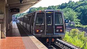
Yellow Line (Washington Metro)
The Yellow Line is a rapid transit line of the Washington Metro system, consisting of 21 stations in Fairfax County, Alexandria, and Arlington County, Virginia, as well as Washington, D.C. and Prince George's County, Maryland. The Yellow Line runs from Huntington in Virginia to Greenbelt station during all times since May 2019. Before then, it used to short turns at Mount Vernon Square during peak hours and ended at Fort Totten station during off-peak hours.[2][3][4][note 1][6]
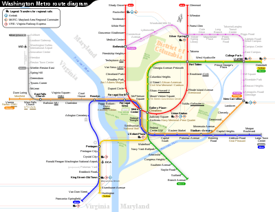
The line shares tracks with the Green Line from L'Enfant Plaza northward to Greenbelt. It is a quick link between downtown Washington and National Airport, and shares nearly all of its track with either the Green or Blue Line. The Yellow Line has only two stations that are not shared by any other lines (Eisenhower Avenue and Huntington), and only two sections of track that are not shared by any other lines – the section at the south end of the line, and the section between the Pentagon and L'Enfant Plaza stations, crossing the Potomac River.
History
Planning for Metro began with the Mass Transportation Survey in 1955 which attempted to forecast both freeway and mass transit systems sufficient to meet the needs of the region projected for 1980.[7] In 1959, the study's final report included two rapid transit lines which anticipated subways in downtown Washington.[8] Because the plan called for extensive freeway construction within the District of Columbia, alarmed residents lobbied for federal legislation creating a regional transportation agency with a moratorium on freeway construction through July 1, 1962.[9] The new agency, the National Capital Transportation Administration, issued a 1962 Transportation in the National Capital Region report, which did not include the route that became the Yellow Line.[10] A central route under 7th Street in downtown was only added in 1967 primarily to serve the "inner city".[11] In March 1968, the Washington Metropolitan Area Transit Authority (WMATA) board approved its 98-mile (158 km) Adopted Regional System (ARS) which included the Yellow Line from Franconia and Backlick Road (in Springfield) to Greenbelt.[12]
While a cut-and-fill tunnel for Yellow Line was built under 7th Street and U Street, both street traffic and pedestrian access on those streets were difficult.[13] The result was the loss of the traditional retail businesses along the route. The downtown segment of the line was originally projected to open in September 1977.[14] Obtaining approval of the District of Columbia and Prince Georges' County of the exact alignment of the Yellow Line north of U Street delayed construction. Originally, the ARS called for the line to be placed in the median strip of the planned North Central Freeway,[14] but after that road was cancelled, the route of the replacement subway tunnel became controversial, resulting in years of expensive delays.[15]
Service on the Yellow Line began on April 30, 1983, adding Archives to the system and linking the two already-built stations of Gallery Place and Pentagon with a bridge across the Potomac River. It was extended beyond National Airport by four stations to Huntington on December 17, 1983, the first station outside the Capital Beltway.[1] When the Green Line link to U Street opened on May 11, 1991, it acted as an extension of the Yellow Line until the southern Green Line branch was completed.[1][13] When Green Line service began, the Yellow Line was truncated at Mount Vernon Square, where a pocket track exists to relay trains.[1]
The Yellow Line was originally planned to follow a slightly different route in Virginia. The plan would have sent Yellow Line trains to Franconia–Springfield, with Blue Line trains serving Huntington. This was changed due to a shortage of rail cars at the time of the completion of the line to Huntington. Because fewer rail cars were required to operate Yellow Line service than would be required to run Blue Line service out to Huntington – due to the Yellow Line's shorter route – the line designations were switched. From 1999 to 2008, the Yellow Line operated to Franconia–Springfield on July 4, as part of Metro's special service pattern on that day.[16]
In 1998, Congress changed the name of the Washington National Airport to the Ronald Reagan Washington National Airport with the law specifying that no money be spent to implement the name change. As a result, WMATA did not change the name of the National Airport station (which never included the full name of the airport). In response to repeated inquiries from Republican congressmen that the station be renamed, WMATA stated that stations are renamed only at the request of the local jurisdiction. Because both Arlington County and the District of Columbia were controlled by Democrats, the name change was blocked. Finally, in 2001, Congress made changing the station's name a condition of further federal funding.[17][18][19][20]
In May 2018, Metro announced an extensive renovation of platforms at twenty stations across the system. To accommodate these platform reconstructions, the Blue and Yellow Lines south of Ronald Reagan Washington National Airport would be closed from May 25, to September 8, 2019, in what would be the longest line closure in Metro's history.[21][22] As a result, all Yellow and Blue line services terminated at Ronald Reagan Washington National Airport during the closure.[23]
From March 26, 2020 until June 28, 2020, trains were bypassing Eisenhower Avenue, Archives, Mount Vernon Square, and College Park–University of Maryland stations due to the 2020 coronavirus pandemic.[24][25] All stations were reopened beginning on June 28, 2020.[26]
Extensions
In 2006, Metro board member Jim Graham and D.C. Mayor Anthony A. Williams proposed re-extending Yellow Line service to Fort Totten station or even to Greenbelt station, which was the originally planned northern terminus for the line. Their proposal did not involve construction of any new track, because either extension would run along the same route as the existing Green Line and would thus relieve crowding on that line. Suburban members of the board initially resisted the proposal. Through a compromise that also increased service on the Red Line, on April 20, 2006 the WMATA board approved a Yellow Line extension to the Fort Totten station during off-peak hours. An 18-month pilot program began on December 31, 2006, at a cost of $5.75 million to the District of Columbia.[27][28] On June 26, 2008, due to the success of the 18- month trial, the Yellow Line was permanently extended to operate all the way up to the Fort Totten Metro Station at all other times other than during weekday rush hour/peak commuter periods.[5] Starting June 18, 2012, the Yellow Line was extended as part of the Rush Plus initiative trial, to operate all the way up to Greenbelt on the northern end and several trains were diverted to Franconia-Springfield on the southern end. However the service was discontinued on June 25, 2017 due to budget cuts.[29] In 2019, Metro announced that Yellow Line trains will be re-extend from Mt Vernon Sq/Fort Totten back to Greenbelt at all times beginning May 25, 2019 in order to provide extra service to the Green Line.[30]
Route
The Southern terminus of the Yellow Line is adjacent to Kings Highway (Virginia Route 241) in Fairfax County, Virginia.[31] The line heads northeast on a bridge over Hunting Creek and the Washington Beltway (Interstate 95) to a station just south of Eisenhower Avenue, which serves a number of government office buildings including the United States Patent Office. The Yellow Line then merges with the Blue Line and follows the right-of-way of the CSX Railroad through the City of Alexandria.[31] The line enters a short tunnel under U.S. Route 1. After crossing a bridge over Four Mile Run, the line enters Arlington County on an elevated structure above the National Airport parking lots.[32] At the north end of the airport, the Yellow Line enters a tunnel under 18th Street South and South Hayes Street in Crystal City.[31] The tunnel continues along the southwest face of the Pentagon which is a two level station to facilitate a fork with the Blue Line. After the Pentagon station, the Yellow Line emerges from its tunnel east of the Pentagon and crosses the Charles R. Fenwick Bridge over the George Washington Memorial Parkway, the Potomac River, and Ohio Drive.[31] At the end of the bridge, the Yellow Line re-enters a tunnel near the Jefferson Memorial and crosses under the Washington Channel.[31] The tunnel merges with the Green Line tunnel under 7th Street Southwest just south of the L'Enfant Plaza.[31] The joint Yellow Line — Green Line tunnel continues north through downtown Washington under 7th Street, turns west under Florida Avenue and U Street, and then north under 14th Street Northwest.[31] The tunnel then turns toward the northeast under Park Road and New Hampshire Avenue.[31] The tunnel then bends eastward under Rock Creek Cemetery and Fort Totten Park to emerge just before entering the lower level of the Fort Totten station. Until May 2019, this was the northernmost terminal for Yellow Line service, with the track continuing northeast as just the Green Line to the Greenbelt terminus.[31] Since then, the Yellow Line continues along these tracks to Greenbelt with the Green Line.
The Yellow Line needs 10 six-car trains (60 rail cars) to run at peak capacity.[33] Internally, the Yellow Line in Virginia was called the "Huntington Route" (C) and the route through the District of Columbia and beyond to Greenbelt as the "Greenbelt Route" (E).[34]
Stations
The following stations are along the line, from south to north.
| Station | Code | Opened | Image | Other Metro Line(s) |
Notes |
|---|---|---|---|---|---|
| Huntington | C15 | 1983 |  | Southern terminus | |
| Eisenhower Avenue | C14 | 1983 |  | ||
| King Street – Old Town | C13 | 1983 | Transfer station for the Blue Line (southern) | ||
| Braddock Road | C12 | 1983 | .jpg) | ||
| Potomac Yard | C11 | 2022 (projected) | |||
| Ronald Reagan Washington National Airport | C10 | 1977 | .jpg) | ||
| Crystal City | C09 | 1977 |  | ||
| Pentagon City | C08 | 1977 |  | ||
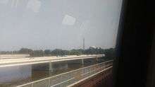
| Pentagon | C07 | 1977 |  | Transfer station for the Blue Line (northern); crosses Potomac River via Fenwick Bridge.
Built as a multi-level station due to geographic constraints, with trains heading south towards Huntington (Yellow Line) and Franconia-Springfield (Blue Line) on the lower level, and trains heading north towards Greenbelt (Yellow Line) and Largo Town Center (Blue Line) on the upper level. | |
| L'Enfant Plaza | F03 | 1977 | 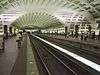 | Transfer station for the Blue, Orange, Green, and Silver Lines. | |
| Archives | F02 | 1983 | 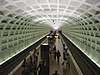 | ||
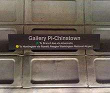
| Gallery Place | F01 | 1976 | 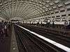 | Transfer station for the Red Line | |
| Mount Vernon Square | E01 | 1991 | 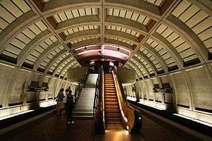 | ||
| Shaw – Howard University | E02 | 1991 | 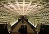 | ||
| U Street | E03 | 1991 | 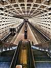 | ||
| Columbia Heights | E04 | 1999 | 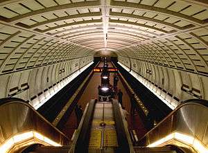 | ||
| Georgia Avenue – Petworth | E05 | 1999 | 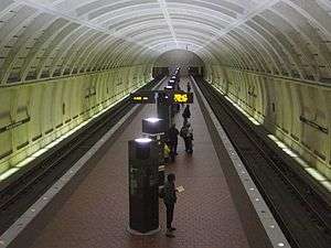 | ||
| Fort Totten | E06 | 1993 |  | Transfer station for the Red Line.
The only station on the metrorail network to have a platform that is both underground and at ground level. | |
| West Hyattsville | E07 | 1993 |  | ||
| Prince George's Plaza | E08 | 1993 |  | ||
| College Park–University of Maryland | E09 | 1993 | .jpg) | Purple Line (planned) | |
| Greenbelt | E10 | 1993 |  | Northern terminus |
Future
On November 16, 1995, WMATA and the developer of the Potomac Yard area of Alexandria, Virginia, signed an agreement to construct a new station between Braddock Road and National Airport that will be financed by the developer.[35] The Federal Transit Administration, in cooperation with WMATA, the National Park Service and The City of Alexandria government, completed an environmental impact statement for the project in June 2016.[36] The station will be completed by Spring 2022.[37]
A second improvement project involves building a pedestrian tunnel to interconnect the Gallery Place station with Metro Center. A July 2005 study proposed connecting the eastern mezzanine of Metro Center with the western mezzanine of Gallery Place that are only one block apart. The proposed connection would reduce the number of passengers that use the Red Line to transfer between the Yellow Line and the Blue and Orange lines at Metro Center. As of 2011, the project remained unfunded.[38]
See also
Notes
- Peak hours are 5 a.m. to 9:30 a.m. and 3 p.m. to 7 p.m.[5]
References
- "WMATA History" (PDF). WMATA. Archived from the original (PDF) on October 15, 2012. Retrieved March 30, 2011.
- "Metrorail Timetable: Weekend" (PDF). Washington Metropolitan Area Transit Authority. May 26, 2007. Retrieved June 22, 2009. Cite journal requires
|journal=(help) - "Metrorail Timetable: Weekday Evening" (PDF). Washington Metropolitan Area Transit Authority. April 14, 2008. Retrieved June 22, 2009. Cite journal requires
|journal=(help) - http://greatergreaterwashington.org/post/15099/how-will-rush-plus-affect-the-yellow-line
- "Metro Pocket Guide 50.532 (REV.3/11)" (PDF). Washington Metropolitan Area Transit Authority. Retrieved March 30, 2011.
- https://www.wmata.com/about/news/GM-FY20-Budget.cfm
- Schrag at p. 33-38.
- Schrag at p. 39.
- Schrag at p. 42.
- Schrag at p. 55.
- Schrag at p. 112.
- Schrag at p. 117.
- Schrag at p. 217.
- Schrag at p. 214.
- Schrag at p. 214-16.
- The Schumin Web Transit Center. "July 4 Service". Archived from the original on May 24, 2011. Retrieved July 26, 2010.
- Schrag at p. 258.
- Layton, Lyndsey (April 20, 2001). "GOP Ups Pressure on Metro". Washington Post.
- Layton, Lyndsey (December 1, 2001). "House Votes to Require 'Reagan' at Metro Stop". Washington Post.
- 2002 Transportation Appropriations Act, Public Law 107-87, section 343, Statutes at Large 115 (2001) 833.
- "Metro wants to rebuild 20 station platforms over three years, creating SafeTrack-like disruptions". Washington Post. May 7, 2018. Retrieved February 19, 2019.
- "Metro plans 'summer shutdown' on Blue, Yellow lines next year". WTOP. May 7, 2018. Retrieved February 19, 2019.
- https://www.wmata.com/service/track-work.cfm
- "Special Covid-19 System Map" (PDF). Washington Metropolitan Area Transit Authority. Retrieved April 14, 2020.
- "Metrorail stations closed due to COVID-19 pandemic". Washington Metropolitan Area Transit Authority. March 23, 2020. Retrieved April 14, 2020.
- "Metro to reopen 15 stations, reallocate bus service to address crowding, starting Sunday | WMATA". www.wmata.com. Retrieved 22 June 2020.
- "Yellow Line to extend to Fort Totten; off-peak Red Line turn backs at Grosvenor to end" (Press release). Washington Metropolitan Area Transit Authority. April 20, 2006. Archived from the original on September 30, 2007. Retrieved March 22, 2007.
- "Yellow Line to Fort Totten expected to be approved". Washington Examiner. April 20, 2006. Retrieved March 30, 2011.
- "Metro announces June 25 effective date for new hours, fares, schedules". WMATA. Retrieved 18 May 2017.
- "Metro to extend Yellow Line service to Greenbelt beginning May 25". WMATA. Retrieved 21 May 2019.
- Metro Washington D.C. Beltway (Map) (2000–2001 ed.). American Automobile Association. 2000.
- "Potomac Yards Metrorail Station EIS". Washington Metropolitan Area Transit Authority. Retrieved April 6, 2011.
- "Approved Fiscal 2009 Annual Budget" (PDF). Washington Metropolitan Area Transit Authority. 2009. p. 80. Archived from the original (PDF) on 2010-12-03.
- Schrag at p. 188.
- "Metro History" (PDF). Washington Metropolitan Area Transit Authority. Archived from the original (PDF) on July 1, 2017. Retrieved July 1, 2017.
- "Potomac Yard Metrorail Station EIS". The Washington Metropolitan Area Transit Authority and the City of Alexandria. 2016. Archived from the original on July 5, 2017. Retrieved July 5, 2017.
- Lazo, Luz (April 6, 2018). "Potomac Yard Metro station is over budget and behind schedule". The Washington Post. Retrieved April 6, 2018.
- "Gallery Place/Chinatown – Metro Center Pedestrian Passageway" (PDF). Washington Metropolitan Area Transity Authority. Archived from the original (PDF) on August 6, 2011. Retrieved April 4, 2011.
Further reading
- Schrag, Zachary (2006). The Great Society Subway: A History of the Washington Metro. Baltimore, MD: Johns Hopkins University Press. ISBN 0-8018-8246-X.
External links
| Wikimedia Commons has media related to Yellow Line (Washington Metro). |
- world.nycsubway.org: Yellow Line
| Subsidiaries | |
|---|---|
| Metrorail lines | |
| Bus rapid transit | |
| Other topics | |
| Agencies | |
|---|---|
| Washington Metro | |
| Commuter rail | |
| Regional rail | |
| Bus |
|
| Bus rapid transit | |
| Streetcar | |
| Aviation | |
| Future projects | |
| Agencies | |||||||
|---|---|---|---|---|---|---|---|
| Metrorail | |||||||
| Rail |
| ||||||
| Bus |
| ||||||
| Aviation |
| ||||||
| Automobile |
| ||||||
| Future projects | |||||||