Badugam
Badugam is a medium-sized village located in Gurez Tehsil of Bandipore district in the Indian union territory of Jammu and Kashmir. It is located 111 kilometres (69 mi) from Bandipora.
Badugam | |
|---|---|
Hill station | |
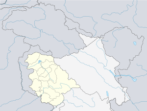 Badugam Location in Jammu and Kashmir, India  Badugam Badugam (India) | |
| Coordinates: 34.58°N 75.04°E | |
| Country | |
| Union territory | Jammu and Kashmir |
| District | Bandipora |
| Tehsil | Gurez |
| Government | |
| • Type | Panchayati raj |
| • Body | Gram panchayat |
| Population (2011) | |
| • Total | 1,813 |
| Languages | |
| • Official | Urdu |
| • Local | Kashmiri, Shina, Urdu |
| Time zone | UTC+5:30 (IST) |
| PIN | 193503[1] |
Demographics
According to the 2011 census of India, Badugam has 250 households. The literacy rate of Badugam village was 56.04% compared to 67.16% of Jammu and Kashmir. In Badugam Male literacy stands at 72.19% while the female literacy rate was 36.22%.
| Total | Male | Female | |
|---|---|---|---|
| Population | 1813 | 990 | 823 |
| Children aged below 6 years | 423 | 224 | 199 |
| Scheduled caste | 0 | 0 | 0 |
| Scheduled tribe | 1808 | 987 | 821 |
| Literacy | 56.04% | 72.19% | 36.22% |
| Workers (all) | 356 | 317 | 39 |
| Main workers (total) | 75 | – | – |
| Marginal workers (total) | 281 | 247 | 34 |
| Non-workers | 1097 | 476 | 621 |
gollark: And I still haven't gotten round to reworking the sandbox.
gollark: 6_4 tells me there are about three unpatched ones.
gollark: ... yes, should I be worried?
gollark: The closest thing is the LAN command daemon, for administration on local networks, which Tau *gained* a while ago, but it only allows shutdown, reboot and update or something like that.
gollark: Nope! Tau dropped that ages ago.
See also
- Gurez
- Tulail Valley
- Bandipora district
- Jammu and Kashmir
This article is issued from Wikipedia. The text is licensed under Creative Commons - Attribution - Sharealike. Additional terms may apply for the media files.