Highway 4 (Finland)
Highway 4 (Finnish: Valtatie 4, Swedish: Riksväg 4) is by far the longest numbered road in Finland. It stretches 1295 km from Helsinki to Utsjoki, almost the full length of the country from south to north. The highway is also part of the European route E75 from Vardø in Norway to Sitia in Greece.
- This article is an itinerary.
Understand
When the first numbering system for roads was established in Finland in 1938, highway 4 connected Helsinki to Petsamo on the Arctic Sea. After the Second World War, that area became part of the Soviet Union and Petsamo is nowadays called Pechenga. The northern end of the road was transfered to Karigasniemi, and in 1993 to Utsjoki.
There have been some other changes to the route over the decades, most notably in the southern end. Originally, highway 4 lead straight north from Helsinki to Hyvinkää, along what is now zig-zaging minor roads up to Padasjoki and along the western bank of Lake Päijänne to Jämsä and Jyväskylä. Later the road was routed via Lahti, but still along the western bank of Lake Päijänne, and since 1996 east of the lake.
North of Jyväskylä the route has (aside of the very northernmost end) roughly stayed the same, though it has been improved and straightened over the years and it has been rerouted around cities and towns. Also, some bodies of water were crossed by ferries until the 1960s. Overall the distance between Helsinki and Ivalo has been cut down from 1265 km in 1938 to 1117 km in 2013.
Prepare
While this isn't exactly driving along the Kolyma Highway or Dalton Highway, north of Rovaniemi the distances between services (from roadside cafés to car repair shops) are quite long. The road is paved and otherwise in good condition throughout.
If you start very early in the morning and literally only stopping for fuel, food or toilet breaks you'd (at least in summer conditions) arrive at the other end of the road before midnight. Budget three days at least for sightseeing, or even more if you want to explore the places along the road in depth or do some sidetrips.
Get in
Southern end
To start your trip in the south, see Helsinki#Get in. There are car ferries coming in from Tallinn, Estonia (the northern end of Via Baltica), Travemünde, Germany and Stockholm, Sweden. Driving in from St. Petersburg along E18, you don't have to take a boat.
If coming from further away, you can rent a car at the airport. If you not only want to drive highway 4 from end to end but really drive mainland Finland from south to north, start your trip in Hanko, 130 km southwest of Helsinki.
Northern end
The northern end of the highway is about as far away from everything else you can get in Europe without venturing into Russia. To drive here, you can for example take E6 through Sweden and Norway, or along the E45 (and take the E6 for the last bit). And you can drive in from Murmansk via northeastern Norway. Also, you can take the Hurtigruten ferry along the Norwegian coast to your port of choice in the north.
There's no airport in Utsjoki, the closest in Finland is in Ivalo, and on the Norwegian side there are several small airports for example in Kirkenes, Vadsø, Lakselv or Alta.
If you want to drive Finland entirely from north to south, start your trip in Nuorgam (also the northernmost point in the EU). Also, Nordkapp, the northernmost point reachable by road on the European mainland, is relatively close.
Drive
In the markers, the distance from Helsinki is written in parenthesis, and as such it represents the distance driven if you travel north or the distance left if you travel south.
Helsinki to Jyväskylä (269 km)
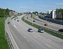
The southernmost point on this itinerary is 🌍 Helsinki (0 km). By far the biggest city along the route, the city features a lot of attractions and experiences. Administratively, highway 4 begins already at Erottaja at the southern edge of downtown, along the esplanades to the Market Square, follows the coast to Kalasatama, Kumpula and up to Vanhakaupunki near the place where the city was originally founded at the mouth of Vantaa river. From here, the road is signposted as highway 4, towards Lahti and the freeway/motorway/controlled-access highway begins. You will pass Kehä I (the first beltway of Helsinki, the second only comprises a few kilometers in Espoo), then highway 7 to Porvoo and all the way to the Russian border splits off, after this follows Kehä III at which point you will cross into the city of 🌍 Vantaa (17 km to Kehä III junction). From here on the environment takes a more rural character, even if you're still in the Capital Region. The city center of Vantaa, Tikkurila, is a bit west of the highway.
The following city is 🌍 Kerava (30 km), an industrial city possibly best known for the Sinebrychoff brewery, right to the west of the road. Look for the huge energy drink can outside the brewery; it used to be a huge beer can but was repainted. Kerava is also a bit west of the highway, as is 🌍 Järvenpää (38 km, southern junction). Järvenpää is known for Ainola, the home of the 19th and early 20th century composer Jean Sibelius. The road continues across forests and fields, and on the western side you can see the Helsinki-Lahti railway, and likely a train or two as this is a rather busy railway connecting Helsinki to the eastern part of the country as well as to Russia. A little more than halfway to Lahti is 🌍 Mäntsälä (59 km), and you start seeing truck stops (before Mäntsälä, if you have to fill up, you can drive into the cities but there are no stations right next to the road). Mäntsälä is the last municipality in the province of Uusimaa and you will enter Päijänne Tavastia. A little before Lahti, you will catch a glimpse of 🌍 Salpausselkä, the ridge system that forms the southern border of the Finnish Lakeland. 99 km from Helsinki you will reach the southern junction of 🌍 Lahti, 7 km south of Finland's 8th largest city. Set among the ridges of Salpausselkä, Lahti is an industrial city, and a notable venue for winter sports, especially nordic skiing events. For seeing a world heritage site, you can take a 🌍 sidetrip to Verla, a well preserved 19th century paper factory, nowadays a museum.
Formerly highway 4 went via Jämsä, along the western bank of Lake Päijänne, now it goes a shorter route along the eastern side. Roadsigns now direct you towards Jyväskylä and 🌍 Heinola (136 km). Heinola is famous for its bird zoo with more than 500 species and like many cities, the highway used to go right through downtown creating quite some bottlenecks a few decades ago. Nowadays the highway is routed west of the city, and crosses Lake Ruotsalainen on 🌍 Tähtiniemi bridge. At a length of 924 m, it was the longest bridge in the country when opened in 1993, and still the second longest. Just north of Heinola, at the village of Lusi, highway 5 forks off, leading to Mikkeli and onwards to Savonia and North Karelia. At 905 km, this is another important north-south link and the second longest road in Finland, and rejoins Highway 4 in Sodankylä. This is also where the 2+2 lane controlled-access highway ends, and apart from short sections around major cities, highway 4 will be undivided for the rest of the journey, mostly two-lane road but at some sections with a third lane for overtaking.
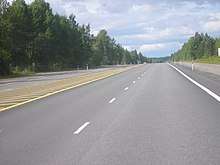
Entering the Finnish Lakeland, you start seeing bodies of water here and there, and the terrain gets a gradually more hilly. The next towns along the road are 🌍 Hartola (182 km), known for it's huge farmer's market event each September and 🌍 Joutsa (202 km), at which point you're already in the province of Central Finland. North of Joutsa is the 🌍 Joutsa emergency airfield, a highway strip, which means that the road is built wide and straight to be used as a runway (for military aircraft). The road passes close to the town of 🌍 Toivakka (240 km), the landscape gets more hilly, and eventually the numbering of the road signs will look quite impressive — "4 9 13 23 E63 E75", as the road from Kuopio, Mikkeli and Varkaus merges into it. Soon after you'll cross the 🌍 Päijänne-Keitele canal with the Vaajakoski lock on the right hand side, together with the Panda candy factory, enter the suburb of Vaajakoski, and drive along some scenic kilometers of motorway into 🌍 Jyväskylä (269 km). The 7th most populous city in Finland, Jyväskylä is a university city and a notable traffic node for both road, rail and boat transport. It is also known for its hills and lakes, and one of the hills, 🌍 Laajavuori was a triangulation point on the Struve Geodetic Arc, a 19th century project to measure the size of the Earth. The Laajavuori point is not one of the 34 points that comprise the world heritage site; to see one such point you need to get to the other side of Lake Päijänne and backtrack a bit to 🌍 Oravivuori, Korpilahti. Interestingly, the Geodetic Arc follows the highway quite closely in Central Finland and at the coast north of Oulu, but no world heritage listed triangulation point is adjacent to the highway. For another world heritage site, you can take a sidetrip to 🌍 Petäjävesi to see its wooden church.
Jyväskylä to Oulu (337 km)
After Jyväskylä, you're in for a fairly long drive to Oulu, the next city on the top of the roadsigns. For some distance out of the city, the road is freeway, after that the road will comprise one lanes in each direction, with an additional overtaking lane every now and then. 🌍 Jyväskylä's airport is right next to the highway and you can see aircraft landing and taking off very close by; however, there are just a couple of flights a day. A little before the airport there's also the Finnish Air Force Museum.
The next city is 🌍 Äänekoski (311 km), and for the following 100 km or so you will cross or pass several bodies of water, such as 🌍 Mämmensalmi. You're about halfway from Helsinki to Oulu, and a quarter of the journey to Utsjoki. The next landmark on the road is a tragic one, a small cross on the eastern side of the road marks the site of the 🌍 Konginkangas bus crash, the worst road accident in Finnish history. The journey continues through the slightly hilly landscape with lakes and bays especially on the eastern side of the road, and the town of 🌍 Viitasaari (368 km) is in a rather scenic setting with lakes on all sides. Here, the road is for some kilometers shared with highway 77, forming part of the Blue Highway. 🌍 Pihtipudas (406 km) is the next town, and by then the landscape has started becoming more flat and perhaps boring. This is pretty much what what the landscape will look like for the rest of the road to Oulu.
You'll enter the province of Northern Ostrobothnia, the part of it that is here on Wikivoyage described as the Southern Oulu region. The first town is 🌍 Pyhäjärvi (450 km), and right next to the road is 🌍 Vaskikello — a truck stop with an outdoor museum with many church bells on display. After Pyhäjärvi, the road follows the river Pyhäjoki, one of the many rivers in this part of the country, though they tend to be rather narrow this far inland. Then follows 🌍 Kärsämäki (484 km) where you can see Paanukirkko, church built in the early 2000s, but using traditional building techniques from the 18th century and using black wood shingles. As a funny piece of trivia, Kärsämäki translates to "snout hill". In the village of Leskelä you will pass next to the 🌍 "Center of Finland" (Suomen keskipiste) (506 km). The geographical center of Finland is reportedly not exactly there but in a nearby swamp, though going there would not be as convenient than just parking off the road. Here, the road is crossed by regional road 800, the longest regional road in Finland. Following that road northeast would bring you to the town of Puolanka which has a marker for the center of the Finnish mainland. That center is by the way not in Puolanka either, but out in the woods, some 10 km away...
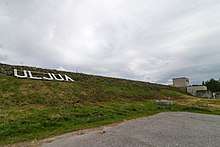
Through the fields and swamplands, and with some fairly long straight sections, the journey continues to the town of 🌍 Pulkkila (516 km), the administrative center of the municipality of Siikalatva covering many towns in the region. The sand walls you will see on the east side of the road soon after Pulkkila, are holding back the water of 🌍 Uljua reservior (Uljuan tekoallas) and Uljua hydroelectric plant. Short after that, the highway crosses river Siikajoki. The following town 🌍 Rantsila (548 km) was probably best known for the Kylmänen meat processing plant right next to the road, which burned down in 2017. The road passes through the town of 🌍 Temmes (578 km) and eventually comes the big roundabout where highway 4 meets up with highway 8 going along the west coast from Turku via Pori, Vaasa and Kokkola.
The road becomes freeway/motorway/controlled-access highway, the surroundings get a more urban character, giving the impression that you've arrived somewhere. The road passes 🌍 Kempele (596 km), with shopping areas next to the highway including the Zeppelin mall, marketing itself as the biggest in northern Finland. Then you enter 🌍 Oulu (606 km, southern junction), the country's 5th most populous city, the second largest urban area on this journey and certainly worth a stop. The city at the mouth of Oulu river is known as an IT hub, and if you want to stay longer, the city with surroundings does feature sights and attractions to keep you busy for a few days at least. A little over 600 km from Helsinki, there's still more road ahead of you than behind you — voyagers who've started in Utsjoki have already come more than halfway.
Oulu to Rovaniemi (224 km)
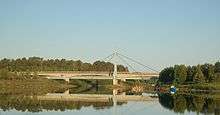
Continuing north, the roadsigns say Kemi, and carries the numbering of one additional European highway, E8. The road passes 🌍 Haukipudas (626 km), which nowadays is part of the city of Oulu and the road becomes undivided again. The section from Oulu to Kemi is a quite busy part of the highway, because there aren't very many other highways in the north-south direction at these latitudes, especially not to the northwestern Finland, and on to northern Sweden. The northern end of the Bay of Bothnia is fed by many rivers and the highway crosses a river in almost all towns. For example, in the town of 🌍 Ii (644 km) — yes, you read the name correctly — the road crosses the 🌍 Ii river delta. Another notable one is Simojoki in 🌍 Simo (687 km), and by that point you've crossed the provincial border into Lapland.
When you start feeling the odor of wood pulp, you've arrived in the industrial city of 🌍 Kemi (714 km), known for its paper industries. If visiting during the winter there are two special attractions here; a big castle made of snow constructed every winter, and icebreaker cruises on the icebreaker Sampo. North of the city, the road crosses the 🌍 Kemi river (Kemijoki) with its quite impressive delta and Isohaara hydroelectric plant on the northeastern side of the highway. You can get a closer look of the plant by taking the old road, it goes on the top of the dam. Right after the river crossing, highway 4 towards Rovaniemi turns straight north. If you'd like to make a quick sidetrip to Sweden, continue along road 29 to 🌍 Tornio and on to Haparanda on the other side of the Tornio river. This is by the way the world's northernmost motorway/freeway/divided highway.
For the stretch to Rovaniemi, highway 4 follows the left bank of Kemi river, which has a length of about 550 km and is the longest in Finland. One sign that you've entered Lapland, though the landscape hasn't changed that much yet, are the reindeer warning signs. Lapland is a region of reindeer husbandry, and the animals are roaming around the nature in flocks, even across roads. Further south in Finland, moose are the animals drivers might crash into, but you need to be rather lucky (or unlucky) to even see one. On the other hand, when driving the length of highway 4 through Lapland you're almost certain to see reindeer at least once, crossing the road or next to the road. Slow down when passing them!
The distances between towns and villages get longer as you travel further north. The only town (and municipal center) on the section to Rovaniemi is 🌍 Tervola (756 km), and even that is on the other bank of the river. Eventually the road reaches the last major city along the highway — 🌍 Rovaniemi (830 km). The capital and gateway to Finnish Lapland, it is a major tourist destination, one reason being that one can meet Santa Claus at the Arctic Circle just north of the city.
Rovaniemi to Utsjoki (452 km)
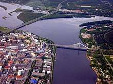
Leaving Rovaniemi, the highway crosses the confluence of the Kemijoki and Ounasjoki rivers with hills visible in almost all directions — you've certainly entered Lapland now. Once again, there are fairly large numbers on the distance road signs; 283 km to Ivalo. The next attraction is not far away, though, it's the Santa Claus Village right next to the highway at the place where the 🌍 Arctic Circle crosses the highway (according to new calculations, the circle crosses the road somewhat further north). A Christmas-themed park, it's aside of winter sports one of the main draws of visitors to Northern Finland. The road to Kemijärvi forks off to the east, and just like the rest of this trip, the distances between villages and settlements are rather long. Big uninhabited areas are also well suited for shooting with big weapons, and the area east of the road makes up the Rovajärvi artillery range — at 1100 km2 the biggest in Europe. Further along the road is the 🌍 Vuojärvi emergency airfield, a highway strip, just like the one in Joutsa.
Before the town of 🌍 Sodankylä (958 km), the highway starts running parallel to Kitinen, a tributary to the Kemi river. In Sodankylä, the second longest road, highway 5 merges back into highway 4. The river still runs parallel to the highway north of Sodankylä, while tributaries are flowing into it. Some of the rivers in this region have been dammed into reservoirs and the road crosses one of them, the 🌍 Porttipahta artificial lake, by a short causeway. After that, you arrive in 🌍 Vuotso, the southernmost Sami village. Indeed, you might have noticed bilingual road signs in Finnish and Sami already.
After Vuotso, some more points of interest will follow not too far away, first the village of 🌍 Tankavaara, known for its gold panning history which has been turned into an attraction. Tankavaara is also an entry point to the large 🌍 Urho Kekkonen National Park with landscapes characteristical to northern Lapland (and unlike the country further south). Driving further north hills will be visible, the landscape will get more barren and you'll arrive in 🌍 Saariselkä (1086 km), the biggest ski resort in this corner of Lapland. The road will now rise up on treeless hills, giving a taste of the tundra you will encounter further north along the road. In the 1930s and 40s, when the road to the Arctic Ocean was new, one of the uphill sections here was very steep (the road has been rerouted) and it was borderline impossible for cars and in particular trucks to climb it. At the time people assumed the hills were magnetic, therethrough creating an additional resistance to the vehicles, and one uphill section was named 🌍 Magneettimäki, Magnetic Hill. In reality the hills aren't magnetic, but the lack of vegetation may make them look less steep than they really are, also, the vehicles of that day were equipped with rather weak engines.
The next town, 🌍 Ivalo (1117 km) is relatively close by. Now finally Utsjoki shows up on road signs. Ivalo is the administrative center of the municipality of Inari, and with the only passenger airport in northeastern Lapland and a road connection to the Russian border at Raja-Jooseppi and onwards to Murmansk it's an important gateway to the region. From here, the original highway 4 went northeast to Petsamo on the Arctic coast, until the end of WWII part of Finland. The town itself doesn't have much to see, but a bit further north there are some beautiful 🌍 views to Lake Inari. 🌍 Inari (1157 km), the next town, is the center of Sami culture in Finland, and houses the Sami parliament and a Sami cultural center.
The further you travel, the conifers are more and more replaced by dwarf birchs and the landscape starts turning into tundra. From 🌍 Kaamanen (1187 km), highway 92 leads west to Karigasniemi, this was the route of highway 4 from the end of WWII until 1993, when it was changed to its current routing. The final 100 km of the highway zig-zags through an uninhabited tundra landscape with low vegetation, but instead hills and mountains. There are protected areas on both sides of the road; 🌍 Kevo Natural Park to the west and 🌍 Kaldoaivi Wilderness Area to the east. Eventually, you will arrive in the town of 🌍 Utsjoki (1282 km), and the very last part of the highway goes to the Sami Bridge crossing the Teno river into Norway.
Other than by car
The itinerary supposes you'll travel by car, though you can very well travel the full length of the route without a car, at least in the summer.
By bus
Bus travel requires, at minimum, a change of buses in Oulu and Rovaniemi. As a rule of thumb, the number of buses is inversely proportional to the distance from Helsinki, and north of Ivalo there might be only one bus a day in each direction and during winter not even that.
Once in Utsjoki without your own wheels, backtrack by bus, or if you find that boring, the bus line operated by Eskelisen Lapin Linjat to Utsjoki continues to Vadsø in Norway. From there you can get onwards by bus, plane or Hurtigruten coastal ferry.
By bike
|
By city bike In the summer of 2017, a man named Xavier Hildén cycled from Helsinki to Nuorgam — though he didn't use a bike built for tour cycling but one of Helsinki's city bikes that you can rent for short periods of time — he had a special permit from the city to borrow the bike for this month-long trip. During the trip he collected litter that people had thrown next the road, and one of the objectives of his journey was to raise awareness of the problem of littering the environment. |
If you are accustomed to long-distance cycling, and have enough time, biking the length of the highway can be an option. The road does include hills in Central Finland and even some mountains in northern Lapland, but this certainly is no crossing of the Alps. Also, from Helsinki to Heinola and around Jyväskylä and Oulu, highway 4 is controlled-access highway, which means you may not bike there and have to use other parallel roads.
Buses reportedly carry bikes (at least on the Finnish side), so you won't get stranded anywhere.
By thumb
Hitchhiking might also be possible, though hitchhikers aren't a common sight on Finnish roads.
Eat and drink
Cities and towns have restaurants and cafes. Other than that, for most of the road there's a place (separate cafeteria/restaurant or service station) to eat and drink at least every 50 km. North of Rovaniemi, with sparse population and less traffic, distances between service stops are considerably longer.
Sleep
Hotels and other accommodation is as a rule available in cities and bigger towns; sometimes but not always in smaller towns. Cottages may be a nice alternative, but as they seldom are at the road (and not always available for single nights), check and book in advance. There are campsites along the road, and wilderness camping is an option in rural areas (see Right to access in the Nordic countries).
Stay safe
Finland is a safe country to travel in. The biggest risks in the traffic are slippery roads (in southern Finland from November to March, but in the far north already as early as September or as late as May) and wildlife accidents (moose and roe deer in southern Finland, and much more likely, reindeer north of Kemi).
If driving north to south in winter, the sun will shine in your eyes most of the time it is above the horizon. Bring good sunglasses and have windscreen and wipers in good condition.
Go next
Where to go next depends on where you've ended your trip. From Utsjoki, you could go further to Nuorgam (the northernmost place in Finland and the EU) or Nordkapp in Norway (the northernmost point in Europe easily visited overland). From Helsinki, you can for instance travel west to Turku and Stockholm, south-west to Hanko at the southernmost point on the Finnish mainland, south to Tallinn or east to St. Petersburg (most nationalities need a visa).
The E75 continues southward from Gdynia or Gdańsk. The ferry connection has been suspended, but you can take the ferry to Tallinn and the Via Baltica (E67) to Poland.