Inari
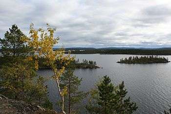
Inari (North Sami: Anár, Inari Sami: Aanaar, Skolt Sami: Aanar, Swedish: Enare) is a municipality and a small village in Finnish Lapland, on the shore of Lake Inari. The village is an administrative and cultural centre of the Sámi people in Finland.

Understand

Because Inari is located 300 km north of the Arctic Circle, there is Midnight sun from late May to late July and Polar Night from the beginning of December to middle January. The last ice within the lake disappears at the end of May. Even in July, the average temperature is only about 17°C. Inari is the largest municipality in Finland (5 % of the country, but less than 7,000 inhabitants), stretching from the Norwegian border in the west to the Norwegian and Russian borders in the east.
Four languages are spoken in Inari: Finnish, Northern Sami, Inari Sami and Skolt Sami. Inari Sami is the language traditionally used by the lake. North Sami is the biggest Sami language, spread with large scale reindeer husbandry. The Skolt Sami people were evacuated from Petsamo when Finland lost it in the World War.
Ivalo is the administrative centre and the biggest village (4,000 inhabitants). Inari is the second (1,000 inhabitants) and houses the Sámi parliament and a Sámi cultural centre. Other villages include Angeli, Kaamanen, Lisma, Nellim, Näätämö, Saariselkä and Sevettijärvi. The municipality got road connection when the road to Petsamo was built 1929. There are parts of two national parks (Lemmenjoki and UKK) and six wilderness areas in the municipality (Muotkatunturit, Paistunturi, Kaldoaivi, Vätsäri, Tsarmitunturi, Hammastunturi). Lake Inari is the third lake in size in Finland, and there are 8,000 other lakes here.
Get in
The nearest airport is in Ivalo. Coaches from or via Rovaniemi pass Inari on their way to Utsjoki, Vadsø, Nordkapp or Kirkenes. By car, the easiest way to get here from southern Finland is by car/sleeper train to Rovaniemi. Inari lies along road E75, but it's over 15 hours by bus from Helsinki.
See
With a bit of luck you can observe Northern lights dancing across the dark Lappish sky any time between September and March during your night walk.
Other sights:
- 🌍 Siida (Inari Sámi Museum), Inarintie 46, Inari, FI-99870, ☎ +358 400 898 212, e-mail: siida@samimuseum.fi. Jun 1-Sep 19: 9:00-20:00; Sep 20-Mar 31: 10:00-17:00. Siida is a museum devoted to the history and culture of the Sámi, the original people of the area. It also doubles as a natural history museum for the region, displaying plants and wildlife from all of the areas inhabited by the Sámi. The main building is from 1998, the outdoor museum has traditions from 1959. The exhibitions are of international standard, and text is provided in local languages, English, and German. In addition to the indoor exhibition, there is an outdoor museum which features traditional Sámi dwellings. Plenty of free parking available at the site. Adults: €10.
- Inari Lake (Inarijärvi) is Lapland's largest lake (and 12th in Europe; about 40 x 80 km). The deepest point is 92 m. More than 50% of the area is not open water but a labyrinth of 3300 islands.
- 🌍 Ukonsaari (Äiji). A high small island, a sacred place for the Sámi people, where offer rituals may have been held still in the 19th century. 11 km from Inari. Guided tours from Siida in summer. Hautuumaasaaret ("Graveyard Islands"; protected area) and some other special islands nearby.
- 🌍 Korkia-Maura Ice Cave. A 15m long cave with permafrost, on the island Korkia-Maura. Reachable with boat in summertime, over the ice in the winter.
- 🌍 Pielpajärvi Wilderness Church. At the former winter village of Inari. The church is from 1760 and thus one of the oldest buildings in northern Lapland. There is a 5 km trail to the church from Sarviniementie parking area, 3 km from Siida, through a nice forest. In wintertime there is a 18 km ski trail passing by the church. Campfire areas by the church and halfway.
Do
The lake is ideal for fishing, canoeing/kayaking and boating: you are alone and will not meet any person for weeks. The landscape is very nice because of the islands, but there are lots of mosquitoes. There are open wilderness huts and cabins for rent in the islands. For boating you need the Lake Inarijärvi boating map (Inarijärven veneilykartta; chart no 480).
Canoes and bikes can be rented from the shop next to Hotel Inari. There are "sea kayaking" routes on the lake, and the Juutuanjoki for those preferring whitewater (but the Jäniskoski rapids have to be portaged). It is possible to come by canoe all the way from Kultasatama in Lemmenjoki National Park (about 70km, most of it more easy/quiet canoeing).
There are also opportunities for horse riding and sleigh riding with huskies, depending on the season.
There are many nature and hiking trails in the area.
- Nature trails:
- Oi Juutua! telling about people, events and fishing. 7.5 km, starting point by the bridge in the village.
- Snowshoe Trail, telling about snow, 1.3 km, starting at the mouth of the Juutuanvuono Fjord.
- Five Senses Nature Trail telling about the history and nature, tough, unmarked but with GPS coordinates.
- Other trails:
- Inari – Otsamo Trail, 9 km. The trails goes by the river through old pine forest, passes the fell birch zone to the treeless 🌍 Otsamo fell top at 418 meters. Great view from the top. Start from Siida or Jäniskoski (where you can get by car or by the Juutua trail). There is also a shorter trail (3 km) to the fell top from the Otsamo/Rovajärvi parking area.
- Pielpajärvi Wilderness Church Trail, see above
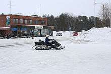
There are also cross country skiing and biking trails and snowmobile tracks in the area.
Cruises, fishing trips and snowmobile safaris can be arranged by Lake & Snow Inari, phone +358 16 671-108.
The 🌍 Lemmenjoki National Park is nearby (45 km), the largest National Park in Finland, and, according to Metsähallitus, "one of the whole Europe’s most extensive uninhabited and roadless backwoods". The park can partly be explored by boat, but there are also marked trails and wilderness huts as well as rental huts, and a vast backcountry. The park borders to Øvre Anárjohka National Park in Norway.
Also nearby is the 🌍 Muotkatunturit Wilderness Area, "literally a wilderness area" according to Metsähallitus. There are no marked trails, few wilderness huts or other facilities in the wilderness area itself – and phones are out of signal except on fell tops. Experience and adequate equipment are needed, but the terrain is quite easy. Suitable for hiking and cross-country skiing, for those who enjoy the silence. A few places are more frequented, such as the Stuorraäytsi canyon.
At the south-eastern shore of lake Inari, there is the Nellim village, with an orthodox church. Nearby (5–7 km) there is infrastructure from the war (Rautaportti, "iron gate"), and a restored log-floating flume. 30 km farther is the common border point between Finland, Norway and Russia (guided tours offered; mind the border zone if going by yourselves, the border point itself is reachable without permits via the border to Norway).
At the eastern end of the lake, past Nellim, is the roadless Vätsäri Wilderness Area, part of the Pasvik-Inari Trilateral Park. Rugged landscape with a mosaic of pine forests, mires and a labyrinth of the lakes. The Piilola trail through the area leads to Øvre Pasvik National Park in Norway (a rather special shortcut to Kirkenes). The trail is marked and there are wilderness huts, but hiking experience is needed as you are on your own here.
Buy
There are two supermarkets and a gas station in the city centre. The K-Market also serves as post office and pharmacy. Several dedicated souvenir shops are located along the main road (E75).
Samekki +358 16 671-086, with handicraft by Petteri Laiti, a famous Sámi goldsmith. Laiti often combines silver and reindeer horn. Among the products are leuku knives, jewellery, spoons and guksi. Not cheap, but true to Sámi tradition and highly regarded. The atelier on a side street by the church is open M–F 10AM–4PM.
Inarin hopea +358 16 671-333, by the Juutuajoki bridge, sells locally made modern jewellery inspired by the traditions and nature of Lapland. You can also watch the goldsmith at work. Open daily in the summertime (15.6–31.8) 9AM–8PM, winter M–F 10AM–5PM.
Eat and drink
- The hotels
- There is a small café at the top floor of the Siida museum, featuring a lunch buffet and sandwiches.
- Bear Caves. At the bear caves about 10 km outside Inari (in direction Ivalo) they offer meals from €6. It seems a bit like a tourist trap with the singing bear at the entrance. A few hundred meters climb through the forest to the bear cave (nice variation to sitting in the car).
Sleep
Budget
- 🌍 Uruniemi camping, Uruniementie 7 (2 km east from the village, towards Ivalo.), ☎ +358 50-371-8826, e-mail: pentti.kangasniemi@uruniemi.fi. Camping site 1.6–20.9, cottages all year. Camping, cottages and rooms. By the lake. Café and kiosk. cottages from €28, rooms from €25 (single?).
- 🌍 Vasatokka, Angelintie 696, ☎ +358 16 670-7960. A modern and comfortable hostel about 10km outside Inari. Also cottages. €54; breakfast €7.40. Sauna €15/h.
Mid-range
- 🌍 Hotel Inari, Inarintie 40, ☎ +358 16 671-026, fax: +358 16 671-047, e-mail: info@hotelliinari.fi. Check-out: 12AM. In the village. Free internet available in the reception area and nearby rooms. Rooms have different standards. Nice view over Lake Inari from some rooms. Restaurant with full menu at a reasonable price. Many of the courses are based on local produce such as reindeer, fish from Lake Inari, and berries. Bar open to 3AM in summer. €108.
- 🌍 Hotel Inarin Kultahovi, Saarikoskentie 2, ☎ +358 16 511-7100, e-mail: inarin.kultahovi@co.inet.fi. In the village. With a riverfront sauna. €106.
- 🌍 Hotel Korpikartano, Meneskartanontie 71 (at lake Menesjärvi), ☎ +358 40-777-4339, e-mail: menesjarvi@menesjarvi.fi. Variety of summer and winter activities are offered. Some 30 km southwest from the village, 10 km from Lemmenjoki National Park. €89; sauna.
Off roads
Going out boating or on the trails, right to access applies, except minor protected areas (and off course private yards etc.). There are campfire sites along the trails. There are open wilderness huts on some islands in the lake. There are also wilderness huts for rent.
Connect
Postal code 99870 Inari.
Mobile phones should work well in the village and along the main roads, but in the wilderness there are large areas with spotty coverage.
Go next
- The gold village Tankavaara, 100 km to the south, on E75
- The ski and spa resort of Saariselkä, 70 kilometers to the south
| Routes through Inari |
| Vardø ← Utsjoki ← | N |
→ Ivalo → Rovaniemi |