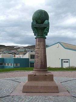
Struve Geodetic Arc
Struve Geodetic Arc is a UNESCO World Heritage Site in Norway, Sweden, Finland, Russia, Estonia, Latvia, Lithuania, Belarus, Moldova and Ukraine.
- This article is an itinerary.

Understand
The Struve Arc is a chain of survey triangulations stretching from Hammerfest in Norway to the Black Sea, through ten countries and over 2,820 km. These are points of a survey, carried out between 1816 and 1855 by the astronomer Friedrich Georg Wilhelm Struve, which represented the first accurate measuring of a long segment of a meridian. This helped establish the exact size and shape of our planet and marked an important step in the development of earth sciences and topographic mapping. It is an extraordinary example of scientific collaboration among scientists from different countries, and of collaboration between monarchs for a scientific cause. The original arc consisted of 258 main triangles with 265 main station points. The listed site includes 34 of the original station points, with different markings, i.e. a drilled hole in rock, an iron cross, cairns, or built obelisks.
Many of the inscribed sites are small posts in fields and may not reward a visit. However the focal point of the arc is the Dorpat Observatory in Tartu, Estonia
Prepare
Get in
The points of the arc run over 2,820 km. from above the Arctic Circle to the Black Sea, making it the longest inscription on the World Heritage List. Due to the vast distances there are very many ways to get to see it.
In addition to being spread over a large area, many of the components of this world heritage site are outside major cities and towns. A car is probably your best bet if you want to visit as many points as possible within a reasonable timeframe. The points located in the Gulf of Finland will still be problematic to access.
Norway, Sweden, Finland, Estonia, Latvia and Lithuania are members of the Schengen Area while Belarus, Moldova and Ukraine are not, meaning they have separate visa regimes. Most EU nationals enjoy relatively hassle-free access to the non Schengen countries on this itinerary, but you should still take your passport. Belarus had a notoriously "closed" visa policy in the past but has since greatly relaxed its rules for EU citizens. The Russian part of the Struve Arc on the island of Gogland is not accessible for tourists, so one has to skip this part and travel from Finland straight to Estonia (or vice versa). For more details see individual country articles.
Go
Norway
- 🌍 Fuglenes, Hammerfest, Finnmark
- 🌍 Luvdiidčohkka, Kautokeino, Finnmark
- 🌍 Baelljasvárri Kautokeino, Finnmark
Sweden
- 🌍 "Pajtas-vaara": Tynnyrilaki, Kiruna Municipality, Norrbottens län
- 🌍 "Pullinki": Pullinki, Övertorneå, Norrbottens län
Finland
- 🌍 Stuorrahanoaivi, Tarvantovaara Wilderness Area north of Karesuvanto, in Enontekiö, Finnish Lapland
- 🌍 Aavasaksa, Ylitornio, Finnish Lapland
- 🌍 Alatornion kirkko, Tornio, Finnish Lapland
- 🌍 Oravivuori, Korpilahti, Central Finland — From the Jyväskylä-Jämsä road E63, follow the signs around 10 km to the parking lot in the right. From there it's 1 km of hiking uphill. View to lake Päijänne from the tower is nice, though at the point where the UNESCO marker is, the view is obstructed by pines.
- 🌍 Tornikallio, Lapinjärvi, Uusimaa — From the Porlammi-Myrskylä road follow the signs to the parking lot, then it's first 200 m backtracking along the road and about 400 m of hiking uphill; probably not a good idea in the winter. Nice view over the lake, although at the point where the UNESCO marker is, the view is mostly obstructed by pines.
- 🌍 Mustaviiri, Pyhtää, Kymenlaakso — Located in the Gulf of Finland, you will need a boat to get to this point.
Russia
Since Russian authorities declared Gogland Island a "border area", it is not allowed for foreign nationals to travel to the island without special permits. This limits tourism from abroad to small groups admitted one at a time. There are two Struve Geodetic Arc points on Gogland: "Mäki-päälys" and 🌍 "Hogland, Z".
Estonia
To get from Finland to Estonia, you can make use of the multiple Ferries on the Baltic Sea that cross from Helsinki to Tallinn among other routes. These ferries are rather popular with Finns due to the vastly lower taxes on alcohol on the Estonian side.
- 🌍 "Woibifer": Võivere, Avanduse, Lääne-Viru
- 🌍 "Katko": Simuna, Avanduse, Lääne-Viru
Lithuania
- 🌍 "Karischki": Gireišiai, Panemunelis, Northern Lithuania
- 🌍 "Meschkanzi": Meškonys, Nemencine, Eastern Lithuania
- 🌍 "Beresnäki": Paliepiukai, Nemežis, Eastern Lithuania
Belarus
- 🌍 "Tupischki": Tupishki, Oshmyany, Grodno Oblast
- 🌍 "Lopati": Lopaty, Zelva, Grodno Oblast
- 🌍 "Ossownitza": Ossovnitsa, Ivanovo, Brest Oblast
- 🌍 "Tchekutsk": Chekutsk, Ivanovo, Brest Oblast
- 🌍 "Leskowitschi": Leskovichi, Ivanovo, Brest Oblast
Stay safe
Consult the individual country articles for safety precautions.
Some of the points are hard to access and entail hiking uphill or through difficult terrain.
Go next
Stretching along most of Europe from north to south, there are several places worth visiting near the route of the arc. If you are at the northern end of the Geodetic Arc, Nordkapp, the northernmost point in Europe reachable by car, isn't far away. In the southern end, continue south for a few hundred km in the same direction as the arc to get to Istanbul, the only major city in the world to stretch across two continents.