Yuat Rural LLG
Yuat Rural LLG is a local-level government (LLG) of East Sepik Province, Papua New Guinea.[1][2] It is named after the Yuat River. The Yuat languages are spoken in this LLG.
Yuat Rural LLG | |
|---|---|
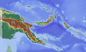
 Yuat Rural LLG Location within Papua New Guinea | |
| Coordinates: 4.405782°S 143.866251°E | |
| Country | Papua New Guinea |
| Province | East Sepik Province |
| Time zone | UTC+10 (AEST) |
Wards
- 01. Kundima
- 02. Aragunum
- 03. Saparu
- 04. Kinakaten
- 05. Akuran
- 06. Branda
- 07. Biwat (Mundugumor language and Bun language speakers)
- 08. Muruat
- 09. Dimiri
- 10. Bun (Bun language speakers?)
- 11. Sipisipi
- 12. Girin (Kyenele language speakers)
- 13. Asangumut
- 14. Mensuat
- 15. Yambimbit
- 16. Kambambit
- 17. Nadvari
- 18. Andafugun
- 19. Yambaidog
- 20. Olimolo
- 21. Itipino
gollark: I mean, maybe.
gollark: Mostly.
gollark: In modern countries we mostly don't have it, happily.
gollark: More of a thing which happens a lot in some types of society, I guess.
gollark: I don't think slavery even is human nature particularly.
See also
References
- "Census Figures by Wards - Momase Region". www.nso.gov.pg. 2011 National Population and Housing Census: Ward Population Profile. Port Moresby: National Statistical Office, Papua New Guinea. 2014.
- "Final Figures". www.nso.gov.pg. 2011 National Population and Housing Census: Ward Population Profile. Port Moresby: National Statistical Office, Papua New Guinea. 2014.
- OCHA FISS (2018). "Papua New Guinea administrative level 0, 1, 2, and 3 population statistics and gazetteer". Humanitarian Data Exchange. 1.31.9.
- United Nations in Papua New Guinea (2018). "Papua New Guinea Village Coordinates Lookup". Humanitarian Data Exchange. 1.31.9.
This article is issued from Wikipedia. The text is licensed under Creative Commons - Attribution - Sharealike. Additional terms may apply for the media files.