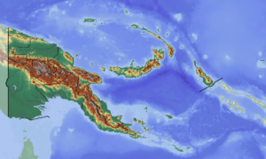
Ambunti Rural LLG
Ambunti Rural LLG is a local-level government (LLG) of East Sepik Province, Papua New Guinea.[1][2] Various Sepik languages are spoken in the LLG.
Ambunti Rural LLG | |
|---|---|
 Ambunti Rural LLG Location within Papua New Guinea | |
| Coordinates: 4.215201°S 142.817621°E | |
| Country | Papua New Guinea |
| Province | East Sepik Province |
| Time zone | UTC+10 (AEST) |
Wards
- 01. Ambunti
- 02. Bangus (Yelogu language speakers)[3][4]
- 03. Waskuk (Kwoma language speakers)
- 04. Beglam (Kwoma language speakers)
- 05. Tangujamb (Kwoma language speakers)[5]
- 06. Singiok
- 07. Amaki 1
- 08. Ablatak
- 09. Waiwos
- 10. Bu-Ur
- 11. Warsei
- 12. Ambuken
- 13. Tauri
- 14. Oum 1
- 15. Oum 2
- 16. Sanapian (Chenapian language speakers)
- 17. Hauna (Pei language speakers)
- 18. Waskuk (Washkuk / Kwoma language speakers)
- 19. Kupkain
- 20. Swagap 1 (Sogap / Nggala language speakers)
- 21. Baku
- 22. Yessan (Yessan language speakers)
- 23. Prukunawi
- 24. Yambun
- 25. Malu
- 26. Yerakai (Yerakai language speakers)
- 27. Garamambu
- 28. Yauambak
- 29. Avatip
- 80. Ambunti Urban
gollark: Minoteaur is to occur due to this.
gollark: Through invocation of dark bee gods and manually editing the PHP template files I finally managed to fix mathjax in dokuwiki.
gollark: I had a cactus once.
gollark: No. We are engaging in high-level apiometadiscussion.
gollark: It's obviously just a metahyperultrapalaiologistiapiothaumatoformic technique to avoid criticism.
References
- "Census Figures by Wards – Momase Region". www.nso.gov.pg. 2011 National Population and Housing Census: Ward Population Profile. Port Moresby: National Statistical Office, Papua New Guinea. 2014.
- "Final Figures". www.nso.gov.pg. 2011 National Population and Housing Census: Ward Population Profile. Port Moresby: National Statistical Office, Papua New Guinea. 2014.
- Eberhard, David M.; Simons, Gary F.; Fennig, Charles D., eds. (2019). "Papua New Guinea languages". Ethnologue: Languages of the World (22nd ed.). Dallas: SIL International.
- United Nations in Papua New Guinea (2018). "Papua New Guinea Village Coordinates Lookup". Humanitarian Data Exchange. 1.31.9.
- Lambert-Brétière, Renée. 2018. Landmarks and Kwoma identity. In S. Drude, N. Ostler & M. Moser (eds.), Endangered languages and the land: Mapping landscapes of multilingualism, Proceedings of FEL XXII/2018 (Reykjavík, Iceland), 19–25. London: FEL & EL Publishing.
- OCHA FISS (2018). "Papua New Guinea administrative level 0, 1, 2, and 3 population statistics and gazetteer". Humanitarian Data Exchange. 1.31.9.
- United Nations in Papua New Guinea (2018). "Papua New Guinea Village Coordinates Lookup". Humanitarian Data Exchange. 1.31.9.
This article is issued from Wikipedia. The text is licensed under Creative Commons - Attribution - Sharealike. Additional terms may apply for the media files.