Yacuiba Airport
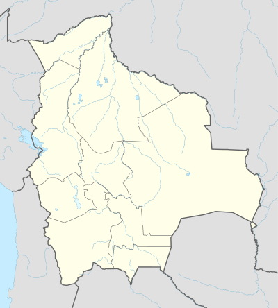
Yacuiba Airport (Spanish: Aeropuerto Yacuiba, IATA: BYC, ICAO: SLYA) is an airport located 4 kilometres (2.5 mi) north of Yacuiba, a city in the Tarija Department of Bolivia.
Yacuiba Airport | |||||||||||
|---|---|---|---|---|---|---|---|---|---|---|---|
| Summary | |||||||||||
| Airport type | Public | ||||||||||
| Serves | Yacuíba | ||||||||||
| Elevation AMSL | 2,116 ft / 645 m | ||||||||||
| Coordinates | 21°57′40″S 63°39′07″W | ||||||||||
| Map | |||||||||||
 BYC Location of airport in Bolivia | |||||||||||
| Runways | |||||||||||
| |||||||||||
The runway is in a north-south aligned valley, with rising terrain to the east, and the Cordillera Central mountains 2.5 kilometres (1.6 mi) to the west.
The Yacuiba non-directional beacon (Ident: YAC) is located on the field.[3]
Airlines and destinations
| Airlines | Destinations |
|---|---|
| Amaszonas | Santa Cruz de la Sierra–Viru Viru, Tarija |
| Boliviana de Aviación | Tarija |
gollark: Technically, this is an inaccurate description.
gollark: Bees run fully deterministic algorithms.
gollark: No, that would be stupid.
gollark: Apparently I mispredicted that, oh well.
gollark: SolarFlame5 is about to shame you for deviating from the norm.
References
- Airport information for Yacuiba Airport at Great Circle Mapper.
- Google Maps - Yacuiba
- Yacuiba NDB
External links
- Yacuiba Airport at OpenStreetMap
- Yacuiba Airport at OurAirports
- Aeronautical chart and airport information for Yacuiba Airport at SkyVector
- Current weather for Yacuiba at NOAA/NWS
This article is issued from Wikipedia. The text is licensed under Creative Commons - Attribution - Sharealike. Additional terms may apply for the media files.