Riberalta Airport
Capitán Av. Selin Zeitun Lopez Airport (IATA: RIB, ICAO: SLRI) is an airport serving Riberalta, a port city on the Beni River in the Beni Department of Bolivia. The airport is in the western section of the city, near the confluence of the Beni and Madre de Dios Rivers.
Cap. Av. Selin Zeitun Lopez Airport Riberalta Airport | |||||||||||
|---|---|---|---|---|---|---|---|---|---|---|---|
| Summary | |||||||||||
| Airport type | Public | ||||||||||
| Serves | Riberalta, Bolivia | ||||||||||
| Elevation AMSL | 462 ft / 141 m | ||||||||||
| Coordinates | 11°00′30″S 66°04′30″W | ||||||||||
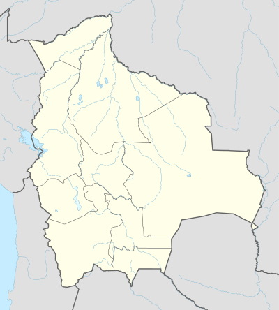
| Map | |||||||||||
 RIB Location of airport in Bolivia | |||||||||||
| Runways | |||||||||||
| |||||||||||
The Riberalta non-directional beacon (Ident: REA) is located on the field.[3]
Airlines and destinations
| Airlines | Destinations |
|---|---|
| Amaszonas | Guayaramerín, Santa Cruz de la Sierra–Viru Viru |
| EcoJet | Cochabamba, La Paz, Santa Cruz de la Sierra–Viru Viru, Sucre, Tarija, Trinidad |
gollark: Breadlicious!
gollark: I have some nice crunchy bread. Popcorn substitute.
gollark: "Oh, one sentence describing in very vague terms what's allowed and missing some exceptions is perfectly clear!"
gollark: I just cannot believe Kaini.
gollark: Probably it was just rushed out and God-Emperor TJ09 won't fix it for whatever reason.
See also


- Transport in Bolivia
- List of airports in Bolivia
References
- Airport information for Riberalta at Great Circle Mapper.
- Google Maps - Riberalta
- Riberalta NDB
External links
- Riberalta Airport at OpenStreetMap
- Riberalta Airport at OurAirports
- Aeronautical chart and airport information for Cap. Av. Selin Zeitun Lopez Airport at SkyVector
- Cap. Av. Selin Zeitun Lopez Airport at FallingRain
- Accident history for Cap. Av. Selin Zeitun Lopez Airport at Aviation Safety Network
- Current weather for Riberalta at NOAA/NWS
This article is issued from Wikipedia. The text is licensed under Creative Commons - Attribution - Sharealike. Additional terms may apply for the media files.