Westfield Parish, New Brunswick
Westfield is a civil parish[lower-alpha 1] in Kings County, New Brunswick, Canada.[2] For governance purposes it is divided between the town of Grand Bay-Westfield and the local service district of the parish of Westfield,[3] which is further divided into the taxing authorities of Westfield East and Westfield West, which are sometimes erroneously described as LSDs in their own right.
Westfield | |
|---|---|
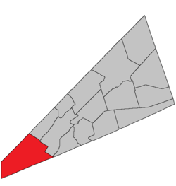 Location within Kings County, New Brunswick. | |
| Country | |
| Province | |
| County | Kings County |
| Established | 1786 |
| Area | |
| • Land | 295.70 km2 (114.17 sq mi) |
| Population (2016)[1] | |
| • Total | 1,962 |
| • Density | 6.6/km2 (17/sq mi) |
| • Change 2011-2016 | |
| • Dwellings | 952 |
| Time zone | UTC-4 (AST) |
| • Summer (DST) | UTC-3 (ADT) |
History
Westfield Parish created in 1786: possibly named for the town of Westfield in Massachusetts.
Delineation
Westfield Parish is defined in the Territorial Division Act[4] as being bounded:
- On the northwest, south and west, by the boundary line of the County; and on the northeast by a line beginning on the County line between Kings and Queens, intersected by the northwestern prolongation of the line dividing lots number twenty-three and number twenty-four at Devils Back, on the Long Reach; thence southeasterly along said prolongation and line to the northwestern shore of the Long Reach; thence southeasterly in a direct line across the Saint John River to the line dividing lots number twenty-five and number twenty-six, granted to Robert and Caleb Merritt; thence southeasterly along said line and its southeastern prolongation to the rear line of lots fronting on the northwest side of Kennebecasis Bay; thence southwesterly along said line to the northeast line of lot number twenty-eight, granted to Dennis Coombe; thence southeasterly along said line and its southeastern prolongation to the County line, including Kennebecasis Island.
Communities
Parish population total does not include incorporated municipalities (in bold):
|
|
|
Bodies of water & Islands
This is a list of rivers, lakes, streams, creeks, marshes and Islands that are at least partially in this parish
- Eagle Lake
- Kennebecasis Island
- Loch Alva
- Seven Mile Lake
Demographics
Access Routes
Highways and numbered routes that run through the parish, including external routes that start or finish at the parish limits:[7]
|
|
|
|
See also
Notes
- Civil parishes served a variety of government functions until 1966, when the new Municipalities Act stripped them of their responsibilities; they continue to provide convenient boundaries for government uses, especially electoral districts and local service districts. Statistics Canada uses civil parishes as census subdivisions for all parts of the province that are not within municipalities and similar entities.
References
- "Census Profile, 2016 Census: Westfield, Parish [Census subdivision], New Brunswick". Statistics Canada. Retrieved September 18, 2019.
- "Chapter T-3 Territorial Division Act". Government of New Brunswick. Retrieved 19 July 2020.
- "New Brunswick Regulation 84-168 under the Municipalities Act (O.C. 84-582)". Government of New Brunswick. Retrieved 19 July 2020.
- "Territorial Division Act (R.S.N.B. 1973, c. T-3)". Government of New Brunswick website. Retrieved 30 August 2016.
- Statistics Canada: 2001, 2006 census
- 2011 Statistics Canada Census Profile: Westfield Parish, New Brunswick
- Atlantic Canada Back Road Atlas ISBN 978-1-55368-618-7
External links
Places adjacent to Westfield Parish, New Brunswick | ||||||||||
|---|---|---|---|---|---|---|---|---|---|---|
| ||||||||||
| Subdivisions |
|
|---|---|
| Cities | |
| Counties | |
| |