Petersville Parish, New Brunswick
Petersville is a civil parish[lower-alpha 1] in Queens County, New Brunswick, Canada.[2]
Petersville | |
|---|---|
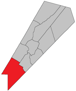 Location within Queens County, New Brunswick. | |
| Country | |
| Province | |
| County | Queens County |
| Established | 1838 |
| Area | |
| • Land | 590.14 km2 (227.85 sq mi) |
| Population (2016)[1] | |
| • Total | 681 |
| • Density | 1.2/km2 (3/sq mi) |
| • Change 2011-2016 | |
| • Dwellings | 325 |
| Time zone | UTC-4 (AST) |
| • Summer (DST) | UTC-3 (ADT) |
For governance purposes it is divided between CFB Gagetown and the local service districts of Wirral-Enniskillen and the parish of Petersville.[3]
History
Petersville Parish erected from Hampstead Parish and Gagetown Parish in 1838: named for Henry Peters, speaker of the New Brunswick house of the Assembly.
Delineation
Petersville Parish is defined in the Territorial Division Act[2] as being bounded:
- Being all that part of the County southwest of a line beginning where the road from Jones’ mill[lower-alpha 2] crosses the County line; thence northerly along the said road to the northwest line of lot number one, granted to John Short; thence northeasterly along the same to the northeast line of lot number five, granted to Sylvanus Haviland; thence northwesterly along the same and its northwestern prolongation to the southeast line of lands granted to James Corbett; thence northeasterly along the same to the southwest line of the grant to Henry Appleby; thence northwesterly along the same to the Gagetown Road;[lower-alpha 3] thence northeasterly along the same to the northeast line of lot number twenty-five, granted to T.T. Hewlett, and thence northwesterly along the same and its northwestern prolongation to the Sunbury County line.
Communities
Parish population total does not include incorporated municipalities (in bold).
|
|
|
Demographics
Access Routes
Highways and numbered routes that run through the parish, including external routes that start or finish at the parish limits:[6]
Notes
- Civil parishes served a variety of government functions until 1966, when the new Municipalities Act stripped them of their responsibilities; they continue to provide convenient boundaries for government uses, especially electoral districts and local service districts. Statistics Canada uses civil parishes as census subdivisions for all parts of the province that are not within municipalities and similar entities.
- Olinville Road
- Lawfield Road, within CFB Gagetown
gollark: Look, I doubt my setup is significantly less secure than the *average* amateurishly run internet-connected server.
gollark: No.
gollark: Thank you.
gollark: You're not punctuating or capitalizing it right and apiosecurihazards are canonically not a thing.
gollark: What? No.
References
- "Census Profile, 2016 Census: Petersville, Parish [Census subdivision], New Brunswick". Statistics Canada. Retrieved September 27, 2019.
- "Chapter T-3 Territorial Division Act". Government of New Brunswick. Retrieved 22 July 2020.
- "New Brunswick Regulation 84-168 under the Municipalities Act (O.C. 84-582)". Government of New Brunswick. Retrieved 19 July 2020.
- Statistics Canada: 2001, 2006 census
- 2011 Statistics Canada Census Profile: Petersville Parish, New Brunswick
- Atlantic Canada Back Road Atlas ISBN 978-1-55368-618-7
External links
Places adjacent to Petersville Parish, New Brunswick | |
|---|---|
| Subdivisions |
|
|---|---|
| Cities | |
| Counties | |
| |
This article is issued from Wikipedia. The text is licensed under Creative Commons - Attribution - Sharealike. Additional terms may apply for the media files.