Clarendon Parish, New Brunswick
Clarendon is a civil parish in Charlotte County, New Brunswick, Canada,[2] located in the interior to the north of Point Lepreau and southwest of CFB Gagetown.
Clarendon | |
|---|---|
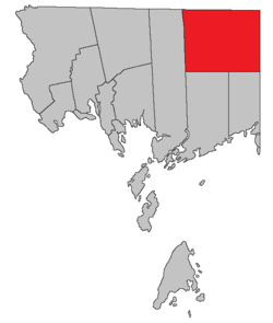 Location within Charlotte County. | |
| Country | |
| Province | |
| County | Charlotte County |
| Established | 1869 |
| Area | |
| • Land | 492.19 km2 (190.04 sq mi) |
| Population (2016)[1] | |
| • Total | 63 |
| • Density | 0.1/km2 (0.3/sq mi) |
| • Change 2011-2016 | |
| • Dwellings | 90 |
| Time zone | UTC-4 (AST) |
| • Summer (DST) | UTC-3 (ADT) |
The local service district (LSD) and Census subdivision of the same name have the same boundaries as the parish.[3]
The LSD assesses for assesses for community & recreation services[4] in addition to basic LSD services.[lower-alpha 1]
History
Clarendon Parish was established in 1869: named for George Frederick Villiers, 4th Earl of Clarendon, (1800-1870) and Foreign Secretary of England from 1853-1858 and from 1868-1870.
Delineation
Clarendon Parish is defined in the Territorial Division Act[2] as:
- "West by Saint George Parish; north and east by the County lines, and south by a line run true west from the most southern angle of Queens County to the eastern boundary of Saint George Parish."
Bodies of water
Bodies of water at least partly within the parish.[5]
|
|
|
|
Conservation areas
- Lepreau River Game Management Area
Demographics
Population
| Canada census – Clarendon Parish, New Brunswick community profile | |||
|---|---|---|---|
| 2016 | 2011 | 2006 | |
| Population: | 63 (+21.2% from 2011) | 52 (-26.8% from 2006) | 71 (+73.2% from 2001) |
| Land area: | 492.19 km2 (190.04 sq mi) | 492.91 km2 (190.31 sq mi) | 492.84 km2 (190.29 sq mi) |
| Population density: | 0.1/km2 (0.26/sq mi) | 0.1/km2 (0.26/sq mi) | 0.1/km2 (0.26/sq mi) |
| Median age: | 59.2 (M: 59.8, F: 57.7) | 58.0 (M: 59.5, F: 56.5) | 48.8 (M: 50.0, F: 47.8) |
| Total private dwellings: | 90 | 76 | 64 |
| Median household income: | $44,928 | $.N/A | $.N/A |
| Notes: Income data for this area has been suppressed for data quality or confidentiality reasons. – References: 2016[6] 2011[7] 2006[8] earlier[9] | |||
|
|
| |||||||||||||||||||||||||||
| [10][1] | |||||||||||||||||||||||||||||
Language
| Canada Census Mother Tongue - Clarendon Parish, New Brunswick[10] 2001 & 2006 language data for this area has been suppressed for data quality or confidentiality reasons. | ||||||||||||||||||
|---|---|---|---|---|---|---|---|---|---|---|---|---|---|---|---|---|---|---|
| Census | Total | French |
English |
French & English |
Other | |||||||||||||
| Year | Responses | Count | Trend | Pop % | Count | Trend | Pop % | Count | Trend | Pop % | Count | Trend | Pop % | |||||
2011 |
50 |
50 | 100.00% | 0 | 0.00% | 0 | 0.00% | 0 | 0.00% | |||||||||
1996 |
50 |
50 | n/a | 100.00% | 0 | n/a | 0.00% | 0 | n/a | 0.00% | 0 | n/a | 0.00% | |||||
Access Routes
Highways and numbered routes that run through the parish, including external routes that start or finish at the parish limits:[11]
See also
Notes
- Firefighting, policing, zoning, EMO, and dog control, along with administrative costs.
References
- "Census Profile, 2016 Census: Clarendon, Parish [Census subdivision], New Brunswick". Statistics Canada. Retrieved 8 September 2019.
- "Chapter T-3 Territorial Division Act". Government of New Brunswick. Retrieved 1 August 2020.
- "New Brunswick Regulation 84-168 under the Municipalities Act (O.C. 84-582)". Government of New Brunswick. Retrieved 1 August 2020.
- "2019 Local Government Statistics for New Brunswick" (PDF). Department of Environment and Local Government. p. 59. Retrieved 2 August 2020.
- "442" (PDF). Province of New Brunswick. Retrieved 2 August 2020."457" (PDF). Province of New Brunswick. Retrieved 2 August 2020."458" (PDF). Province of New Brunswick. Retrieved 2 August 2020."470" (PDF). Province of New Brunswick. Retrieved 2 August 2020."471" (PDF). Province of New Brunswick. Retrieved 2 August 2020.
- "2016 Community Profiles". 2016 Canadian Census. Statistics Canada. 21 February 2017. Retrieved 8 September 2019.
- "2011 Community Profiles". 2011 Canadian Census. Statistics Canada. 5 July 2013. Retrieved 15 March 2014.
- "2006 Community Profiles". 2006 Canadian Census. Statistics Canada. 30 March 2011. Retrieved 15 March 2014.
- "2001 Community Profiles". 2001 Canadian Census. Statistics Canada. 17 February 2012.
- Statistics Canada: 1996, 2001, 2006, 2011 census
- Atlantic Canada Back Road Atlas ISBN 978-1-55368-618-7 Pages 4, 12
Places adjacent to Clarendon Parish, New Brunswick | |
|---|---|
| Subdivisions |
|
|---|---|
| Cities | |
| Counties | |
| |