Western Heights, Hamilton
Western Heights is a suburb on the western boundary of the city of Hamilton in the Waikato region of the North Island of New Zealand.[1]
Western Heights | |
|---|---|
Suburb | |
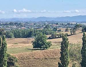 Western Heights viewed from Wallace Road, looking north | |
| Country | New Zealand |
| Local authority | Hamilton, New Zealand |
| Electoral ward | Hamilton West |
| Established | 1998 |
| Area | |
| • Land | 107 ha (264 acres) |
| Population (2018 Census) | |
| • Total | 2,913 |
| Grandview Heights | Rotokauri | Crawshaw |
| Whatawhata |
|
Nawton |
| Stonebridge | Temple View | Dinsdale |
Skyline landmarks include Dinsdale water reservoir, the adjacent Newcastle reservoir,[2] one of the largest in the city holding 21,000 m3 (740,000 cu ft),[3] and a block of gum trees. As these mature many have had to be culled. Google Earth maps highlight the area as the most clearly defined block to Hamilton's west. Situated as it is to the west of the ridge on the city's boundary, the suburb is a little exposed to wind but the views are good.[4]
In the 2018 census the new area of Western Heights (Hamilton City) was created from parts of Brymer, Norton and Dinsdale North.[5] It includes the area marked as Grandview Heights on the 1:50,000 map.[6]
Hamilton Boundary Road was renamed Brymer Road by Waipa County Council in 1967, after Mr Brymer, a local property owner.[7] In 2007 $865,000 was spent widening it[8] to become the main road through Western Heights. In 2018 it was used by 3,600 vehicles a day,[9] 60 of them buses on the half hourly route 3.[10]
References
- Western Heights, Hamilton, AA, New Zealand.
- "Scheduled maintenance at Dinsdale Reservoir". Our Hamilton. 5 July 2019. Retrieved 5 April 2020.
- "Water improvements for Dinsdale" (PDF). Hamilton City Council. 31 May 2014.
- "Westview Place". ketehamilton.peoplesnetworknz.info. Retrieved 5 April 2020.
- "Western Heights". statsnz.maps.arcgis.com. Retrieved 4 April 2020.
- "Frankton, Waikato". NZ Topo Map. Retrieved 5 April 2020.
- "Brymer Road". ketehamilton.peoplesnetworknz.info. Retrieved 23 April 2020.
- "Hamilton Community Plan" (PDF). Hamilton City Council. 2004.
- "2018 Traffic Flow Map" (PDF). Hamilton City Council.
- "3 Dinsdale". www.busit.co.nz. Retrieved 23 April 2020.