Crawshaw, New Zealand
Crawshaw is a compact suburb, close to Te Rapa railway depot, in western Hamilton in New Zealand,[1] and extended in the 2018 census to cover 0.86 km2 (210 acres).[2] Although sometimes referred to as a suburb in its own right,[3] it is often described as being part of Nawton.[4][5][6]
Crawshaw | |
|---|---|
Suburb | |
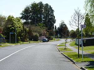 A neighbourhood in Crawshaw, Hamilton. | |
| Country | New Zealand |
| Local authority | Hamilton, New Zealand |
| Electoral ward | Hamilton West |
| Population (2006 Census) | |
| • Total | 2,835 |
| Te Rapa | ||
| Rotokauri |
|
Forest Lake |
| Nawton |
The southern part of the suburb was developed about 1913,[7][8] but the northern in the 1960s[9] and 1970s.[10] Housing New Zealand properties, tenanted by low income families have been reported to make up a majority of homes.[11]
Crawshaw Park was created between 1979 and 1985. It covers 3.1 ha (7.7 acres), includes some remnant kahikateas and forms a link in a green chain through Mooney Park, Bishops Lane Reserve, Crawshaw Park and Dominion Park.[12]
Demographics
Crawshaw census area had a block of about 25 houses from Nawton East added in 2018.[2] The population increased by about a quarter from 1996 to 2018. They are poorer and younger than the 37.4 years of the national average, with more than double Hamilton's Māori average of 23.7%,[13] as shown below -[14]
| Year | Population | Average age | Households | Median income | National median income |
|---|---|---|---|---|---|
| 1996 | 2,541 | 780[15] | |||
| 2001 | 2,874 | 24.7 | 897 | $16,100 | $18,500 |
| 2006 | 2,838 | 25.3 | 912 | $21,900 | $24,100 |
| 2013 | 2,796[16] (2,889)[14] | 26.1 | 906 | $22,600 | $27,900[16] |
| 2018 | 3,249 | 26.9 | 963 | $23,800 | $31,800 |
In 2018 the main ethnic groups were -
| European | Māori | Pacific | Asian |
|---|---|---|---|
| 52% | 50.2% | 11.8 | 8.3 |
References
- "Hamilton Map". Hamilton City Council. Archived from the original on 23 September 2010. Retrieved 18 September 2010.
- "Geographic Boundary Viewer". statsnz.maps.arcgis.com. Retrieved 4 April 2020.
- "Game on for new Crawshaw sports court". www.hamilton.govt.nz. Retrieved 4 April 2020.
- "Odlin Crescent". ketehamilton.peoplesnetworknz.info. Retrieved 4 April 2020.
- "Crawshaw School - 07/09/2018". Education Review Office. Retrieved 4 April 2020.
- "Property details for 35A Crawshaw Drive, Nawton, Hamilton, 3200". www.qv.co.nz. Retrieved 4 April 2020.
- "Sunnyside Road". ketehamilton.peoplesnetworknz.info. Retrieved 4 April 2020.
- "Breckons Avenue". ketehamilton.peoplesnetworknz.info. Retrieved 4 April 2020.
- "Mooney Street". ketehamilton.peoplesnetworknz.info. Retrieved 4 April 2020.
- "Odlin Crescent". ketehamilton.peoplesnetworknz.info. Retrieved 4 April 2020.
- "Fight to make Crawshaw playground safe for kids". Stuff. Retrieved 4 April 2020.
- "Neighbourhood and Amenity Reserves Management Plan" (PDF). Hamilton City Council. May 2007.
- "2018 Census place summaries | Hamilton". www.stats.govt.nz. Retrieved 4 April 2020.
- "2018 Census place summaries | Crawshaw". www.stats.govt.nz. Retrieved 4 April 2020.
- "2006 Census of Population and Dwellings - Hamilton City". Stats NZ.
- "2013 Census map – QuickStats about a place". archive.stats.govt.nz. Retrieved 4 April 2020.