Wendell State Forest
Wendell State Forest is a Massachusetts state forest located in the town of Wendell. The 7,566-acre (3,062 ha) parcel occupies a forested and hilly upland plateau south of the Millers River and west of the Quabbin Reservoir. Park roads were developed by the Civilian Conservation Corps in the 1930s.[1]
| Wendell State Forest | |
|---|---|
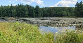 Beaver activity on Ruggles Pond | |
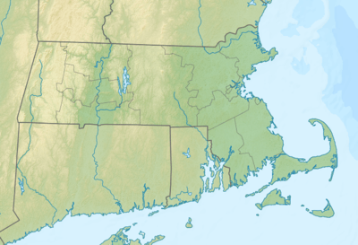 Location in Massachusetts | |
| Location | Wendell, Franklin, Massachusetts, United States |
| Coordinates | 42°33′0″N 72°27′11″W |
| Area | 7,566 acres (30.62 km2) |
| Established | Unspecified |
| Operator | Massachusetts Department of Conservation and Recreation |
| Website | Wendell State Forest |
Activities and amenities
- Ponds: The day-use area at 10-acre (4.0 ha) Ruggles Pond offers swimming, fishing and a picnic area. The southern end of Ruggles Pond has beaver activities, while the northern end has human activities. Wickett Pond has a boat ramp at its northern end.
- Trails: Trails are used for walking, hiking, mountain biking, horseback riding, and cross-country skiing. Backcountry camping is available at a lean-to along the Metacomet-Monadnock Trail.
- The forest is also used for hunting (in season) and forest product extraction.
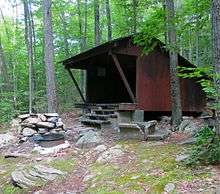
Adirondack type lean-to along the M & M Trail just north of Ruggles Pond
gollark: I'll just get some wireless WiFi cables.
gollark: Sounds expensive.
gollark: It's not my house. I just stole it.
gollark: It is!
gollark: Or else...?
References
- "Wendell State Forest". MassParks. Executive Office of Energy and Environmental Affairs. Retrieved August 12, 2013.
External links
- Wendell State Forest Department of Conservation and Recreation
| |||||||||||||||||
| |||||||||||||||||
| |||||||||||||||||
| |||||||||||||||||
| |||||||||||||||||
| |||||||||||||||||
| |||||||||||||||||
| |||||||||||||||||
This article is issued from Wikipedia. The text is licensed under Creative Commons - Attribution - Sharealike. Additional terms may apply for the media files.