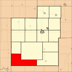
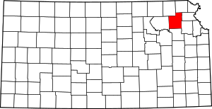
Washington Township, Jackson County, Kansas
Washington Township is a township in Jackson County, Kansas, USA. As of the 2000 census, its population was 516.
Washington Township | |
|---|---|
 Location in Jackson County | |
| Coordinates: 39°13′45″N 95°56′01″W | |
| Country | United States |
| State | Kansas |
| County | Jackson |
| Area | |
| • Total | 53.69 sq mi (139.06 km2) |
| • Land | 53.62 sq mi (138.88 km2) |
| • Water | 0.07 sq mi (0.19 km2) 0.14% |
| Elevation | 1,017 ft (310 m) |
| Population (2000) | |
| • Total | 516 |
| • Density | 9.6/sq mi (3.7/km2) |
| GNIS feature ID | 0476262 |
Geography
Washington Township covers an area of 53.69 square miles (139.06 square kilometers); of this, 0.07 square miles (0.19 square kilometers) or 0.14 percent is water. The streams of Dutch Creek, Illinois Creek, James Creek, Salt Creek and Sullivan Creek run through this township.
Cities and towns
Adjacent townships
- Adrian Township (north)
- Lincoln Township (northeast)
- Douglas Township (east)
- Grove Township, Shawnee County (southeast)
- Menoken Township, Shawnee County (southeast)
- Rossville Township, Shawnee County (south)
- Emmett Township, Pottawatomie County (west)
- St. Marys Township, Pottawatomie County (west)
Cemeteries
The township contains one cemetery, Delia.
gollark: No, although potatOS did used compressed base64ed bytecode for one thing.
gollark: Bytecode. Lua supports bytecode.
gollark: Oh, it already sort of did that.
gollark: Eventually™ it could contain a cryptopotatographic signature, as I said, thus allowing updates to be verified remotely.
gollark: I suppose I can add a configuration setting where it says "EndOS 3" instead of "PotatOS 6.2".
References
This article is issued from Wikipedia. The text is licensed under Creative Commons - Attribution - Sharealike. Additional terms may apply for the media files.
