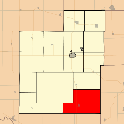
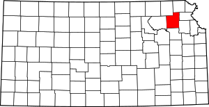
Douglas Township, Jackson County, Kansas
Douglas Township is a township in Jackson County, Kansas, USA. As of the 2000 census, its population was 2,135.
Douglas Township | |
|---|---|
 Location in Jackson County | |
| Coordinates: 39°16′00″N 95°41′26″W | |
| Country | United States |
| State | Kansas |
| County | Jackson |
| Area | |
| • Total | 64.81 sq mi (167.86 km2) |
| • Land | 64.77 sq mi (167.75 km2) |
| • Water | 0.04 sq mi (0.11 km2) 0.07% |
| Elevation | 1,053 ft (321 m) |
| Population (2000) | |
| • Total | 2,135 |
| • Density | 33/sq mi (12.7/km2) |
| GNIS feature ID | 0478303 |
History
Douglas Township was organized in 1855.[1]
Geography
Douglas Township covers an area of 64.81 square miles (167.86 square kilometers); of this, 0.04 square miles (0.11 square kilometers) or 0.07 percent is water. The streams of Middle Fork Muddy Creek and Spring Creek run through this township.
Cities and towns
Adjacent townships
- Cedar Township (north)
- Delaware Township, Jefferson County (northeast)
- Rock Creek Township, Jefferson County (east)
- Soldier Township, Shawnee County (south)
- Menoken Township, Shawnee County (southwest)
- Lincoln Township (northwest)
- Washington Township (west)
Cemeteries
The township contains four cemeteries: Hoyt, Hoyt, Mayetta and Steward.
Major highways
gollark: How do you even define "job"?
gollark: Well, yes, but we'd lose all existing programs, produce piles of specialized tooling, and do tons of extra work.
gollark: Yes.
gollark: Plus inevitably there will be subtle incompatibilities and it won't be plug-and-play.
gollark: Is it going to just send a description of what to draw? In that case, lots of overhead and problems porting to different environments since for example each GUI framework will end up needing its own module communication layer.
References
- Barr, Elizabeth N. (1907). Business directory and history of Jackson County. p. 72.
This article is issued from Wikipedia. The text is licensed under Creative Commons - Attribution - Sharealike. Additional terms may apply for the media files.
