Virgil Township, Kane County, Illinois
Virgil Township is one of sixteen townships in Kane County, Illinois, USA. As of the 2010 census, its population was 1,937 and it contained 766 housing units.[2] The land is primarily used for agriculture.
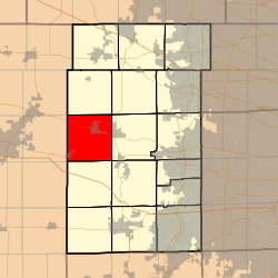
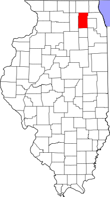
Virgil Township | |
|---|---|
 Location in Kane County | |
 Kane County's location in Illinois | |
| Coordinates: 41°56′09″N 88°32′48″W | |
| Country | |
| State | |
| County | Kane |
| Established | November 6, 1849 |
| Area | |
| • Total | 35.02 sq mi (90.7 km2) |
| • Land | 35.01 sq mi (90.7 km2) |
| • Water | 0.01 sq mi (0.03 km2) 0.03% |
| Elevation | 863 ft (263 m) |
| Population (2010) | |
| • Estimate (2016)[1] | 1,952 |
| • Density | 55.3/sq mi (21.4/km2) |
| Time zone | UTC-6 (CST) |
| • Summer (DST) | UTC-5 (CDT) |
| ZIP codes | 60119, 60151 |
| FIPS code | 17-089-78188 |
Geography
According to the 2010 census, the township has a total area of 35.02 square miles (90.7 km2), of which 35.01 square miles (90.7 km2) (or 99.97%) is land and 0.01 square miles (0.026 km2) (or 0.03%) is water.[2]
Cities, towns, villages
- Maple Park (all but western edge)
- Virgil
Extinct settlements
- Meredith at 41.8994723°N 88.5403588°W
- Richardson at 41.9664165°N 88.5856395°W
Cemeteries
The township contains these two cemeteries: Saints Peter and Paul's Catholic Cemetery and Thatcher Cemetery.
Airports and landing strips
- Aeroview Airport
- Miller/Maple Park Farm Airport
School districts
- Central Community Unit School District 301
- Kaneland Community Unit School District 302
- Sycamore Community Unit School District 427
Political districts
- Illinois's 14th congressional district
- State House District 50
- State Senate District 25
gollark: Given the economic benefits of having people able to go to work and whatever in relative safety, probably at least a few hundred $.
gollark: So they probably wouldn't just go "muahahaha, we will now dectuple the price".
gollark: I'm not sure there's much incentive to. The only buyers are governments, who want to pay arguably unreasonably low amounts and generally manage to.
gollark: American Civil Liberties Union or something.
gollark: I see.
References
- "Virgil Township, Kane County, Illinois". Geographic Names Information System. United States Geological Survey. Retrieved 2010-06-26.
- United States Census Bureau 2009 TIGER/Line Shapefiles
- United States National Atlas
- "Population and Housing Unit Estimates". Retrieved June 9, 2017.
- "Population, Housing Units, Area, and Density: 2010 - County -- County Subdivision and Place -- 2010 Census Summary File 1". United States Census. Archived from the original on 2020-02-12. Retrieved 2013-05-28.
- "Census of Population and Housing". Census.gov. Retrieved June 4, 2016.
External links
This article is issued from Wikipedia. The text is licensed under Creative Commons - Attribution - Sharealike. Additional terms may apply for the media files.