Uzboi-Landon-Morava
The Uzboi-Landon-Morava (ULM) outflow system is a long series of channels and depressions that may have carried water across a major part of Mars. It starts with channels that drain into the Argyre basin in the Argyre quadrangle. Water ponded in the Argyre basin, then the overflow is believed to have traveled northward through Uzboi Vallis, into Landon basin, through Morava Valles, to the floor of Margaritifer basin.[1][2][3] Some of the water may have helped to carve Ares Vallis.[4][5][6][7][8] Altogether, the total area drained for this watershed may have been about 11 X 106 km2 or about 9% of Mars.[9][10]
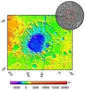
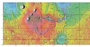
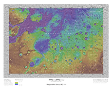
Pictures below show the Argyre basin which was once full of water. Also, the wider view shows the distance the water traveled, which was south of Argyre basin to Margaritifer Terra.
Gallery
 MOLA maps showing the geographic context of Argyre.
 MOLA map showing boundaries for Argyre Planitia and other regions
 Map showing locations Uzboi Vallis and Ladon Vallis, other nearby features
See also
References
- Baker, V. 1982. The Channels of Mars. University of Texas Press. Austin, TX
- Phillips, R., et al. 2001. Ancient geodynamics and global-scale hydrology on Mars. Science: 291, 2587_2591.
- Saunders, S. 1979. Geologic map of the Margaritifer Sinus quadrangle of Mars, U.S. Geological Survey Misc. Invest. Ser. Map I-1144, scale 1:5M.
- Carr, M. 1979. Formation of Martian flood features by the release of water from confined aquifers. J. Geophys. Res. 84, 2995-3007.
- Carr, M., G. Clow. 1981. Martian channels and valleys: their characteristics, distribution, and age. Icarus: 48 (1), 91-117.
- Grant, J., T. Parker. 2002. Drainage evolution of the Margaritifer Sinus region, Mars. J. Geophys. Res. 107, doi:10.1029/2001JE001678.
- Grant., J. et al. 2009. Geologic map of MTM-20012 and -25012 quadrangles, Margaritifer Terra region of Mars, U.S. Geol. Sur, Scientific Investigations Map 3041, scale 1:1,000,000.
- Rotto, S., K. Tanaka. 1995. Geologic/Geomorphic map of the Chryse Planitia region of Mars, U.S. Geol. Surv. Invest. Ser. Map I-2441, scale 1:5M.
- Banerdt,W. 2000. Surface drainage patterns on Mars from MOLA tpoography, Eos Trans. AGU, 81, 48, Fall Meet. Suppl. Abstract P52C-04.
- Phillips, R., et al. 2001. Ancient geodynamics and global-scale hydrology on Mars. Science: 291, 2587_2591.