Urimari
Urimari is a census town in Barkagaon CD Block in Hazaribagh Sadar subdivision of Hazaribagh district in the Indian state of Jharkhand.
Urimari | |
|---|---|
Census Town | |
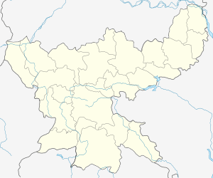
 Urimari Location in Jharkhand, India  Urimari Urimari (India) | |
| Coordinates: 23.6983°N 85.3131°E | |
| Country | |
| State | Jharkhand |
| District | Hazaribagh |
| Elevation | 397 m (1,302 ft) |
| Population (2011) | |
| • Total | 4,948 |
| Languages | |
| • Official | Hindi, Urdu |
| Time zone | UTC+5:30 (IST) |
| PIN | 829125 (Sayal) |
| Telephone/ STD code | 06551 |
| Vehicle registration | JH 02 |
| Website | hazaribag |
Geography
The Damodar flows past Urimari.[1]
Police out-post
Urimari police out-post serves the Barkagaon CD Block.[2]
Demographics
As per the 2011 Census of India Urimari had a total population of 4,948, of which 2,640 (53%) were males and 2,308 (47%) were females. Population below 6 years was 638. The total number of literates in Urimari was 3,392 (78.70% of the population over 6 years).[3]
Economy
Projects in the Barka Sayal Area of Central Coalfields are: Bhurkunda U/G, Central Saunda U/G, Saunda-D U/G, Saunda U/G, Sayal-D U/G, Urimari U/G, Urimari O/C, North Urimari/ Birsa O/C and Bhurkunda O/C.[4]
Education
DAV Public School was established at Urimari in 1994.The school has classes up to senior secondary level. It is a co-educational school affiliated to CBSE.[5] [6]
References
- Google maps
- "Jharkhand Police". Contact Number. Jharkhand Government. Archived from the original on 6 December 2016. Retrieved 11 November 2017.
- "2011 Census C.D. Block Wise Primary Census Abstract Data(PCA)". Jharkhand – District-wise CD Blocks. Registrar General and Census Commissioner, India. Retrieved 11 November 2017.
- "Central Coalfields Ltd". Areas – Barka Sayal. CCL. Retrieved 14 November 2017.
- "DAV Public School, Urimari, Hazaribagh". DAV. Retrieved 14 November 2017.
- "DAV Public School Hazaribagh". ICBSE. Retrieved 14 November 2017.