Chaube, Hazaribagh
Chaube is a village in Chalkusha CD block in Barhi subdivision of Hazaribagh district in the Indian state of Jharkhand.
Chaube | |
|---|---|
Village | |
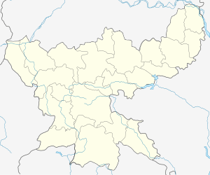
 Chaube Location in Jharkhand, India  Chaube Chaube (India) | |
| Coordinates: 24.237039°N 85.816392°E | |
| Country | |
| State | Jharkhand |
| District | Hazaribagh |
| Population (2011) | |
| • Total | 6,730 |
| Languages | |
| • Official | Hindi, Urdu |
| Time zone | UTC+5:30 (IST) |
| PIN | 825324 (Palounjia) |
| Telephone/ STD code | 06548 |
| Vehicle registration | JH 02 |
| Website | hazaribag |
Demographics
As per the 2011 Census of India Chaube had a total population of 6,730, of which 3,528 (52%) were males and 3,202 (48%) were females. Population below 6 years was 1,233. The total number of literates in Chaube was 3,814 (69.38% of the population over 6 years).[1]
Transport
Chaube has a railway station in the Dhanbad-Koderma sector of the Grand chord.[2]
Chaube is linked to Markacho through the Markacho-Chaube road and to Keshwari through the Chaube-Keshwari road.[3]
gollark: I don't know any languages which assign genders to random nouns particularly *well*.
gollark: Or with a cool language supporting good variables/backreferences.
gollark: PROVE ME WRONG!
gollark: 1+1=2.0000000000000000000001
gollark: It's gender recognized somewhat in grammar.
References
- "2011 Census C.D. Block Wise Primary Census Abstract Data(PCA)". Jharkhand – District-wise CD Blocks. Registrar General and Census Commissioner, India. Retrieved 11 November 2017.
- "046 Koderma-Dhanbad Passenger memu". Time Table. Indiarailino. Retrieved 11 November 2017.
- Google maps
This article is issued from Wikipedia. The text is licensed under Creative Commons - Attribution - Sharealike. Additional terms may apply for the media files.