Katkamdag
Katkamdag is a village in Katkamdag CD block in Hazaribagh Sadar subdivision of Hazaribagh district in the Indian state of Jharkhand.
Katkamdag | |
|---|---|
Village | |
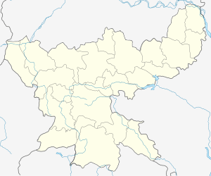
 Katkamdag Location in Jharkhand, India  Katkamdag Katkamdag (India) | |
| Coordinates: 23.9857°N 85.2918°E | |
| Country | |
| State | Jharkhand |
| District | Hazaribagh |
| Population (2011) | |
| • Total | 2,334 |
| Languages | |
| • Official | Hindi, Urdu |
| Time zone | UTC+5:30 (IST) |
| PIN | 825302 (College More) |
| Telephone/ STD code | 06546 |
| Vehicle registration | JH 02 |
| Website | hazaribag |
CD block HQ
The headquarters of Katkamdag CD block are located at Katkamdag.[1]
Demographics
As per the 2011 Census of India Katkamdag (referred to in census data as Katamdag) had a total population of 2,334, of which 1,189 (51%) were males and 1,145 (49%) were females. Population below 6 years was 396. The total number of literates in Katkamdag was 1,305 (67.34% of the population over 6 years).[2]
Transport
Katkamdag is on Hazaribagh-Simariya Road.[3]
gollark: The implications are obvious.
gollark: On an entirely unrelated note, it appears that you can buy very cheap projectors with astonishing 320x240 resolution.
gollark: I'm glad you agree on what you said.
gollark: Just use grep?
gollark: I mean, sure, `import sys` isn't great, but you could easily make a wrapper which brings all the necessary stuff into scope.
References
- "Official Website of Hazaribag District". Administration – Subdivision and Blocks. Jharkhand Government. Archived from the original on 5 February 2012. Retrieved 11 November 2017.
- "2011 Census C.D. Block Wise Primary Census Abstract Data(PCA)". Jharkhand – District-wise CD Blocks. Registrar General and Census Commissioner, India. Retrieved 11 November 2017.
- Google maps
This article is issued from Wikipedia. The text is licensed under Creative Commons - Attribution - Sharealike. Additional terms may apply for the media files.