Barhi, Hazaribagh
Barhi is a census town and headquarters of a subdivision in Hazaribagh district in the state of Jharkhand, India. It stands at the crossing of NH 19 (old number NH 2)/ Grand Trunk Road and NH 20.. All major buses on the Ranchi-Patna, Ranchi-Gaya, Dhanbad-Patna and Dhanbad-Gaya routes pass through Barhi. Both Tilaiya Dam of DVC and Hazaribagh Wildlife Sanctuary are near Barhi.
Barhi | |
|---|---|
Town | |
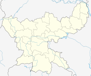
 Barhi Location in Jharkhand, India  Barhi Barhi (India) | |
| Coordinates: 24.3°N 85.42°E | |
| Country | |
| State | Jharkhand |
| District | Hazaribagh |
| Elevation | 374 m (1,227 ft) |
| Population (2011) | |
| • Total | 11,867 |
| Languages | |
| • Official | Hindi, Urdu |
| Time zone | UTC+5:30 (IST) |
| Vehicle registration | JH |
| Lok Sabha constituency | Hazaribagh |
| Vidhan Sabha constituency | Barhi |
| Website | hazaribag |
History
Barhi was once a subdivisional town (up to 1872). There is a small cemetery on Grand Trunk Road, with a grave of Col Knyvett, Commander of Grand Trunk Road. He died in 1857.[1]
Geography
Barhi is located at 24.3°N 85.42°E.[2] It has an average elevation of 374 metres (1227 feet). The Barakar River lies 3 kilometres (1.9 mi) from Barhi. Hazaribag National Park is 18 kilometres (11 mi) away from Barhi. Tilaiya Dam is 17 kilometres (11 mi) away.[3]
CD Block HQ
The headquarters of Barhi CD Block are located at Barhi.[5]
Demographics
As per the 2011 Census of India Barhi had a total population of 11,867, of which 6,107 (51%) were males and 5,560 (49%) were females. Population below 6 years was 1,755. The total number of literates in Barhi was 8,140 (80.50% of the population over 6 years).[6]
As of 2001 India census,[7] Barhi had a population of 9,933. Males constitute 53% of the population and females 47%. Barhi has an average literacy rate of 60%, higher than the national average of 59.5%; with 62% of the males and 38% of females literate. 18% of the population is under 6 years of age.
Education
College
(R.N.Y.M. College, Barhi, Hazaribag)
School
- Royal Orchid International School, Barhi
- Delhi Public School, Barhi
- DAV public school Barhi(+2)
- Saraswati Shishu Vidya Mandir barhi
- Boy's middle school
- Ilex public school
- S.D.G.M Academy, konra, Barhi
- ST'S VINOVABHAVE PUBLIC
- Little champ play school
- +2 high school
- girls middle school
- little moon play school
- nexgan kids play school
Transportation
- Railway
The 79.7 km long first stage railway project from Koderma to Hazaribagh costing ₹ 936 crores was inaugurated by Prime Minister Narendra Modi on 20 February 2015. The railway line passes through the Barhi CD Block and there is a station at Barhi.[8]
- Roadways
- Barhi is connected with new Delhi and Kolkata by NH-2 highway and major cities like Ranchi and Patna.
- An international road, Asian Highway 42 (AH42) starts from Barhi to Lanzhou, China connecting India, Nepal & China. It is the nearest Asian Highway to Mount Everest.
- Barhi bus station(closed)
A bus station is at barhi but closed after 2011 due to maintenance after focusing of government on it again the work started but due to some reason again station has been closed
References
- Houlton, Sir John, Bihar, the Heart of India,1949, p177, Orient Longmans Ltd.
- Falling Rain Genomics, Inc - Barhi
- "Barhi". india9.com. Retrieved 17 April 2010.
- "Jharkhand Police". Contact Number. Jharkhand Government. Archived from the original on 6 December 2016. Retrieved 11 November 2017.
- "Official Website of Hazaribag District". Administration – Subdivision and Blocks. Jharkhand Government. Archived from the original on 5 February 2012. Retrieved 11 November 2017.
- "2011 Census C.D. Block Wise Primary Census Abstract Data(PCA)". Jharkhand – District-wise CD Blocks. Registrar General and Census Commissioner, India. Retrieved 11 November 2017.
- "Census of India 2001: Data from the 2001 Census, including cities, villages and towns (Provisional)". Census Commission of India. Archived from the original on 16 June 2004. Retrieved 1 November 2008.
- "PM Narendra Modi flags off Hazaribagh-Koderma DMU train". The Indian Express 20 February 2015. Retrieved 2 December 2015.