Dari, Jharkhand
Dari is a census town in Dadi (community development block) of Hazaribag district in the state of Jharkhand, India.
Dari | |
|---|---|
Census Town | |
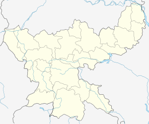
 Dari Location in Jharkhand, India  Dari Dari (India) | |
| Coordinates: 23.71°N 85.38°E | |
| Country | |
| State | Jharkhand |
| District | Hazaribag |
| Government | |
| • Body | Representative democracy |
| Population (2011) | |
| • Total | 6,405 |
| Languages | |
| • Official | Hindi, Urdu |
| Time zone | UTC+5:30 (IST) |
| PIN | 829109 (Gidi C) |
| Telephone/ STD code | 06545 |
| Vehicle registration | JH 02 |
| Website | hazaribag |
CD Block HQ
The headquarters of Dadi CD Block are located at Dari.[1]
Demographics
As per the 2011 Census of India Dari had a total population of 6,405, of which 3,283 (51%) were males and 3,122 (49%) were females. Population below 6 years was 846. The total number of literates in Dari was 4,348 (78.22% of the population over 6 years).[2]
As of 2001 India census,[3] Dari had a population of 7,382. Males constitute 52% of the population and females 48%. Dari has an average literacy rate of 62%, higher than the national average of 59.5%: male literacy is 70% and, female literacy is 52%. In Dari, 17% of the population is under 6 years of age.
Transport
The Kuju-Giddi Road links this area to Kuju on NH 20.[4]
References
- "Official Website of Hazaribag District". Administration – Subdivision and Blocks. Jharkhand Government. Archived from the original on 5 February 2012. Retrieved 11 November 2017.
- "2011 Census C.D. Block Wise Primary Census Abstract Data(PCA)". Jharkhand – District-wise CD Blocks. Registrar General and Census Commissioner, India. Retrieved 11 November 2017.
- "Census of India 2001: Data from the 2001 Census, including cities, villages and towns (Provisional)". Census Commission of India. Archived from the original on 16 June 2004. Retrieved 1 November 2008.
- Google maps