Upala (canton)
Upala is the 13th canton in the province of Alajuela in Costa Rica.[1] The canton covers an area of 1,580.67 square kilometres (610.30 sq mi),[2] and has a population of 48,910 (estimate as of 2013).[3]
Upala | |
|---|---|
Cantón | |
 Flag  Seal | |
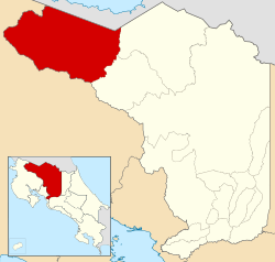 Location of Upala Canton in Alajuela Province | |
| Country | Costa Rica |
| Province | Alajuela |
| Founded | 17 March 1970 |
| Area | |
| • Total | 1,580.67 km2 (610.30 sq mi) |
| Population (June 2013) | |
| • Total | 48,910 |
| • Density | 31/km2 (80/sq mi) |
The capital city of the canton is also called Upala.
Geography
Upala Canton is bordered by Nicaragua on the north, the Río Las Haciendas on the northwest, Río Rito on the southeast, and the Cordillera de Guanacaste on the south. The Rincón de la Vieja, Santa María, Miravalles and Tenorio volcanoes are landmarks along the southern border.
Districts
The canton of Upala is subdivided into eight districts (distritos):[1]
- Upala
- Aguas Claras
- San José O Pizote
- Bijagua
- Delicias
- Dos Ríos
- Yoliyllal
- Canalete
History
The canton was established by a decree of March 17, 1970.
gollark: They do manage to get less frustrated with nemysmerp1 or whatever it is than me.
gollark: I see.
gollark: Maybe you're meant to check the maths somehow?
gollark: So if I generate enough information I can get energy for free? How convenient.
gollark: Also combinatorics.
References
- "División Territorial Administrativa de Costa Rica" (PDF) (in Spanish). Instituto de Fomento y Asesoria Municipal (IFAM). 5 May 2009. Archived from the original (PDF) on 2 August 2015. Retrieved 2 August 2015.
- Instituto Geográfico Nacional (IGN), 2001.
- Estadísticas Vitales 2013 Archived 2015-04-02 at the Wayback Machine - INEC
This article is issued from Wikipedia. The text is licensed under Creative Commons - Attribution - Sharealike. Additional terms may apply for the media files.