León Cortés (canton)
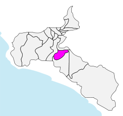
León Cortés Castro,[2] also known as León Cortés,[3] is the 20th canton in the province of San José in Costa Rica.[3][6] The canton covers an area of 120.80 square kilometres (46.64 sq mi).[2][3][4] Its estimated population as of 2009 was 13,285.[2] The capital city of the canton is San Pablo. It is part of Los Santos Zone, together with Dota and Tarrazú.
León Cortés Castro León Cortés | |
|---|---|
 León Cortés Castro canton in San José province | |
| Coordinates: 09°41′N 84°04′W | |
| Country | Costa Rica |
| Province | San José |
| Established | 29 March 1962 |
| Named for | León Cortés Castro |
| Capital | San Pablo |
| Districts | 6 districts (distritos)
|
| Government | |
| • Alcalde | Leonardo Quesada Durán (2010-2016) (PLN[1]) |
| Area | |
| • Total | 120.80 km2 (46.64 sq mi) |
| Population (2010)[5] | |
| • Total | 13,356 |
| • Density | 110/km2 (290/sq mi) |
The Delicias creek and the Pirrís river form major portions of the western and southern boundary, and the Tarrazú river establishes the northern and eastern limits of the canton.
History
The Supreme Elections Tribunal of Costa Rica in a resolution of March 29, 1962, proclaimed the results of a plebiscite in the previous month that created the canton. An executive decree on June 12 delineated the portions of the surrounding cantons of Aserrí, Tarrazú, Dota and Desamparados that were to be included in the new canton. It is named in honor of former President León Cortés Castro of Costa Rica.[3]
Districts
The canton of León Cortés Castro is subdivided into six districts (distritos):[3]
| District | Postal code | Alt. (m) | Area (km2) | Pop. (2008) | Coordinates |
|---|---|---|---|---|---|
| San Pablo | 12001 | 1,542 | 20.93 | 4,450 | 09°41′08″N 84°02′32″W |
| Barrios (neighborhoods): Estadio, La Clara, La Virgen, Los Ángeles, Sagrada Familia | |||||
| Poblados (villages): Abejonal, Carrizales, Los Navarro, Montes de Oro, Rosario | |||||
| San Andrés | 12002 | 1,340 | 15.95 | 1,981 | 09°44′25″N 84°05′15″W |
| Poblados (villages): Angostura (part), Bajo Gamboa, Higuerón, Llano Grande, Ojo de Agua (part), Rastrojales | |||||
| Llano Bonito | 12003 | 1,780 | 33.79 | 2,401 | 09°40′03″N 84°06′32″W |
| Poblados (villages): Bajo Mora, Bajo Venegas (part), Concepción, San Francisco, San Luis, San Rafael Abajo, Santa Juana, Santa Rosa (part) | |||||
| San Isidro | 12004 | 1,640 | 18.68 | 1,631 | 09°40′40″N 84°04′35″W |
| Poblados (villages): Alto Carrizal, Loma de la Altura, Santa Rosa (part), Trinidad | |||||
| Santa Cruz | 12005 | 1,650 | 21.47 | 1,798 | 09°44′04″N 84°01′35″W |
| Poblados (villages): Cedral (part), Lucha (part), San Martín, Rincón Gamboa | |||||
| San Antonio | 12006 | 1,770 | 9.98 | 1,027 | 09°43′10″N 84°03′42″W |
| Poblados (villages): Angostura (part), Cuesta | |||||
References
- "Lista de alcaldes electos 2010 - 2016 en los comicios municipales" [List of mayors elected 2010 - 2016 in the municipal elections]. El País (in Spanish). 6 December 2010. Archived from the original on 9 December 2010. Retrieved 2 October 2011.
- "Annuario Estadístico 2009" (PDF) (in Spanish). Instituto Nacional de Estadística y Censos (INEC). December 2010. Archived from the original (PDF) on 1 April 2012. Retrieved 2 October 2011.
- "División Territorial Administrativa de Costa Rica" (PDF) (in Spanish). Instituto de Fomento y Asesoria Municipal (IFAM). 5 May 2009. Archived from the original (PDF) on 2 August 2015. Retrieved 2 October 2011.
- Instituto Geográfico Nacional (IGN), 2001.
- "León Cortés Castro 1-20, San José" (PDF) (in Spanish). Instituto de Formacion y Estudios en Democracia. Archived from the original (PDF) on 28 March 2012. Retrieved 2 October 2011.
- "Cantones: León Cortés" (in Spanish). Guia Costa Rica. Retrieved 2 October 2011.