U.S. Route 83 in Kansas
U.S. Route 83 (US-83) is a part of the U.S. Highway System that runs from the Veterans International Bridge in Brownsville, Texas north to the Canadian border, north of Westhope, North Dakota, where it continues as Manitoba Highway 83. In the U.S. state of Kansas, US-83 is a main north–south highway that runs from the Oklahoma border north to the Nebraska border.
| ||||
|---|---|---|---|---|
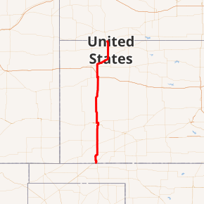
US-83 highlighted in red | ||||
| Route information | ||||
| Maintained by KDOT | ||||
| Existed | c. 1931[1]–present | |||
| Major junctions | ||||
| South end | ||||
| North end | ||||
| Location | ||||
| Counties | Seward, Haskell, Finney, Scott, Logan, Thomas, Sheridan, Decatur | |||
| Highway system | ||||
| ||||

In 1927 the highway that first became known as US-83 was established as K-22. Then between 1930 and 1931, US-83 was extended into Kansas along K-22, which was decommissioned. Then between 1941 and 1944, US-83 and US-183 were swapped within Nebraska and a small portion into Kansas. US-83 was changed to turn north just northeast of Selden and the former alignment of US-83 from northeast of Selden to US-183 east of Woodruff became US-383, now K-383.
Route description
US-83 enters the Sunflower State, overlapped with US-270 in Seward County, approximately four miles (6.4 km) south of Liberal. From here it continues north to Liberal where it intersects US-54 and US-270 ends. North of Liberal, US-83 begins a concurrency with US-160, and the highways remain joined until reaching Sublette, the seat of Haskell County. US-83 and US-160 split north of Sublette; US-160 heads west toward Ulysses, and US-83 continues north toward Garden City.
At Garden City, US-50 and US-400 join US-83 for a brief concurrency on a bypass around the east and north sides of the city while US-83 Business follows the former routing through downtown. All three routes cross K-156, also known as Kansas Avenue, in the northwest portion of the city. At the north end of the US-50/US-83 Business route, US-83 splits and heads north toward Scott City, while US-50 and US-400 remain joined through the rest of the state. The highway passes through largely unpopulated areas of Finney County and Scott County before reaching a junction with K-96 in downtown Scott City.
In northern Scott County, K-4 has its origins at US-83, heading east toward Healy, and US-83 traverses through rolling farmlands until reaching Oakley, the seat of Logan County. US-83 reaches US-40 less than a mile west of I-70, and the two highways jog west for a brief multiplex before US-83 splits and crosses I-70.
North of I-70, US-83 intersects US-24 then curves northeast, east of Gem in Thomas County. US-83 continues its northeasterly track through Rexford and Selden. After passing through Selden, US-83 intersects the southern terminus of K-383 and the northern terminus of K-23. From here, US-83 turns north, crosses into Decatur County then continues north and intersects US-36 in Oberlin. Oberlin is the last area of significant population the highway passes in Kansas; the next city is McCook, Nebraska.
History
| |
|---|---|
| Existed | 1927[2]–c. 1931[1] |
In 1927 the highway that first became known as US-83 was established as K-22. Then between 1930 and 1931, US-83 was extended into Kansas along K-22, which was decommissioned.[1] Between July 1938 and 1939, US-183 was altered to follow US-36 east to K-1 in Phillipsburg, which created a short overlap between US-83 and US-183 near Norton.[3][4] Then between 1941 and 1944, US-183 and US-83 were swapped within Nebraska and a small portion into Kansas. US-83 was changed to turn north just northeast of Selden and US-183 was changed to continue north past Phillipsburg, which eliminated the overlap between the two in Norton. The former alignment of US-83 from northeast of Selden to east of Woodruff became US-383, now K-383.[5][6]
Major intersections
| County | Location | mi[7] | km | Destinations | Notes |
|---|---|---|---|---|---|
| Seward | | 0.000 | 0.000 | Continuation into Oklahoma | |
| Liberal | 3.116 | 5.015 | Western terminus of US-270; northern end of US-270 overlap | ||
| | 12.785 | 20.575 | Eastern terminus of K-51 | ||
| | 21.627 | 34.805 | Southern end of US-160 overlap | ||
| | 28.650 | 46.108 | Eastern terminus of K-190 | ||
| Haskell | | 35.644 | 57.363 | ||
| | 41.663 | 67.050 | Northern end of US-160 overlap; western terminus of K-144 | ||
| Finney | | Southern terminus of US-83 Business | |||
| Garden City | Southern end of US-50 and US-400 overlap; eastern terminus of US-50 Business | ||||
| Western terminus of K-156 | |||||
| Northern end of US-160 overlap; western terminus of US-50 Business; northern terminus of US-83 Business | |||||
| Scott | Scott City | ||||
| | Western terminus of K-4 | ||||
| | Southern terminus of K-95 | ||||
| | Northern terminus of K-95 | ||||
| Logan | Oakley | Southern end of US-40 overlap | |||
| Northern end of US-40 overlap | |||||
| Thomas | | I-70 exit 70; diamond interchange | |||
| | |||||
| Sheridan | | Northern terminus of K-23; southern terminus of K-383 | |||
| Decatur | Oberlin | ||||
| | Continuation into Nebraska | ||||
1.000 mi = 1.609 km; 1.000 km = 0.621 mi
| |||||
Business route
| |
|---|---|
| Location | Garden City |
U.S. Route 183 Business (US-183 Business) is a business route in Garden City. It begins at US-83 and runs north and ends at US-40.
References
- Rand McNally and Company (1931). "Kansas" (Map). Clason's Road Map of Kansas. 1:2,000,000. Denver: Clason Map Company. p. 87 – via Rumsey Collection.
- Rand McNally and Company (1927). "Kansas" (Map). Rand McNally Auto Road Atlas of the United States and Ontario, Quebec, and the Maritime Provinces of Canada, with a Brief Description of the National Parks and Monuments. 1:1,600,000. Chicago: Rand McNally and Company. pp. 54–55. OCLC 2078375 – via Rumsey Collection.
- State Highway Commission of Kansas (1938). Kansas State Highway System (PDF) (Map). Scale not given. Topeka: State Highway Commission of Kansas. Retrieved July 22, 2020.
- State Farm Insurance Companies Travel Bureau (1939). "Nebraska" (Map). Rand McNally Road map: Nebraska. 1:1,267,200. Chicago: Rand McNally and Company. pp. 58–59. Retrieved July 26, 2020 – via Rumsey Collection.
- State Highway Commission of Kansas (1941). Kansas State Highway System (PDF) (Map). Scale not given. Topeka: State Highway Commission of Kansas. Retrieved July 22, 2020.
- State Farm Insurance Companies Travel Bureau (1944). "Kansas" (Map). State Farm Road map: Kansas. 1:1,235,520. Chicago: Rand McNally and Company. Retrieved July 26, 2020 – via Rumsey Collection.
- Staff (2016). "Pavement Management Information System". Kansas Department of Transportation. Retrieved April 21, 2017.