Selden, Kansas
Selden is a city in Sheridan County, Kansas, United States. As of the 2010 census, the city population was 219.[6]
Selden, Kansas | |
|---|---|
 Location within Sheridan County and Kansas | |
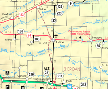 KDOT map of Sheridan County (legend) | |
| Coordinates: 39°32′28″N 100°34′1″W | |
| Country | United States |
| State | Kansas |
| County | Sheridan |
| Founded | 1880s |
| Platted | 1888 |
| Incorporated | 1905 |
| Named for | Selden Hopkins |
| Area | |
| • Total | 0.30 sq mi (0.79 km2) |
| • Land | 0.30 sq mi (0.79 km2) |
| • Water | 0.00 sq mi (0.00 km2) |
| Elevation | 2,835 ft (864 m) |
| Population | |
| • Total | 219 |
| • Estimate (2019)[3] | 211 |
| • Density | 696.37/sq mi (268.70/km2) |
| Time zone | UTC-6 (CST) |
| • Summer (DST) | UTC-5 (CDT) |
| ZIP code | 67757 |
| Area code | 785 |
| FIPS code | 20-63875[4] |
| GNIS ID | 0471107[5] |
| Website | seldenks.org |
History
Selden was laid out in 1888.[7] It was named for one of its founders, Selden G. Hopkins.[8]
The first post office in Selden was established in July 1888.[9]
In 1893, not long after its founding, tragedy struck the rural town. A mysterious fire started among the files in the courthouse. All attempts to put the fires out failed, and the entire courthouse burnt to the ground. Two people died in the fire, and important files regarding accusations of a wealthy land owner killing an immigrant family were destroyed.[10]
Geography
Selden is located at 39°32′28″N 100°34′1″W (39.541194, -100.567064).[11] According to the United States Census Bureau, the city has a total area of 0.30 square miles (0.78 km2), all of it land.[12]
Climate
The climate in this area is characterized by hot, humid summers and generally mild to cool winters. According to the Köppen Climate Classification system, Selden has a humid subtropical climate, abbreviated "Cfa" on climate maps.[13]
Demographics
| Historical population | |||
|---|---|---|---|
| Census | Pop. | %± | |
| 1910 | 297 | — | |
| 1920 | 280 | −5.7% | |
| 1930 | 399 | 42.5% | |
| 1940 | 401 | 0.5% | |
| 1950 | 438 | 9.2% | |
| 1960 | 347 | −20.8% | |
| 1970 | 271 | −21.9% | |
| 1980 | 266 | −1.8% | |
| 1990 | 248 | −6.8% | |
| 2000 | 201 | −19.0% | |
| 2010 | 219 | 9.0% | |
| Est. 2019 | 211 | [3] | −3.7% |
| U.S. Decennial Census | |||
2010 census
As of the census[2] of 2010, there were 219 people, 101 households, and 57 families living in the city. The population density was 730.0 inhabitants per square mile (281.9/km2). There were 118 housing units at an average density of 393.3 per square mile (151.9/km2). The racial makeup of the city was 97.3% White, 0.5% Native American, and 2.3% from other races. Hispanic or Latino of any race were 6.8% of the population.
There were 101 households of which 23.8% had children under the age of 18 living with them, 45.5% were married couples living together, 5.9% had a female householder with no husband present, 5.0% had a male householder with no wife present, and 43.6% were non-families. 39.6% of all households were made up of individuals and 14.9% had someone living alone who was 65 years of age or older. The average household size was 2.17 and the average family size was 2.96.
The median age in the city was 43.7 years. 23.3% of residents were under the age of 18; 8.2% were between the ages of 18 and 24; 20.9% were from 25 to 44; 28.3% were from 45 to 64; and 19.2% were 65 years of age or older. The gender makeup of the city was 56.6% male and 43.4% female.
2000 census
As of the census[4] of 2000, there were 201 people, 103 households, and 55 families living in the city. The population density was 666.0 people per square mile (258.7/km2). There were 118 housing units at an average density of 391.0 per square mile (151.9/km2). The racial makeup of the city was 99.50% White, and 0.50% from two or more races.
There were 103 households out of which 19.4% had children under the age of 18 living with them, 41.7% were married couples living together, 7.8% had a female householder with no husband present, and 46.6% were non-families. 44.7% of all households were made up of individuals and 20.4% had someone living alone who was 65 years of age or older. The average household size was 1.95 and the average family size was 2.73.
In the city, the population was spread out with 20.4% under the age of 18, 6.5% from 18 to 24, 25.9% from 25 to 44, 20.9% from 45 to 64, and 26.4% who were 65 years of age or older. The median age was 43 years. For every 100 females, there were 105.1 males. For every 100 females age 18 and over, there were 107.8 males.
The median income for a household in the city was $28,750, and the median income for a family was $37,500. Males had a median income of $20,417 versus $16,250 for females. The per capita income for the city was $17,137. About 8.9% of families and 10.0% of the population were below the poverty line, including 16.0% of those under the age of eighteen and 6.1% of those sixty five or over.
Education
School unification consolidated Menlo, Rexford and Selden schools forming USD 316 Golden Plains. The Golden Plains High School mascot is Bulldogs.[14]
Selden High School was closed through school unification. The Selden Wildcats[15] won the Kansas State High School class B baseball championship in 1958.[16]
References
- "2019 U.S. Gazetteer Files". United States Census Bureau. Retrieved July 24, 2020.
- "U.S. Census website". United States Census Bureau. Retrieved 2012-07-06.
- "Population and Housing Unit Estimates". United States Census Bureau. May 24, 2020. Retrieved May 27, 2020.
- "U.S. Census website". United States Census Bureau. Retrieved 2008-01-31.
- "US Board on Geographic Names". United States Geological Survey. 2007-10-25. Retrieved 2008-01-31.
- "2010 City Population and Housing Occupancy Status". U.S. Census Bureau. Retrieved September 1, 2011.
- Kansas State Historical Society (1916). Biennial Report of the Board of Directors of the Kansas State Historical Society. Kansas State Printing Plant. pp. 299.
- "Profile for Selden, Kansas". ePodunk. Retrieved June 23, 2014.
- "Kansas Post Offices, 1828-1961". Kansas Historical Society. Archived from the original on October 9, 2013. Retrieved June 23, 2014.
- "Kansas Post Offices, 1828-1961". Archived from the original on October 9, 2013. Retrieved June 2, 2017.
- "US Gazetteer files: 2010, 2000, and 1990". United States Census Bureau. February 12, 2011. Retrieved April 23, 2011.
- "US Gazetteer files 2010". United States Census Bureau. Archived from the original on July 2, 2012. Retrieved July 6, 2012.
- Climate Summary for Selden, Kansas
- "Golden Plains USD 316". USD 316. Retrieved January 4, 2017.
- "Selden Grid Team Unbeaten", The Salina Journal, December 11, 1959, p.14.
- "Baseball". KSHSAA. Retrieved January 6, 2017.
Further reading
External links
- City
- Schools
- USD 316, local school district
- Maps
- Selden City Map, KDOT
Municipalities and communities of Sheridan County, Kansas, United States | ||
|---|---|---|
| Cities |  Map of Kansas highlighting Sheridan County | |
| Unincorporated communities | ||
| Ghost towns | ||
| Townships | ||