K-23 (Kansas highway)
K-23 is a 199.117-mile-long (320.448 km) south–north state highway in the U.S. State of Kansas. It starts as a continuation of Oklahoma State Highway 23 (SH-23) and it runs northward to U.S. Route 83 (US-83) and K-383 near Selden. Along the way it intersects several major east–west highways, including US-54 and US-160 in Meade, US-50 and US-400 in Cimarron, US-56 near Montezuma, K-4 near Healy, and Interstate 70 (I-70) and US-40 south of Grainfield.
| ||||
|---|---|---|---|---|
%26groups%3D_80b75ff15808e2f747478025e4124647218a0b9d.svg)
K-23 in red, K-23 Alternate in blue, K-23 Spur in green | ||||
| Route information | ||||
| Maintained by KDOT | ||||
| Length | 199.117 mi (320.448 km) | |||
| Existed | 1927[1]–present | |||
| Major junctions | ||||
| South end | ||||
| North end | ||||
| Location | ||||
| Counties | Meade, Gray, Finney, Lane, Gove, Sheridan | |||
| Highway system | ||||
| ||||

K-23 was first designated in 1927, and at that time it travelled from K-96 in Dighton, north to the Nebraska state line. By 1931, US-36 in Dresden had become US-83, and US-183 was created and overlapped K-23 from US-83 to Nebraska. By 1932, it was extended from Dighton southward to Meade. Between July 1938 and 1940, US-183 was realigned to go east from Oberlin, at this time K-23 was realigned to follow K-9 west to US-83, then north to Oberlin. This lasted until 1945, when K-23 was truncated to US-83, and US-83 replaced K-23 from here north to Oberlin.
Route description
The Kansas Department of Transportation (KDOT) tracks the traffic levels on its highways, and in 2018, they determined that on average the traffic varied from 390 vehicles per day just south of K-156 to 1760 vehicles per day just south of Cimarron.[2][3] K-23 is not included in the National Highway System,[4] a system of highways important to the nation's defense, economy, and mobility.[5] K-27 does connect to the National Highway System at its junction with US-54 and US-160 in Meade, US-50 and US-400 in Cimarron, I-70 and US-40 by Grainfield, and its northern terminus at US-83 and K-383.[4]
Meade and Gray counties
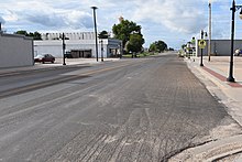
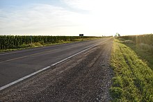
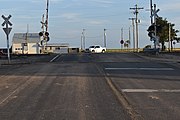
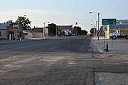
K-23 begins its northerly journey at the Kansas-Oklahoma state line northwest of Forgan, Oklahoma, picking up northbound traffic from Oklahoma Highway 23. It soon crosses the Cimarron River, then continues north through a series of s-curves through flat land with a few hills. The highway then curves to the east, as it passes along the south side of Meade State Park, the location of Lake Meade. It continues east for about four miles (6.4 km) then curves north at a intersection with V Road and 18 Road. It continues north for 7.5 miles (12.1 km), crossing Crooked Creek along the way, and enters Meade becoming Fowler Street. It continues through Meade then intersects US-54 and US-160, known as Carthage Street, downtown. As the highway exits Meade, it crosses a Union Pacific Railroad track and begins to traverse rolling hills. After about 6.5 miles (10.5 km), K-23 reaches a junction with K-98 at the 6th Standard Parallel South. The road begins to level out, and after about 4.2 miles (6.8 km) north it crosses a different Crooked Creek, then crosses into Gray County 1.8 miles (2.9 km) later.[6] It continues north into the county and intersects Jumbo Road after about two miles (3.2 km). About 8.5 miles (13.7 km) the highway intersects US-56 and crosses a Cimarron Valley Railroad track, southwest of Haggard. It continues north from here to Ford-Ensign Road, passing a KBSD-DT transmitter station along the way. From Ford-Ensign Road, the highway continues north for six miles (9.7 km) and intersects Beeson Road. From here it continues north for 4.6 miles (7.4 km), and enters Cimarron becoming Main Street. It then continues through the city and intersects US-50 and US-400, known as Avenue A, which is a part of the America Discovery Trail. As K-23 exits Cimarron, it crosses the 5th Standard Parallel South as the route begins to alternate between flat and hilly land through farmland. About 7.8 miles (12.6 km) north of Cimarron, the highway crosses Buckner Creek and then crosses into Finney County.[7][8]
Finney and Lane counties
K-23 continues north into the county for four miles (6.4 km), then intersects K-156 just west of Kalvesta. Here, it turns west and overlaps K-156 for six miles (9.7 km) then turns north again and leaves K-156. The highway begins to level out, and after about 6.5 miles (10.5 km) north it crosses the Pawnee River then intersects Lake Road. Another five miles (8.0 km) north it intersects Potter Road, then crosses into Lane County two miles (3.2 km) later, at the Fourth Standard Parallel South.[9] It continues northward into the county through rural farmlands and after about 3.9 miles (6.3 km) crosses Hackberry Creek, then Buffalo Creek about 4.5 miles (7.2 km) later. About 6.1 miles (9.8 km) later it crosses the South Fork Walnut Creek as it enters Dighton, the only city in Lane County, becoming Main Street. As it passes through the city, it intersects K-96, known as Long Street, at a four-way intersection. K-96 here is codesignated as U.S. Bicycle Route 76 (Trans America Trail). As it exits Dighton, it crosses the Kansas and Oklahoma Railway, continues north for 2.3 miles (3.7 km) where it crosses Middle Fork Walnut Creek. about 3.7 miles (6.0 km) past here it crosses the North Fork Walnut Creek, then intersects K-4, southwest of Shields, 2.5 miles (4.0 km) later. Here it curves west and overlaps K-4 for two miles (3.2 km) then turns north again and leaves K-4. It continues north for 6.1 miles (9.8 km) then crosses into Gove County, at the Third Standard Parallel South.[10][8]
Gove and Sheridan counties
About 3.2 miles (5.1 km) into Gove County it crosses the Smoky Hill River, then Plum Creek about 1.3 miles (2.1 km) later. The highway continues northward for about 13 miles (21 km) where it enters the city of Gove, becoming Broad Street. The highway exits the city, and continues north for 3.8 miles (6.1 km) then crosses Spring Creek. It continues north for 2.8 miles (4.5 km), crosses Big Creek, then North Fork Big Creek 2.3 miles (3.7 km) later. It continues north and soon reaches a diamond interchange with I-70 and US-40 at exit 93. Just north of the interchange K-23 turns east and begins to follow the old US-40 along the south edge of Grainfield. It soon intersects K-23 Alternate, also known as Main Street, which turns north and serves the city of Grainfield. K-23 continues east and soon reaches a junction with K-23 Spur, which travels south to I-70 and US-40. Here and K-23 turns north off of old US-40 as it crosses a Union Pacific Railroad track. K-23 then continues north through rural farmlands as it intersects the northern terminus of K-23 Alternate, about .8 miles (1.3 km) later. The highway continues north for one mile (1.6 km) then crosses into Sheridan County, as the rolling hills begin to alternate with the flatter land.[11] About two miles (3.2 km) into the county, the highway crosses Saline River as it continues north. Roughly 4.9 miles (7.9 km) later it crosses Midway Draw, then South Fork Solomon River 4.6 miles (7.4 km) later. K-23 continues north for about 3.4 miles (5.5 km) and enters the city of Hoxie becoming Main Street. It continues through the city, where it intersects US-24, also known as Oak Avenue. As the highways exits the city it passes by Hoxie Cemetery. It continues north and soon crosses South Bow Creek, then crosses North Fork Solomon River 6.5 miles (10.5 km) later. K-23 continues north for 2.3 miles (3.7 km), where it intersects K-123, which travels north toward K-9's western terminus. Here, K-23 turns west, then intersects K-223 one mile (1.6 km) later. K-23 continues west for four miles (6.4 km) then curves north and reaches its northern terminus at US-83 and K-383.[12][8]
History
Early roads
Before state highways were numbered in Kansas there were Auto trails, which were an informal network of marked routes that existed in the United States and Canada in the early part of the 20th century. In Meade it crosses the former Atlantic and Pacific Highway. Then in Cimarron it crosses the former National Old Trails Road, Old Santa Fe Trail, New Santa Fe Trail and Albert Pike Highway. Further north in Dighton it crosses the former Kansas-Colorado Boulevard. Then the overlap with K-4 follows the former Bee Line. By Grainfield, the section that follows old US-40 is the former Golden Belt. A section from Hoxie southward along K-23 follows the former Roosevelt National Highway. Farther north in Hoxie, it crosses the former Kansas White Way and former Blue Line. The northern terminus connects to the former Pikes Peak Ocean to Ocean Highway.[13]
Establishment and realignments
K-23 was first designated as a state highway in 1927. At that time it began at K-96 in Dighton, and ran north and had a short overlap with K-52 east of Healy. It left the overlap and continued north through Gove to US-40S in Grainfield. From here, the highway continued north to US-40N in Hoxie. It continued past Hoxie northward to US-36 and K-22 in Dresden. It continued north, crossing K-2 in Oberlin, before terminating at the Nebraska state line.[1] By 1931, US-36 was realigned to go west into Colorado, and the old portion through Dresden became US-83. Also by 1931, K-23 was truncated to US-83, and US-183 was created to follow the former K-23, from US-83 to Nebraska.[14] By 1932, it was extended from Dighton southward to US-50N west of Kalvesta. Then continued south to US-50S in Cimarron, then to K-45 west of Ensign. From here it continued south and ended at US-54 and US-160 in Meade.[15] Between July 1938 and 1940, US-183 was realigned to go east from Oberlin, at this time K-23 was realigned to follow K-9 west to US-83, then north to US-36 and US-183 in Oberlin. Also K-123 was created and replaced the former K-23 from K-9 to Dresden.[16][17] This lasted until 1944, when K-23 was truncated to US-83, and US-83 replaced it from here north to Oberlin. Also the old alignment of US-83 from here to Nebraska became US-383, now K-383.[18][19][20]
In an October 11, 1935 resolution, K-23 was slightly realigned by Gove.[21] In a January 11, 1938 resolution, the overlap with K-4, west of Shields, was moved one mile (1.6 km) north.[22] In an August 7, 1941 resolution, K-23 was realigned one mile (1.6 km) to the east, just south of the K-9 junction, to eliminate several sharp curves.[23] In a May 8, 1957 resolution, it was realigned slightly on the north side of Gove to eliminate two sharp curves.[24] In a June 25, 1958 resolution, K-23 Alternate was designated from from K-23 west, along the north side of Grainfield to Main Street, then south along Main Street to end at K-23.[25] In a December 9, 1959 resolution, the future I-70 was to be built along with US-40 being realigned onto it. Also K-23 Spur was to be built from I-70 and US-40 north to K-23.[26] In a March 8, 1961 resolution, K-23 was realigned to follow the former K-98 to Meade State Lake, then south to the Oklahoma border.[27] Before 1990, K-23 continued directly west to US-83 at its northern terminus. Then in a March 12, 1990 resolution, US-83 was realigned, and at that time K-23 was realigned to curve north then intersect US-83, northeast of Selden.[28]
Major intersections
| County | Location | mi[29] | km | Destinations | Notes |
|---|---|---|---|---|---|
| Meade | Cimarron Township | 0.000 | 0.000 | Continuation into Oklahoma | |
| Meade | 26.474 | 42.606 | |||
| Crooked Creek Township | 33.557 | 54.005 | Western terminus of K-98 | ||
| Gray | Montezuma Township | 50.130 | 80.676 | ||
| Cimarron | 62.622 | 100.780 | |||
| Finney | Garfield Township | 80.207 | 129.081 | Southern end of concurrency with K-156 | |
| 86.187 | 138.705 | Northern end of concurrency with K-156 | |||
| Lane | Dighton | 115.372 | 185.673 | ||
| Shields | 124.336 | 200.099 | Southern end of concurrency with K-4 | ||
| Wilson Township | 126.352 | 203.344 | Northern end of concurrency with K-4 | ||
| Gove | Grainfield Township | 160.927 | 258.987 | I-70 exit 93; diamond interchange | |
| Grainfield | 161.814 | 260.414 | Southern terminus of K-23 Alt. | ||
| Grainfield Township | 163.059 | 262.418 | Northern terminus of K-23 Spur | ||
| 163.829 | 263.657 | Northern terminus of K-23 Alt. | |||
| Sheridan | Hoxie | 180.300 | 290.165 | ||
| Union–Sheridan township line | 193.774 | 311.849 | Southern terminus of K-123 | ||
| Sheridan Township | 194.815 | 313.524 | Southern terminus of K-223 | ||
| 199.117 | 320.448 | Northern terminus; southern terminus of K-383 | |||
1.000 mi = 1.609 km; 1.000 km = 0.621 mi
| |||||
Related routes
K-23 Alternate
| |
|---|---|
| Location | Grainfield |
| Length | 1.828 mi[29] (2.942 km) |
| Existed | June 25, 1958[25]–present |
K-23 Alternate starts at the intersection of K-23 on the southern edge of Grainfield. K-23 Alternate heads north and crosses a Union Pacific Railroad track as it enters the city. The highway continues through the city along Main Street. Just north of the city limits, the route turns to the east and ends at the mainline K-23. K-23 Alternate was designated in a June 25, 1958 resolution, and ran from K-23 west, along the north side of the city to Main Street.[25]
Major junctions
The entire route is in Gove County.
| Location | mi[29] | km | Destinations | Notes | |
|---|---|---|---|---|---|
| Grainfield | 0.000 | 0.000 | Southern terminus | ||
| Grainfield Township | 1.828 | 2.942 | Northern terminus | ||
| 1.000 mi = 1.609 km; 1.000 km = 0.621 mi | |||||
K-23 Spur
| |
|---|---|
| Location | Near Grainfield |
| Length | 0.30 mi[30] (0.48 km) |
| Existed | December 9, 1959[26]–present |
K-23 Spur is a 0.3-mile-long (0.48 km) connection between K-23 and I-70 / US 40 near Grainfield. In a December 9, 1959 resolution, the future I-70 was to be built along with US-40 being realigned onto it, at this time K-23 Spur was designated from I-70 and US-40 north to K-23.[26]
Major junctions
The entire route is in Gove Township, Gove County.
| mi[29] | km | Destinations | Notes | ||
|---|---|---|---|---|---|
| 0.000 | 0.000 | Southern terminus; I-70 exit 95; diamond interchange | |||
| 0.300 | 0.483 | Northern terminus | |||
| 1.000 mi = 1.609 km; 1.000 km = 0.621 mi | |||||
References
- Rand McNally and Company (1927). "Kansas" (Map). Rand McNally Auto Road Atlas of the United States and Ontario, Quebec, and the Maritime Provinces of Canada, with a Brief Description of the National Parks and Monuments. 1:1,600,000. Chicago: Rand McNally and Company. pp. 54–55. OCLC 2078375 – via Rumsey Collection.
- Bureau of Transportation Planning (2018). Traffic Flow Map Kansas State Highway System (PDF) (Map). [c. 1:1,584,000]. Topeka: Kansas Department of Transportation. Retrieved April 27, 2020.
- Bureau of Transportation Planning (2018). Traffic Flow Inset Map Kansas State Highway System (PDF) (Map). [c. 1:1,584,000]. Topeka: Kansas Department of Transportation. Retrieved April 27, 2020.
- Federal Highway Administration (May 8, 2019). National Highway System: Kansas (PDF) (Map). Scale not given. Washington, DC: Federal Highway Administration. Retrieved April 25, 2020.
- Natzke, Stefan; Neathery, Mike; Adderly, Kevin (September 26, 2012). "What is the National Highway System?". National Highway System. Federal Highway Administration. Retrieved April 27, 2020.
- Bureau of Transportation Planning (October 2008). Meade County (PDF) (Map). [c. 1: 211,200]. General Highway Map. Topeka: Kansas Department of Transportation. Retrieved August 10, 2020.
- Bureau of Transportation Planning (December 2008). Gray County (PDF) (Map). [c. 1: 211,200]. General Highway Map. Topeka: Kansas Department of Transportation. Retrieved August 10, 2020.
- Google (August 10, 2020). "Overview map of K-23" (Map). Google Maps. Google. Retrieved August 10, 2020.
- Bureau of Transportation Planning (July 2007). Finney County (PDF) (Map). [c. 1: 211,200]. General Highway Map. Topeka: Kansas Department of Transportation. Retrieved August 10, 2020.
- Bureau of Transportation Planning (June 2010). Lane County (PDF) (Map). [c. 1: 211,200]. General Highway Map. Topeka: Kansas Department of Transportation. Retrieved August 10, 2020.
- Bureau of Transportation Planning (October 2006). Gove County (PDF) (Map). [c. 1: 211,200]. General Highway Map. Topeka: Kansas Department of Transportation. Retrieved August 10, 2020.
- Bureau of Transportation Planning (November 2009). Sheridan County (PDF) (Map). [c. 1: 211,200]. General Highway Map. Topeka: Kansas Department of Transportation. Retrieved August 10, 2020.
- Rand McNally and Company (1924). "Kansas" (Map). AutoTrails Map, Southern Nebraska, Eastern Colorado, Kansas, Northeastern New Mexico, Northern Oklahoma. 1:1,600,000. Chicago: Rand McNally and Company. OCLC 2078375. Retrieved August 8, 2020 – via Rumsey Collection.
- Rand McNally and Company (1931). "Kansas" (Map). Clason's Road Map of Kansas. 1:2,000,000. Denver: Clason Map Company. p. 87 – via Rumsey Collection.
- State Highway Commission of Kansas (1932). Kansas State Highway System (PDF) (Map). Scale not given. Topeka: State Highway Commission of Kansas. OCLC 1007837202. Retrieved April 23, 2020.
- Kansas State Highway Department (1938). Kansas State Highway System (PDF) (Map). Scale not given. Highway & Transportation Map. Topeka: Kansas State Highway Department. Retrieved April 26, 2020.
- Kansas State Highway Department (1940). Kansas State Highway System (PDF) (Map). Scale not given. Highway & Transportation Map. Topeka: Kansas State Highway Department. Retrieved April 26, 2020.
- Kansas State Highway Department (1941). Kansas State Highway System (PDF) (Map). Scale not given. Highway & Transportation Map. Topeka: Kansas State Highway Department. Retrieved April 26, 2020.
- State Farm Insurance Companies Travel Bureau (1944). "Kansas" (Map). State Farm Road map: Kansas. 1:1,235,520. Chicago: Rand McNally and Company. Retrieved July 26, 2020 – via Rumsey Collection.
- Kansas State Highway Department (1945). Kansas State Highway System (PDF) (Map). Scale not given. Highway & Transportation Map. Topeka: Kansas State Highway Department. Retrieved April 26, 2020.
- State Highway Commission of Kansas (October 11, 1935). "Resolution for Relocation and Redesignation of Road in Gove County". Topeka: State Highway Commission of Kansas. Retrieved April 23, 2020.
- State Highway Commission of Kansas (January 11, 1938). "Resolution for Relocation and Redesignation of Road in Lane County". Topeka: State Highway Commission of Kansas. Retrieved April 23, 2020.
- State Highway Commission of Kansas (August 7, 1941). "Resolution for Relocation and Redesignation of Road in Sheridan County". Topeka: State Highway Commission of Kansas. Retrieved April 26, 2020.
- State Highway Commission of Kansas (May 8, 1957). "Resolution for Relocation and Redesignation of Road in Gove County". Topeka: State Highway Commission of Kansas. Retrieved April 23, 2020.
- State Highway Commission of Kansas (June 25, 1958). "Resolution for addition to State Highway System in Gove County". Topeka: State Highway Commission of Kansas. Retrieved April 26, 2020.
- State Highway Commission of Kansas (December 9, 1959). "Resolution for Relocation and Redesignation of Road in Gove and Trego Counties". Topeka: State Highway Commission of Kansas. Retrieved April 23, 2020.
- State Highway Commission of Kansas (March 8, 1961). "Resolution for Relocation and Redesignation of Road in Meade County". Topeka: State Highway Commission of Kansas. Retrieved April 23, 2020.
- State Highway Commission of Kansas (March 12, 1990). "Resolution to Relocate a segment of highway in Sheridan County". Topeka: State Highway Commission of Kansas. Retrieved April 26, 2020.
- Staff (2016). "Pavement Management Information System". Kansas Department of Transportation. Retrieved April 21, 2017.
- Bureau of Transportation Planning (October 2006). General Highway Map of Gove County, Kansas (PDF) (Map). Kansas Department of Transportation. Retrieved April 21, 2017.