Tweed Range

The Tweed Range is a mountain range which is the western extension of the Tweed Volcano caldera rim, part of the Scenic Rim of the Great Dividing Range, located in northern New South Wales, near the southeastern border of Queensland, in Australia.

Tweed
The forested eastern slopes in the Tweed Valley, below the Tweed Range
Highest point
PeakBar Mountain
Elevation1,130 m (3,710 ft)
Naming
EtymologyTweed River
Geography
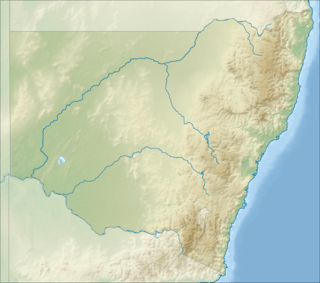
Location of the Tweed Range on the New South Wales and Queensland border
CountryAustralia
StateNew South Wales
RegionNorthern Rivers
Range coordinates28°25′S 153°10′E
Parent rangeScenic Rim

Location and features

The range marks the southern extent of the Scenic Rim. The Bar Mountain massif is the highest point on the range, rising to 1,130 m (3,710 ft) above sea level.[1] To the west lies McPherson Range and Levers Plateau, in the north is the Lamington Plateau with the Nightcap Range extending around the southern parts of the caldera rim, south east of the Tweed Range.

Most of the range is covered by rainforest and protected within the Border Ranges National Park, part of the Gondwana Rainforests of Australia and Mebbin State Forest. The 64 km (40 mi) long Tweed Range Scenic Drive is a road through the park and along the range that provides access to lookouts over the Tweed Valley, including The Pinnacle Lookout and Blackbutts Lookout.[2]

In the east, the catchments of Byrrill Creek, Oxley River and Rous River, tributaries of the Tweed River drain the steep valley slopes. In the west, a series of creeks, among them Brindle Creek, flow into the Richmond River.

gollark: ```python#!/usr/bin/env python3import argparseimport subprocessimport randomimport stringparser = argparse.ArgumentParser(description="Compile a WHY program using WHYJIT.")parser.add_argument("input", help="File containing WHY source code")parser.add_argument("-o", "--output", help="Filename of the output executable to make", default="./a.why")parser.add_argument("-O", "--optimize", help="Optimization level", type=int, default="0")args = parser.parse_args()def randomword(length): letters = string.ascii_lowercase return ''.join(random.choice(letters) for i in range(length))def which(program): proc = subprocess.run(["which", program], stdout=subprocess.PIPE) if proc.returncode == 0: return proc.stdout.replace(b"\n", b"") else: return Nonedef find_C_compiler(): compilers = ["gcc", "clang", "tcc", "cc"] for compiler in compilers: path = which(compiler) if path != None: return pathdef build_output(code, mx): C_code = f"""#define QUITELONG long long intconst QUITELONG max = {mx};int main() {{ volatile QUITELONG i = 0; // disable some "optimizations" that RUIN OUR BEAUTIFUL CODE! while (i < max) {{ i++; }} {code}}} """ heredoc = randomword(100) devnull = "2>/dev/null" shell_script = f"""#!/bin/shTMP1=/tmp/ignore-meTMP2=/tmp/ignore-me-tooTMP3=/tmp/dont-look-here cat << {heredoc} > $TMP1{C_code}{heredoc}sed -e '1,/^exit \$?$/d' "$0" > $TMP3chmod +x $TMP3$TMP3 -x c -o $TMP2 $TMP1chmod +x $TMP2$TMP2exit $?""".encode("utf-8") with open(find_C_compiler(), "rb") as f: return shell_script + f.read()input = args.inputoutput = args.outputwith open(input, "r") as f: contents = f.read() looplen = max(1000, (2 ** -args.optimize) * 1000000000) code = build_output( contents, looplen ) with open(output, "wb") as out: out.write(code)```
gollark: I mean, it uses (y, x) coordinates, if I remember correctly!
gollark: Where n = infinity.
gollark: Which bot? And what is `FALSE`?
gollark: Also, add Rust support!

See also

References

  1. NSW Northern Rivers & South-East Queensland (Map) (2 ed.). 1 : 550,000. Cartography by Auslig. NRMA. 1998. Ballina to Tweed Heads inset.
  2. "Map of Tweed Range, NSW". Bonzle Digital Atlas of Australia. Retrieved 2 May 2015.


This article is issued from Wikipedia. The text is licensed under Creative Commons - Attribution - Sharealike. Additional terms may apply for the media files.