Taltali Upazila
Taltali (Bengali: তালতলী) is an Upazila of Barguna District in the division of Barisal, Bangladesh.
Taltali তালতলী | |
|---|---|
Upazila | |
 Taltali Location in Bangladesh | |
| Coordinates: 22°0.0876′N 90°0.177′E | |
| Country | |
| Division | Barisal Division |
| District | Barguna District |
| Area | |
| • Total | 258.94 km2 (99.98 sq mi) |
| Population (2011) | |
| • Total | 88,004 |
| • Density | 541/km2 (1,400/sq mi) |
| Time zone | UTC+6 (BST) |
| Website | Official website |
History
Taltali Upazila was established on 25 April 2012.[1] It was previously part of Amtali Upazila.
Geography
Amtali is at 22.0876°N 90.1770°E. It covers an area of 258.94 km2 with the population of 88,004 people. It's literacy rate is 89%. It is by the Bay of Bengal.
Demographics
Administration
Current Upazila chairman is Rajbi-ul Kabir Jomaddar.
Subdivisions
Taltali Upazila os consisted of 7 unions.
- Pachacoralia Union
- Chotobogi Union
- Koroibaria Union
- Sharikkhali Union
- Borobogi Union
- Nishanbaria Union
- Sonakata Union
Upazila Nirbahi Officer Md Badruddoza Shuvo
gollark: <@!332271551481118732> The wiki now contains Emu War games you haven't even written yet! https://tty0.xyz/emuwar/doku.php?id=games:online:start
gollark: For ntpd text processor.
gollark: Call it... NTP Text Processor, instead.
gollark: Optical isn't really better than HDDs most of the time, but is useful for backups.
gollark: Flash storage is *far* superior to HDDs and mostly to optical.
See also
- Upazilas of Bangladesh
- Districts of Bangladesh
- Divisions of Bangladesh
References
- "Taltali Upazila at a glance". National Information Web. Retrieved 18 September 2015.
External links
| Upazila/Thana: | ||
|---|---|---|
Capital: Barisal | ||
| Barguna District | 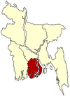 | |
| Barisal District | ||
| Bhola District |
| |
| Jhalokati District | ||
| Patuakhali District | ||
| Pirojpur District | ||
This article is issued from Wikipedia. The text is licensed under Creative Commons - Attribution - Sharealike. Additional terms may apply for the media files.