Amtali Upazila
Amtali (Bengali: আমতলী) is an Upazila of Barguna District[1] in the division of Barisal, Bangladesh.
Amtali আমতলী | |
|---|---|
Upazila | |
 Amtali Location in Bangladesh | |
| Coordinates: 22°7.764′N 90°13.734′E | |
| Country | |
| Division | Barisal Division |
| District | Barguna District |
| Area | |
| • Total | 720.76 km2 (278.29 sq mi) |
| Population (1991) | |
| • Total | 244,438 |
| • Density | 340/km2 (880/sq mi) |
| Time zone | UTC+6 (BST) |
| Website | Official Map of the Amtali Upazila |
Geography
Amtali is at 22.1294°N 90.2289°E. It has 45,804 households and a total area of 695 square km with 212 square km of water bodies.
Demographics
| Year | Pop. (000) | ±% |
|---|---|---|
| 1981 | 232 | — |
| 1991 | 244 | +5.2% |
| 2001 | 260 | +6.6% |
| 2011 | 271 | +4.2% |
| Source: Bangladesh Bureau of Statistics[2] | ||
According to the 2011 Bangladesh census, Amtali Upazila had 63,212 households and a population of 270,802, 8.1% of whom lived in urban areas. 10.3% of the population was under the age of 5. The literacy rate (age 7 and over) was 89.8%, compared to the national average of 72.8%.[3][4]
Administration
Amtali upazila consists of 7 unions and one municipality. It has 66 mauzas and 200 villages.
The unions are:
- Gulishakhali
- Kukua
- Atharogachia
- Haladia
- Chawra
- Amtali Sador
- Arpangasia
gollark: ++remind 1589299993 æææææææææææææ
gollark: ++remind 1589289993 æææææææææææææ
gollark: ++remind 5d Test abcd aadalfksalfaslfasf.
gollark: ++remind 5d Test abcd.
gollark: ++help
See also
- Upazilas of Bangladesh
- Districts of Bangladesh
- Divisions of Bangladesh
References
- Shabuddin Panna (2012). "Amtali Upazila". In Sirajul Islam and Ahmed A. Jamal (ed.). Banglapedia: National Encyclopedia of Bangladesh (Second ed.). Asiatic Society of Bangladesh.
- "District Statistics 2011: Barguna" (PDF). Bangladesh Bureau of Statistics. Retrieved June 19, 2018.
- "Population Census 2011: Bogra Table C-01" (PDF). Bangladesh Bureau of Statistics. Retrieved July 11, 2014.
- "Population and Housing Census 2011: Bangladesh at a Glance" (PDF). Bangladesh Bureau of Statistics. pp. 11, 93. Archived from the original (PDF) on 2014-07-28. Retrieved July 21, 2014.
External links
| Upazila/Thana: | ||
|---|---|---|
Capital: Barisal | ||
| Barguna District | 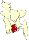 | |
| Barisal District | ||
| Bhola District |
| |
| Jhalokati District | ||
| Patuakhali District | ||
| Pirojpur District | ||
This article is issued from Wikipedia. The text is licensed under Creative Commons - Attribution - Sharealike. Additional terms may apply for the media files.