Takeley
Takeley is a village and civil parish in the Uttlesford district of Essex, England.
| Takeley | |
|---|---|
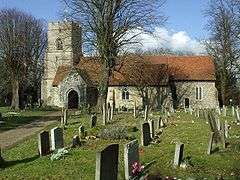
 Holy Trinity Church, Takeley | |
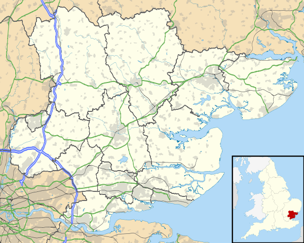
 Takeley Location within Essex | |
| Population | 3,367 (2011)[1] |
| OS grid reference | TL561212 |
| • London | 25 mi (40 km) SW |
| District | |
| Shire county | |
| Region | |
| Country | England |
| Sovereign state | United Kingdom |
| Post town | Bishop's Stortford |
| Postcode district | CM22 |
| Dialling code | 01279 |
| Police | Essex |
| Fire | Essex |
| Ambulance | East of England |
| UK Parliament | |
History
A number of theories have arisen over the origin of the village's name. One believes the village's name was a corruption from the "Teg-Ley" of sheep clearing. Another theory is that Takeley is derived from the Saxon lord Taecca, who owned land in Essex and Oxfordshire, the latter of which has a village named Tackley. In more recent times, Takeley is thought to have derived from "settlement next to open forest" in reference to the Forest of Essex.[2]
When Takeley was first recorded by the Normans in 1086–87 its boundaries were approximately 8 miles (13 km) in length, with a total area of 3,000 acres (12 km²). However, since the development of Stansted Airport, it has lost nearly a third of its land.
The previous Cooper's End was demolished and the cargo area of Stansted Airport stands on the ground once occupied by the settlement. The access to and from the airport at Cooper's End was closed briefly in January 1991 but was re-opened in November of that year. Cooper's End roundabout was constructed as part of the new airport, and is just west of the terminal.
Takeley parish church, dating from the 12th century, is dedicated to the Holy Trinity, and was Grade I listed by English Heritage in 1967.[3]
Geography
The village is situated approximately halfway between Bishop's Stortford and Great Dunmow, and on Stane Street, the Roman road from Braughing to Colchester. The A120 road and Stansted Airport is at the north.
Takeley consists of a number of 'Ends' and 'Greens', namely Brewer's End (John le Brewer, 1327), The Street, Smith's Green, Bamber's Green (Bambrose Green, from the Banbury family at Sheering Hall), Molehill Green (Morrell's Green), and Mill End.
Governance
Takeley is part of the electoral ward of Takeley and the Canfields. The population of the ward at the 2011 census was 4,716.[4]
Sport
Takeley has a non-league football club, Takeley Football Club, who play at Station Road. They were members of the Essex Olympian League in 2007–08, and entered the Essex Senior League in 2008–09.[5] The cricket team at Takeley was established c. 1880.
See also
References
- "Civil Parish population 2011". Retrieved 27 September 2015.
- Takeley F.C. (18 August 2018). Takeley Matchday Programme v Walthamstow FC. Takeley F.C. p. 6.
- Historic England. "Church of the Holy Trinity, Church Lane (1168843)". National Heritage List for England. Retrieved 2 February 2015.
- "Takeley and the Canfields ward population 2011". Retrieved 27 September 2015.
- Takeley Football Club. Retrieved 4 July 2013