Szeremle
Szeremle (Croatian: Srimljan) is a village in Bács-Kiskun county, in the Southern Great Plain region of southern Hungary.
Szeremle | |
|---|---|
 Szeremle Location of Dunafalva | |
| Coordinates: 46.1500°N 18.8833°E | |
| Country | |
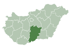
| County | Bács-Kiskun |
| Area | |
| • Total | 34.64 km2 (13.37 sq mi) |
| Population (2015) | |
| • Total | 1,414[1] |
| • Density | 41.5/km2 (107/sq mi) |
| Time zone | UTC+1 (CET) |
| • Summer (DST) | UTC+2 (CEST) |
| Postal code | 6512 |
| Area code(s) | 79 |
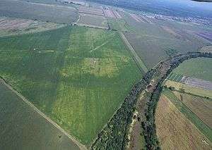
Aerialphotography: Szeremle - nature
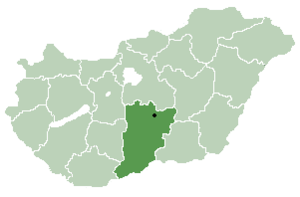
Location of Bács-Kiskun
county in Hungary
Geography
It covers an area of 34.64 km2 (13 sq mi) and has a population of 1414 people (2015).[1]
Demographics
gollark: What *are* you actually doing, though?
gollark: <@617340663368777777> Less unseriously, this sounds like an X/Y problem, what is your actual goal here?
gollark: Have you tried 3rot13? It's an advanced stateless keyless symmetric cipher.
gollark: And some languages don't really have English-style discrete alphabets at all as far as I know.
gollark: Yes. Also, you can write stuff like accented es as either one character or e + a diacritic.
References
- Gazetteer of Hungary, 1 January 2015. Hungarian Central Statistical Office. 3 September 2015
This article is issued from Wikipedia. The text is licensed under Creative Commons - Attribution - Sharealike. Additional terms may apply for the media files.