South Baltimore, Baltimore
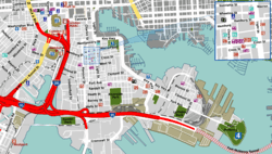
South Baltimore is a neighborhood in the Southern District of Baltimore,[1] located to the west of the neighborhood of Riverside and south of Federal Hill. Its boundaries are marked by East Ostend Street (north), Light Street (east), Race Street (west) and Interstate 95 (south).[2]
South Baltimore | |
|---|---|
neighborhood statistical area | |
| Nickname(s): SoBo | |
 | |
| Coordinates: 39.2705°N 76.6137°W | |
| Country | United States |
| State | Maryland |
| City | Baltimore |
| Time zone | UTC-5 (Eastern) |
| • Summer (DST) | UTC-4 (EDT) |
| ZIP code | 21230 |
| Area code | 410, 443, and 667 |
Landmarks
Heath Street Park, a small neighborhood park, is located along Heath Street between South Charles Street and Harden Court.[2]
gollark: EWO is cool but also uses FAR TOO MUCH CPU.
gollark: But mostly I'd just expect you to have relatively low-resources content which is interesting enough that I'll host it and somewhat manage it for free.
gollark: It's augmented by our collection of web-facing chairs.
gollark: The primary web-facing server has a quad-core 3.4GHz x86 CPU and 4GB of RAM.
gollark: Not THAT bad.
See also
External links
| Wikimedia Commons has media related to South Baltimore, Baltimore. |
References
- "Southern District Area Guide". Baltimore Police Department. Archived from the original on January 9, 2014. Retrieved January 9, 2014.
- "Discover Baltimore City Neighborhoods". Live Baltimore. Retrieved January 9, 2014.
This article is issued from Wikipedia. The text is licensed under Creative Commons - Attribution - Sharealike. Additional terms may apply for the media files.