Sirajganj Sadar Upazila
Sirajganj Sadar (Bengali: সিরাজগঞ্জ সদর) is an upazila of Sirajganj District in the Division of Rajshahi, Bangladesh.[1]
Sirajganj Sadar সিরাজগঞ্জ সদর | |
|---|---|
Upazila | |
 Sirajganj Sadar Location in Bangladesh | |
| Coordinates: 24°27.5′N 89°42′E | |
| Country | |
| Division | Rajshahi Division |
| District | Sirajganj District |
| Area | |
| • Total | 325.77 km2 (125.78 sq mi) |
| Population (1991) | |
| • Total | 389,160 |
| • Density | 1,200/km2 (3,100/sq mi) |
| Time zone | UTC+6 (BST) |
| Postal code | 6700 |
| Website | Official map of Sirajganj Sadar |
Geography
Sirajganj Sadar is located at 24.4583°N 89.7000°E. It has 71,511 households and a total area of 325.77 km².
Demographics
The 1991 Bangladesh census reports Sirajganj Sadar's population as 389,160 51.54% males and 48.46% females and 195,911 adults (18 years and over). 29.8% of people aged 7 and older were recorded as literate, slightly below the national average of 32.4%.[2]
Administration
Sirajganj Sadar has 18 unions/wards, 283 Mauzas/mahallas, and 283 villages.
Unions of Sirajganj Sadar:
- Ratankandi Union
- Bagbati Union
- Songacha Union
- Bohuli Union
- Chouhali Union
- Kamarkhando Union
gollark: Did you know? Strength is a strength just like other strengths.
gollark: It's fine apart from the black.
gollark: Lyricly highlights them all manually.
gollark: (wow, this RNG is good)
gollark: You obviously made #5.
See also
- Upazilas of Bangladesh
- Districts of Bangladesh
- Divisions of Bangladesh
References
- Kamrul Islam (2012), "Sirajganj Sadar Upazila", in Sirajul Islam and Ahmed A. Jamal (ed.), Banglapedia: National Encyclopedia of Bangladesh (Second ed.), Asiatic Society of Bangladesh
- "Population Census Wing, BBS". Archived from the original on 2005-03-27. Retrieved November 10, 2006.
External links
| Upazila/Thana: | ||
|---|---|---|
Headquarters: Rajshahi | ||
| Bogra District | 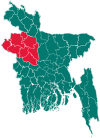 | |
| Joypurhat District | ||
| Naogaon District | ||
| Natore District | ||
| Nawabganj District | ||
| Pabna District | ||
| Rajshahi District | ||
| Sirajganj District | ||
This article is issued from Wikipedia. The text is licensed under Creative Commons - Attribution - Sharealike. Additional terms may apply for the media files.