Naogaon Sadar Upazila
Naogaon Sadar (Bengali: নওগাঁ সদর) is an Upazila of Naogaon District in the Division of Rajshahi, Bangladesh.
Naogaon Sadar নওগাঁ সদর | |
|---|---|
Upazila | |
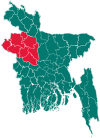
 Naogaon Sadar Location in Bangladesh | |
| Coordinates: 24°48.3′N 88°57′E | |
| Country | |
| Division | Rajshahi Division |
| District | Naogaon District |
| Area | |
| • Total | 275.73 km2 (106.46 sq mi) |
| Population (2011) | |
| • Total | 405,148 |
| • Density | 1,500/km2 (3,800/sq mi) |
| Time zone | UTC+6 (BST) |
| Website | Official Map of Naogaon Sadar |
History
In British India sub-districts were called as "Thana", which were mainly exercised by the police. When development activities become widespread, it would be known as a development circle. In 1949 Naogaon Sadar was declared as a thana, in 1960 as a development circle and in 1984 as a sub-district.[1]
Geography
_Bangladesh.svg.png)
Naogaon Sadar is located at 24.8042°N 88.9500°E. It has more than 80,000 households and total area of about 275.73 km2.
Demographics
According to 2011 Bangladesh census, Naogaon Sadar had a population of 405,148. Males constituted 50.48% of the population and females 49.52%. Muslims formed 92.07% of the population, Hindus 7.65%, Christians 0.05% and others 0.23%. Naogaon Sadar had a literacy rate of 53.59% for the population 7 years and above.[2]
At the 2001 Bangladesh census, Naogaon Sadar had a population of 348,940. Males constituted 51.58% of the population, and females 48.42%. Naogaon Sadar had an average literacy rate of 34.5% (7+ years), against the national average of 32.4% literate.[3]
Administration
Naogaon Sadar has 12 Unions/Wards, 237 Mauzas/Mahallas, and 215 villages.:[4]
- M P :Md. Abdul Malek
- Mayor of Naogaon Municipality: Nazmul Haque Sony
Education
According to Banglapedia, Chak Atitha High School, founded in 1914, and Kirtipur Multilateral High School, founded in 1921, are notable secondary schools.[4]
See also
- Upazilas of Bangladesh
- Districts of Bangladesh
- Divisions of Bangladesh
- Naogaon town
References
- এক নজরে উপজেলা [Sub-district at a glance]. Dcnaogaon.gov.bd (in Bengali). Retrieved 19 January 2013.
- "Bangladesh Population and Housing Census 2011: Zila Report – Nagaon" (PDF). Table P01 : Household and Population by Sex and Residence, Table P05 : Population by Religion, Age group and Residence, Table P09 : Literacy of Population 7 Years & Above by Religion, Sex and Residence. Bangladesh Bureau of Statistics (BBS), Ministry of Planning, Government of the People’s Republic of Bangladesh. Retrieved 9 December 2018.
- "Population Census Wing, BBS". Archived from the original on 27 March 2005. Retrieved 10 November 2006.
- Rahman, Md. Moklesur (2012). "Naogaon Sadar Upazila". In Islam, Sirajul; Jamal, Ahmed A. (eds.). Banglapedia: National Encyclopedia of Bangladesh (Second ed.). Asiatic Society of Bangladesh.
