Atrai Upazila
Atrai (Bengali: আত্রাই) is an Upazila of Naogaon District in the Division of Rajshahi, Bangladesh.[1]
Atrai আত্রাই | |
|---|---|
Upazila | |
 Atrai Location in Bangladesh | |
| Coordinates: 24°36.8′N 88°58.2′E | |
| Country | |
| Division | Rajshahi Division |
| District | Naogaon District |
| Area | |
| • Total | 284.41 km2 (109.81 sq mi) |
| Population (2011) | |
| • Total | 193,256 |
| • Density | 680/km2 (1,800/sq mi) |
| Time zone | UTC+6 (BST) |
| Website | Official website (in Bengali) |
Geography
_Bangladesh.svg.png)
Map of Naogaon District
Atrai has 30570 households and total area 284.41 km².
Demographics
According to 2011 Bangladesh census, Atrai had a population of 193,256. Males constituted 49.74% of the population and females 50.26%. Muslims formed 90.66% of the population, Hindus 9.31% and others 0.03%. Atrai had a literacy rate of 45.38% for the population 7 years and above.[2]
As of the 1991 Bangladesh census, Atrai has a population of 166978. Males constitute 50.88% of the population, and females 49.12%. The population above the age of eighteen years is 83466.
Administration
Atrai has 8 Unions.
| Numbers | Unions | Wards | villages | |
|---|---|---|---|---|
| 3 | Ahsanganj | |||
| 2 | Bhonpara | |||
| 4 | Bisha | |||
| 8 | Hatkalupara | |||
| 7 | Kalikapur | |||
| 6 | Maniary | |||
| 5 | Panchupur | |||
| 1 | Sahagola | |||
gollark: `+++++++++++++[>+++++<-]>.` ← what does this do?
gollark: ```Viewing THE-FROG-CANNOT-BE-OBTAINEDno```
gollark: Fine, I'll spam something instead of "any more".
gollark: This ridiculous spam is an advert for minoteaur, my web-based note-taking wiki project. Try it here: http://osmarks.tk:8080/
gollark: What fools they be.
See also
- Upazilas of Bangladesh
- Districts of Bangladesh
- Divisions of Bangladesh
References
- Md. Muklesur Rahman (2012). "Atrai Upazila". In Sirajul Islam and Ahmed A. Jamal (ed.). Banglapedia: National Encyclopedia of Bangladesh (Second ed.). Asiatic Society of Bangladesh.
- "Bangladesh Population and Housing Census 2011: Zila Report – Nagaon" (PDF). Table P01 : Household and Population by Sex and Residence, Table P05 : Population by Religion, Age group and Residence, Table P09 : Literacy of Population 7 Years & Above by Religion, Sex and Residence. Bangladesh Bureau of Statistics (BBS), Ministry of Planning, Government of the People’s Republic of Bangladesh. Retrieved 9 December 2018.
| Upazila/Thana: | ||
|---|---|---|
Headquarters: Rajshahi | ||
| Bogra District | 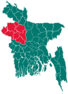 | |
| Joypurhat District | ||
| Naogaon District | ||
| Natore District | ||
| Nawabganj District | ||
| Pabna District | ||
| Rajshahi District | ||
| Sirajganj District | ||
This article is issued from Wikipedia. The text is licensed under Creative Commons - Attribution - Sharealike. Additional terms may apply for the media files.