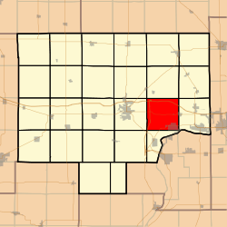
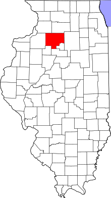
Selby Township, Bureau County, Illinois
Selby Township is one of twenty-five townships in Bureau County, Illinois, USA. As of the 2010 census, its population was 2,536 and it contained 971 housing units.[2]
Selby Township | |
|---|---|
 Location in Bureau County | |
 Bureau County's location in Illinois | |
| Coordinates: 41°21′45″N 89°19′53″W | |
| Country | United States |
| State | Illinois |
| County | Bureau |
| Established | November 6, 1849 |
| Area | |
| • Total | 36.15 sq mi (93.6 km2) |
| • Land | 35.94 sq mi (93.1 km2) |
| • Water | 0.21 sq mi (0.5 km2) 0.58% |
| Elevation | 659 ft (201 m) |
| Population (2010) | |
| • Total | 2,536 |
| • Estimate (2016)[1] | 2,400 |
| • Density | 70.6/sq mi (27.3/km2) |
| Time zone | UTC-6 (CST) |
| • Summer (DST) | UTC-5 (CDT) |
| ZIP codes | 61322, 61356, 61359, 61362 |
| FIPS code | 17-011-68562 |
Geography
According to the 2010 census, the township has a total area of 36.15 square miles (93.6 km2), of which 35.94 square miles (93.1 km2) (or 99.42%) is land and 0.21 square miles (0.54 km2) (or 0.58%) is water.[2]
Villages
- DePue (northwest three-quarters)
- Hollowayville
- Seatonville (west quarter)
Unincorporated towns
Cemeteries
The township contains six cemeteries:
- Artestian Well
- DePue Village
- Evangelical and Reformed
- Hollowayville
- Saint Johns Lutheran
- Searl Ridge
Major highways
Airports and landing strips
- Foley Airport
Landmarks
- Lake Park
- White City Park
School districts
- Depue Community Unit School District 103
Political districts
- Illinois's 11th congressional district
- State House District 76
- State Senate District 38
gollark: A web API is very different to the poorly named CC "API" s.
gollark: Well, yes.
gollark: That would be some weird JSON RPC thing, you literally just receive JSON data from some URLs.
gollark: No.
gollark: You send a GET request to it and parse the JSON.
References
- "Selby Township, Bureau County, Illinois". Geographic Names Information System. United States Geological Survey. Retrieved 4 January 2010.
- US Census Bureau 2007 TIGER/Line Shapefiles
- US National Atlas
- "Population and Housing Unit Estimates". Retrieved June 9, 2017.
- "Population, Housing Units, Area, and Density: 2010 - County". US Census Bureau. Archived from the original on 12 February 2020. Retrieved 28 January 2013.
- "Census of Population and Housing". Census.gov. Retrieved June 4, 2016.
External links
This article is issued from Wikipedia. The text is licensed under Creative Commons - Attribution - Sharealike. Additional terms may apply for the media files.