Neponset Township, Bureau County, Illinois
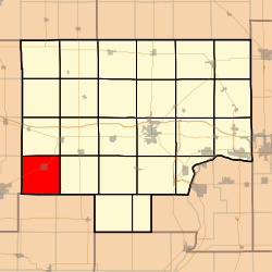
Neponset Township is one of twenty-five townships in Bureau County, Illinois, USA. As of the 2010 census, its population was 742 and it contained 339 housing units.[2] Neponset Township changed its name from Brawby Township on 5 March 1866.
Neponset Township | |
|---|---|
 Location in Bureau County | |
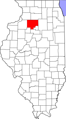
 Bureau County's location in Illinois | |
| Coordinates: 41°16′49″N 89°47′40″W | |
| Country | United States |
| State | Illinois |
| County | Bureau |
| Established | November 6, 1849 |
| Area | |
| • Total | 36.15 sq mi (93.6 km2) |
| • Land | 36.14 sq mi (93.6 km2) |
| • Water | 0.01 sq mi (0.03 km2) 0.03% |
| Elevation | 784 ft (239 m) |
| Population (2010) | |
| • Total | 742 |
| • Estimate (2016)[1] | 698 |
| • Density | 20.5/sq mi (7.9/km2) |
| Time zone | UTC-6 (CST) |
| • Summer (DST) | UTC-5 (CDT) |
| ZIP codes | 61314, 61345 |
| FIPS code | 17-011-52012 |
Geography
According to the 2010 census, the township has a total area of 36.15 square miles (93.6 km2), of which 36.14 square miles (93.6 km2) (or 99.97%) is land and 0.01 square miles (0.026 km2) (or 0.03%) is water.[2]
The southern and eastern parts of the township form part of the Illinois River watershed, the headwaters of Spoon River arising in the northeast portion of the township. The northwest portion of Neponset township is drained by Mud Creek, which flows into Green River, thence into Rock River.
Villages
Cemeteries
- Floral Hill
- Neponset
Major highways

School districts
- Bureau Valley Community Unit School District 340
- Neponset Community Consolidated District 307
- Wethersfield Community Unit School District 230
Political districts
- Illinois's 11th congressional district
- State House District 74
- State Senate District 37
gollark: I'm thinking:- simple number theory or other mathy problem- matrix algorithm of some kind- emulate a basic CPU
gollark: I plan to do so within 1.5 days.
gollark: Epicbot got 13/12 somehow.
gollark: Lyricly got two guesses right so he doesn't have to leave.
gollark: Here you go, apiobees, a version using a THEOREM PROVER.
References
- "Neponset Township, Bureau County, Illinois". Geographic Names Information System. United States Geological Survey. Retrieved 4 January 2010.
- US Census Bureau 2007 TIGER/Line Shapefiles
- US National Atlas
- "Population and Housing Unit Estimates". Retrieved June 9, 2017.
- "Population, Housing Units, Area, and Density: 2010 - County". US Census Bureau. Archived from the original on 12 February 2020. Retrieved 28 May 2013.
- "Census of Population and Housing". Census.gov. Retrieved June 4, 2016.
External links
This article is issued from Wikipedia. The text is licensed under Creative Commons - Attribution - Sharealike. Additional terms may apply for the media files.