Macon Township, Bureau County, Illinois
Macon Township is one of twenty-five townships in Bureau County, Illinois, USA. As of the 2010 census, its population was 208 and it contained 95 housing units.[2] Macon Township changed its name from Jefferson Township in June 1850.
Macon Township | |
|---|---|
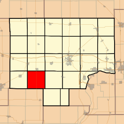 Location in Bureau County | |
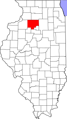 Bureau County's location in Illinois | |
| Coordinates: 41°16′19″N 89°41′19″W | |
| Country | United States |
| State | Illinois |
| County | Bureau |
| Established | November 6, 1849 |
| Area | |
| • Total | 36.61 sq mi (94.8 km2) |
| • Land | 36.61 sq mi (94.8 km2) |
| • Water | 0 sq mi (0 km2) 0% |
| Elevation | 764 ft (233 m) |
| Population (2010) | |
| • Total | 208 |
| • Estimate (2016)[1] | 199 |
| • Density | 5.7/sq mi (2.2/km2) |
| Time zone | UTC-6 (CST) |
| • Summer (DST) | UTC-5 (CDT) |
| ZIP codes | 61314, 61345, 61368 |
| FIPS code | 17-011-45928 |
Geography
According to the 2010 census, the township has a total area of 36.61 square miles (94.8 km2), all land.[2]
Unincorporated towns
Cemeteries
The township contains four cemeteries:
- Bunker Hills
- Mount Pleasant
- Walnut Grove
- Wood Family Cemetery
Major highways

School districts
- Bradford Community Unit School District 1
- Bureau Valley Community Unit School District 340
- Neponset Community Consolidated District 307
Political districts
- Illinois's 11th congressional district
- State House District 74
- State Senate District 37
gollark: But without globals, how will you define global variables?
gollark: Thus, inevitable minoteaur lisp rewrite WHEN?
gollark: <@331320482047721472> yes
gollark: It should merely be a compiler backend for macron.
gollark: Make macron.
References
- "Macon Township, Bureau County, Illinois". Geographic Names Information System. United States Geological Survey. Retrieved 4 January 2010.
- US Census Bureau 2007 TIGER/Line Shapefiles
- US National Atlas
- "Population and Housing Unit Estimates". Retrieved June 9, 2017.
- "Population, Housing Units, Area, and Density: 2010 - County". US Census Bureau. Archived from the original on 12 February 2020. Retrieved 28 May 2013.
- "Census of Population and Housing". Census.gov. Retrieved June 4, 2016.
External links
Places adjacent to Macon Township, Bureau County, Illinois | |
|---|---|
Municipalities and communities of Bureau County, Illinois, United States | ||
|---|---|---|
| Cities | Map of Illinois highlighting Bureau County | |
| Villages | ||
| Townships | ||
| Unincorporated communities | ||
| Ghost town | ||
| Footnotes | ‡This populated place also has portions in an adjacent county or counties | |
This article is issued from Wikipedia. The text is licensed under Creative Commons - Attribution - Sharealike. Additional terms may apply for the media files.